This is a popup dialog that overlays the main content of the page. The popup includes a search form to help you find the information you are seeking. Pressing the close button or using the escape key will close the popup.
Stateline Campground is the perfect basecamp for your trip to Vermilion Cliffs National Monument
Stateline Campground, located on the border of Arizona and Utah, is a convenient basecamp for trips to Vermilion Cliffs National Monument.
If you’re looking to hike Wire Pass, Buckskin Gulch, or the Wave, the trailheads are just a few miles up the road.
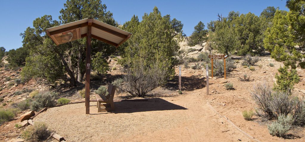
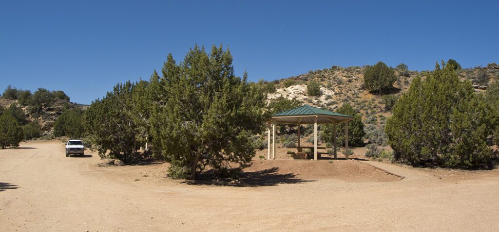
This campground has nicely spaced sites separated by piñon and juniper trees. All sites have views of Coyote Valley, which is made up of colorful rock of Chinle, Kayenta, Moenave, and Navajo sandstones. A handicap-accessible bench and small shade structure sit on a ridge above the campground. Stateline Campground, also marks the start of the 800-mile Arizona Trail that winds across Arizona to end at the Mexico border.
Note: This is a dry campground, so you will have to bring all your water with you.
Amenities at Stateline Campground
Picnic tables
Fire pits
No trash collection
Bathrooms
No water
Directions to Stateline Campground
From Page, Arizona: Drive west on Highway 89 for 34 miles. Turn left on House Rock Valley Road, just past a deep road cut where the highway turns sharply right.
From Kanab, Utah: Drive east on Highway 89 for 38 miles. Turn right on House Rock Valley Road, just before the highway turns sharply left and goes through a deep road cut.
Continuing south on House Rock Valley Road, you pass Buckskin Gulch Trailhead and the Wire Pass Trailhead. The road is dirt/gravel and in wet weather it can become impassable. At 10.5 miles from the highway junction, you reach the campground.
From Highway 89A: Turn north on House Rock Valley Road, which meets 89A where it begins to climb the eastern side of the Kaibab Plateau, about 14 miles east of Jacob Lake Lodge and 18 miles west of Cliff Dweller’s Lodge. The campground is about 20 miles north of the junction with the highway.
General LocationIn a remote area near the Arizona/Utah border about 30 miles west of Page, Arizona, and 27 miles east of Kanab, Utah.
Elevation5,040 ft (1,536 m)
Number of Sites7
SeasonYear-round
Managed ByArizona Strip Field Office, BLM
FeesNo fee at this time – Check the website below for current information