Hike Bullion Canyon Trail to see a waterfall in the Tushar Mountains
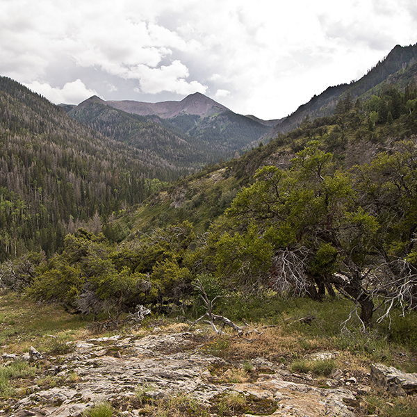
The Bullion Canyon Trail in Fish Lake National Forest follows Pine Creek to Bullion Falls, and then climbs to the top of a large rounded outcrop of polished quartzite.
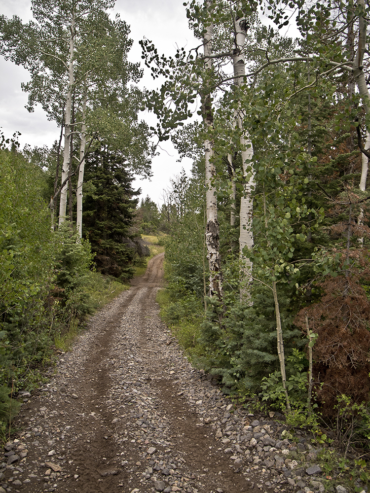
The trail follows an old road, used by ATVs, along the side of Pine Creek for the first 0.5 mile, passing some old tumbledown structures built during the mining boom that began in 1865 when gold was discovered. Soon after the discovery, a mining town with a peak population of more than 1,600 residents sprung up just above where the bridge is today. But little evidence remains, even though gold was mined until the late 1930s when the last mill closed. The canyon is still covered with mining claims, some of which are worked just enough to keep them valid.
After passing the first building, the trail reaches a second structure where a road takes off to the right. Continue straight, and you soon reach two switchbacks where the trail climbs out of the canyon bottom to travel well above the cascading stream. A few hundred yards after the switchbacks, you reach a talus slope. If you look carefully (and there is enough runoff), it’s possible to see another waterfall—Cascade Falls—on the other side of the canyon where a creek tumbles down the side of Mount Brigham. At 0.9 mile you reach the end of the ATV route where there is a large sign describing the Bullion Canyon Trail system and some history of the area.
On to Bullion Falls
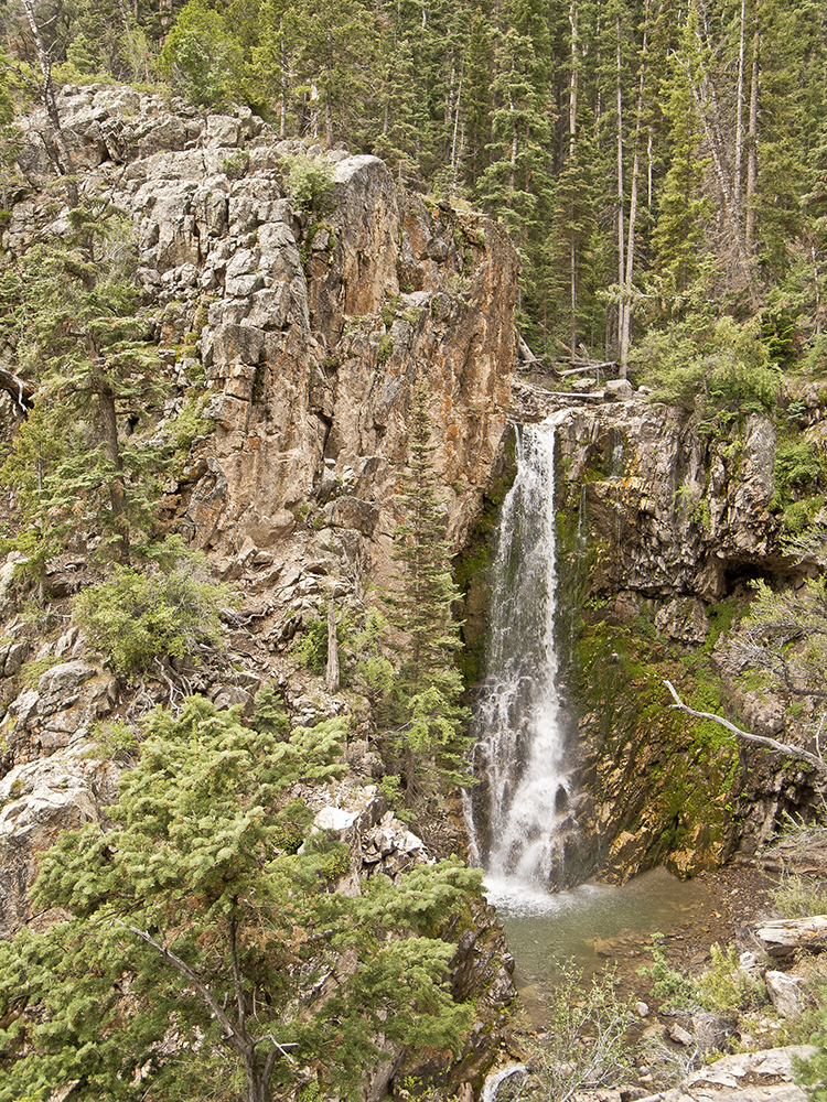
A smaller sign with an arrow points the way to Bullion Falls, the ATV track is left behind, and the trail becomes much more amiable and enjoyable, at least for hikers! After a fairly steep climb, the trail reaches the overlook for the falls in a couple of hundred yards.
The sound of the falling water fills the canyon with a muted roar that is particularly enjoyable in this typically arid part of the world. It’s possible to work your way down the steep slope to get closer to the falls, but be careful. It is very steep and there are some good-sized drop-offs.
Immediately after leaving the overlook, the trail begins to climb the north side of the canyon aggressively. The trail continues to climb, passing a sign about mountain goats as it works up a steep slope covered with dense shrubbery, oaks, and an occasional small pine tree.
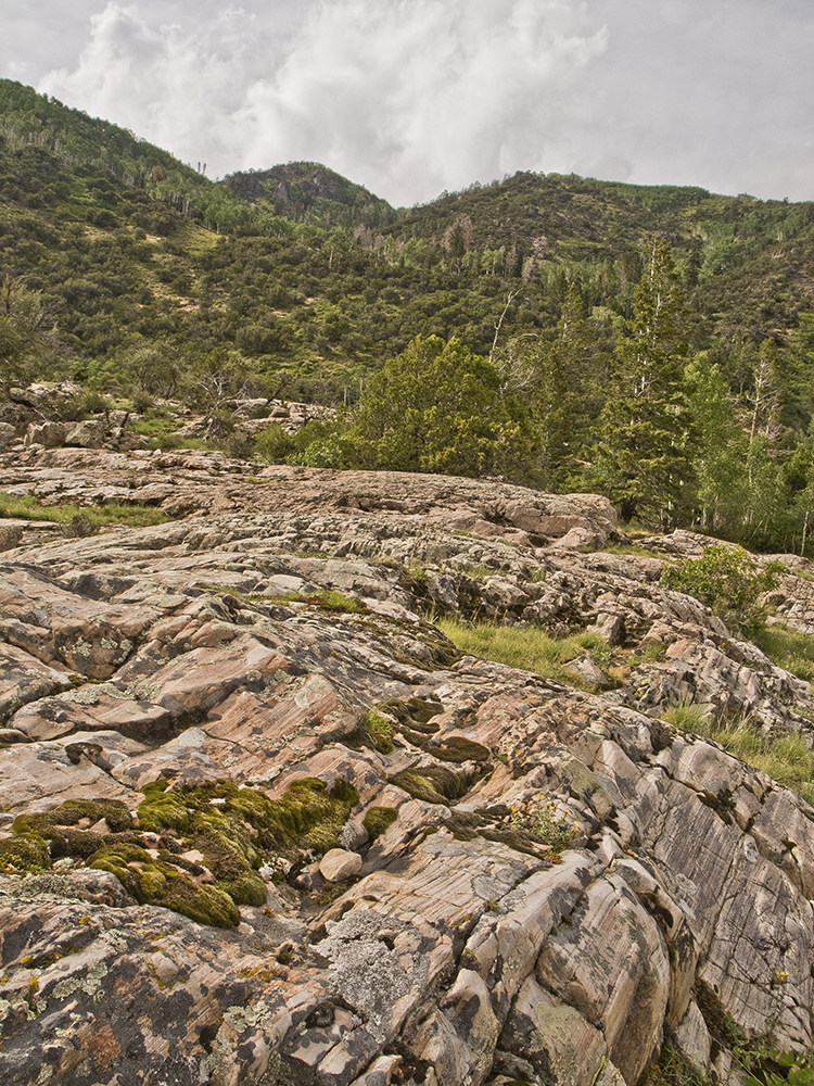
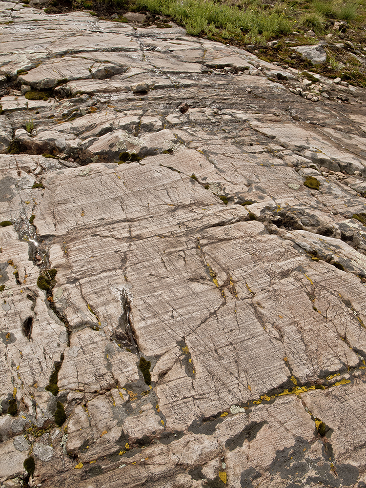
Polished stone
After some switchbacks and a traverse across the brushy hillside, the trail levels off and enters a small aspen grove with a large rounded rock outcrop on the left side. Watch for a small hole dug into the side of the outcrop where there is an easy route to the top. There you’ll find a delightful natural garden of smooth gray rock, stunted piñon pines, cliffrose, gray-green groundcover, and moss.
The rock is quartzite, which surprisingly began as Navajo Sandstone laid down about 200 million years ago during the Jurassic Era. Navajo Sandstone is found across the Colorado Plateau and it is especially prominent in Zion and Canyonlands national parks. Here, however, the western edge of the Colorado Plateau experienced a spate of volcanic activity about 20 to 30 million years ago, which created the Tushar Mountains. During that process the much older Navajo Sandstone was cooked at very high temperatures while under a great deal of pressure, creating the remarkably hard quartzite you are standing on. The rock has stubbornly resisted erosion, creating a barrier across the canyon and a hanging valley. The stream has eroded a narrow defile in the rock, but still has not cut to the canyon floor, hence the existence of Bullion Falls.
But the Earth’s natural processes were not finished with this particular outcrop. Extreme cold came into play next, when glaciers wormed their way down the valley during the last 1.8 million years, polishing the quartzite. And scratching it. If you look closely you can still see the scratches left by rocks carried downcanyon on the bottom of the glaciers.
This summit is a wonderful spot to relax in the cool mountain air and take in the incredible views up the canyon, including Shelly Baldy Peak (11,321 feet), and down the canyon towards Marysvale and the Sevier Valley. Return the way you came.
Directions to the trailhead
From downtown Marysvale, drive west on Center Street for 1.4 miles and go left on Bullion Canyon Road. Drive 4 miles until you reach a bridge crossing Pine Creek. The trail begins on the right side of the road just before the bridge, but you need to cross the bridge to get to the parking area.