Combine Ding and Dang canyons for a semi-technical loop through the San Rafael Swell.
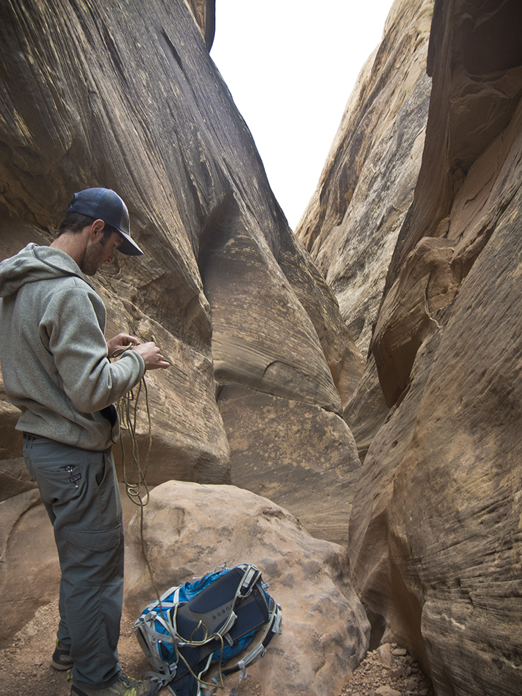
Hiking Ding and Dang canyons requires semi-technical canyoneering moves. Rope may prove useful in negotiating the obstacles.
Hike overview: Climb up Ding, skirt Ding Dang Dome, and return down Dang. Now that’s a tongue twister!
Start at the trail sign, and walk north up the wash towards the San Rafael Swell. Ignore a drainage that comes in from the right around 0.4 mile, and continue hiking northwest until the main wash splits at 1 mile. You can hike this loop in either direction, but obstacles in Dang Canyon prove to be harder going up than coming down. For this reason, this description details the route up Ding, and returning down Dang.
Up Ding
Veering right at the fork, enter Ding Canyon. The Navajo Sandstone sweeps up at an increasingly severe angle as you make your way into the San Rafael Reef, the distinctively upturned eastern edge of the San Rafael Swell.
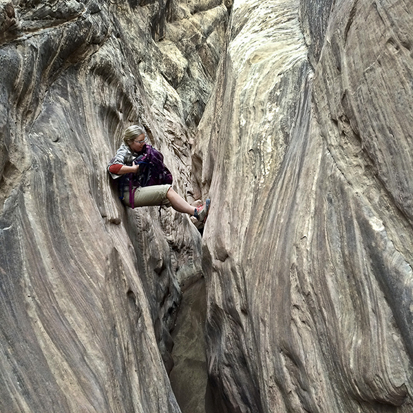
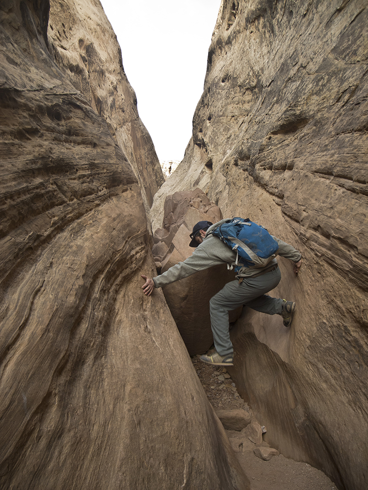
Follow the winding wash past juniper trees and desert shrubs, ascending a steep slickrock ramp in less than a quarter mile. The trail then follows the canyon floor as the walls pinch in, narrowing into a sculpted slot. Boulders and chockstones periodically block progress, but you can maneuver past these obstacles fairly easily, especially with the help of a partner.
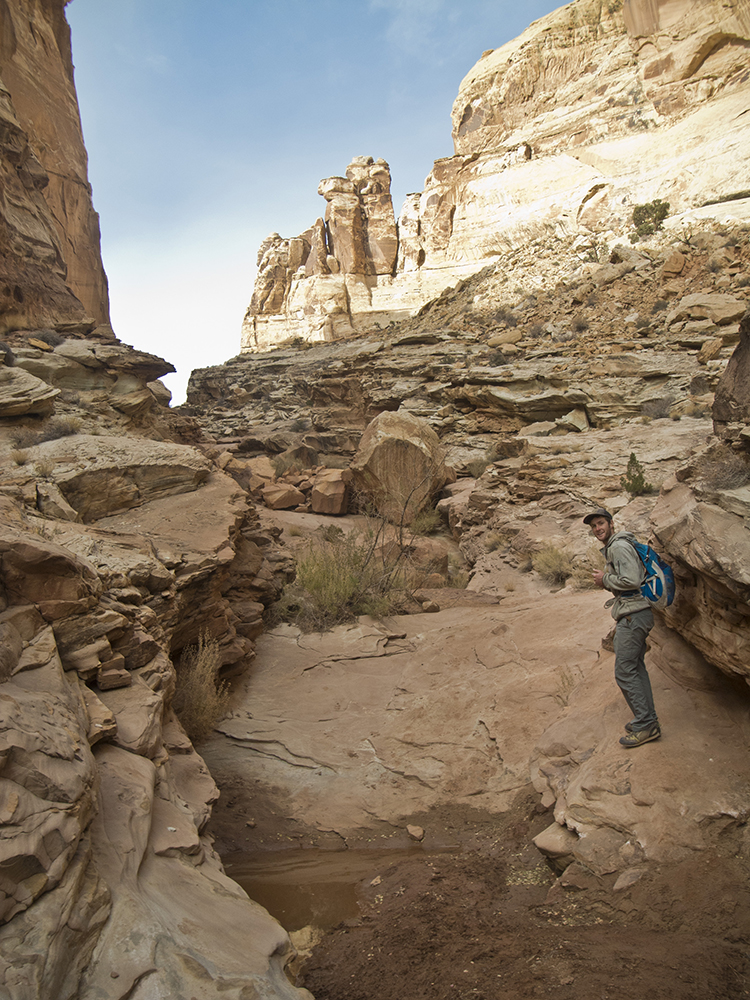
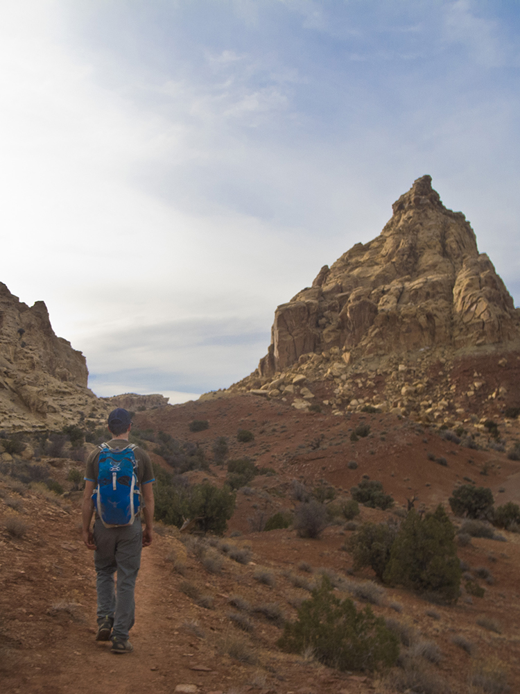
When the canyon opens up, you enter an amphitheater messy with rocks and debris. Several slickrock pitches continue upcanyon, along with muddy potholes. Skirt a series of pools at the top of the canyon, and look for cairns as you exit Ding. The trail veers left, heading west towards the pyramid of rock called Ding Dang Dome.
Past Ding Dang Dome
You continue a gradual climb up Chinle shale hills, hugging the backside of the honeycombed Reef. At 2.75 miles, you reach the hike’s high point at a saddle between Ding Dang Dome and the back of the Reef. Continue down the saddle, turn left into the first drainage, and begin heading down Dang Canyon.
Down Dang
The canyon starts off wide and easy as you head back through the Reef, with few obstacles slowing you down in the next half mile. Several downclimbs build up your confidence for the more technical canyoneering moves ahead.
After the canyon walls narrow, you arrive at the first significant obstacle. A large dry waterfall with two options of varying difficulty: descend via narrow ledges on the right canyon wall (warning: exposure), or downclimb to an undercut ledge on the left side of the dryfall. Both are unnerving for the casual canyon hiker, and the latter option looks especially intimidating from above. An unreliable bolt with an attached length of webbing is partway down the slickrock bowl, which you can use as a guide to lower yourself to the undercut ledge. (caution: some trail reports say the webbing isn’t always there. If it is, test the bolt/webbing before trusting it with your life).
From here on, a line of chockstone problems follow. Rope may prove useful in negotiating the obstacles. To avoid getting your feet wet, you may have to chimney and stem above several pools.
The canyon opens up around 4 miles, and you descend slabs of sandstone to a gravely wash bottom. From here, it’s a short walk to the mainstem of the trail where you retrace your steps back to your vehicle.
Directions to the trailhead
From Hanksville, Utah, drive north on UT 24 for 19.5 miles. Pass mile marker 136, and turn left onto Temple Mountain Road. Drive 5 miles, turning left at the junction towards Goblin Valley State Park. Reset your odometer, and continue southwest for about 6 miles. Make a right turn just after the Goblin Valley State Park boundary sign, and follow signs toward Little Wild Horse Canyon. At 11.4 miles, pass the Little Wild Horse Canyon trailhead and continue driving in the wash for 1.3 miles. The trailhead for Ding and Dang Canyons is on the right side of the road; pull out of the wash and park on the bank.