The Eardley Pool Trail cuts through the Sand Rafael Swell in southern Utah
Pass several small pools, and boulder hop until the trail dead ends at Eardley Pool
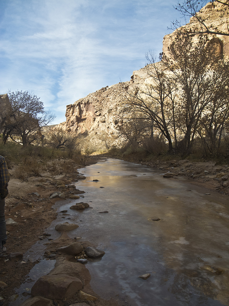
From the wooden trail board, drop into Straight Wash and start heading upcanyon. Cottonwood trees, blackbrush, and rubber rabbitbrush line the banks, and you may find intermittent water in the wash.
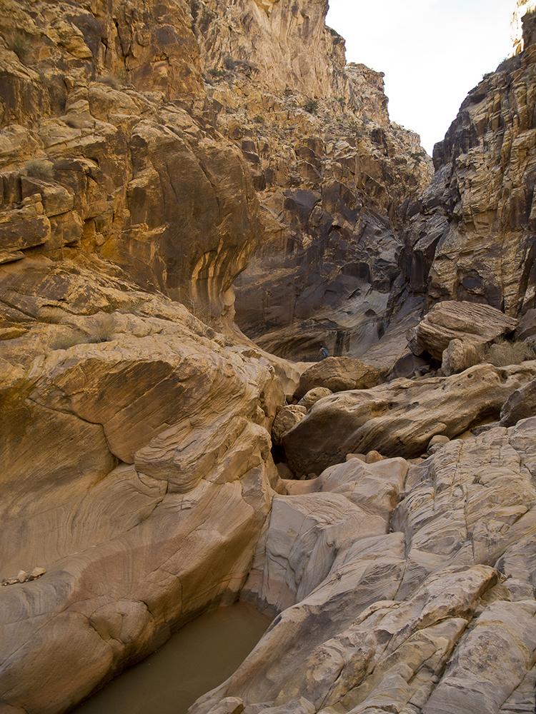
The trail cuts through steeply slanted rock layers that form the San Rafael Reef, the eastern edge of the San Rafael Swell. After a narrow passage through Navajo and Wingate Sandstone walls, the canyon opens into rolling Chinle hills around 1 mile. You veer northwest, following the mainstem of the wash. Where a drainage comes in from the right in a quarter mile, stay straight.
The trail gains elevation as it climbs up a sculpted bedrock chute. You reach the high point of the hike around 1.5 miles, as you clamber past some large boulders. Here, the canyon turns south through narrow, crumbly walls. Rocks lie strewn about the wash, and depending on recent rainfall, you may see several muddy pools.
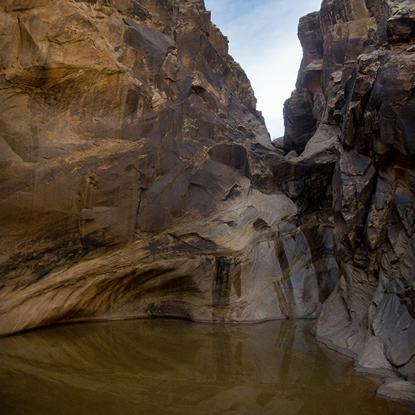
Eardley Canyon
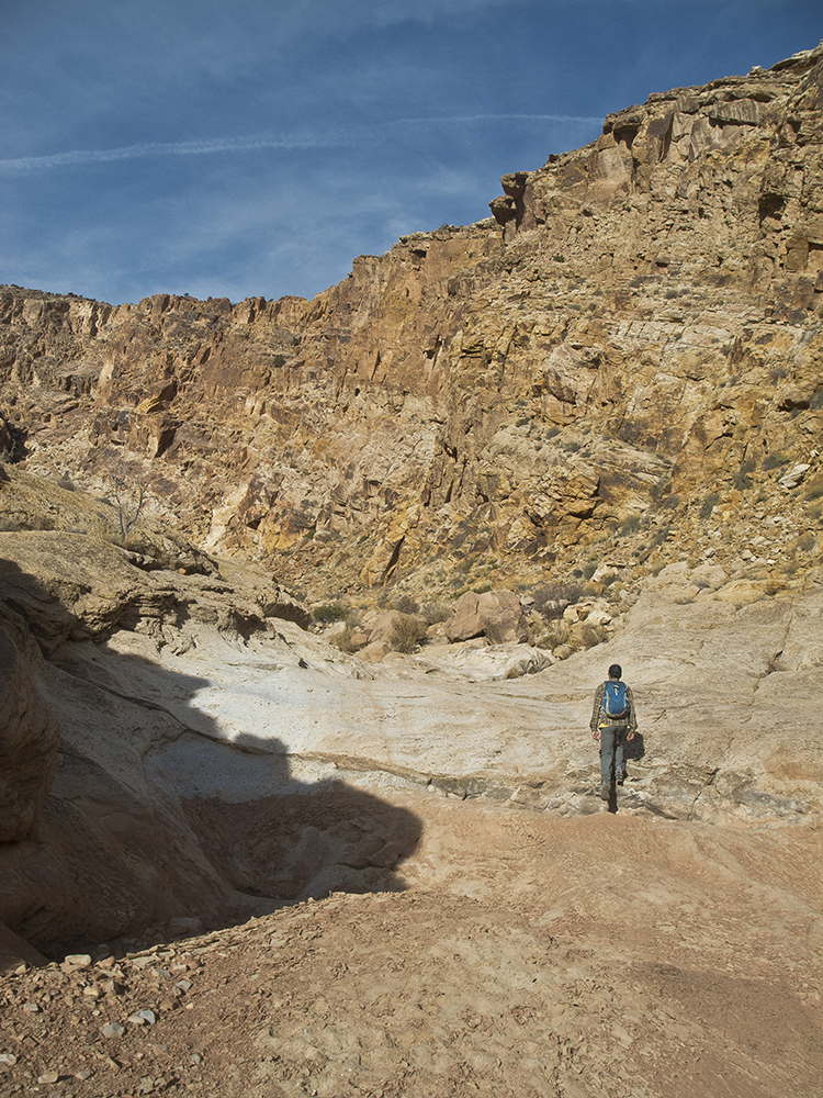
The canyon widens again around 2 miles as you approach Eardley Canyon. In another quarter mile or so, turn into Eardley Canyon, skirting pools and mud pits. Make your way through the narrow slot, boulder hopping your way about 500 feet upcanyon until you dead end at Eardley Pool.
Dip your feet in the water, or take a swim! This shady watering hole is a great summer respite. When you’re ready to return, retrace your route back to the trailhead.
Or take a shortcut back
After exiting Eardley Canyon, look for a well-worn foot trail that branches off to the right before the main wash swings north. This spur trail climbs up and over the hill, cutting east across a scree slope to rejoin Straight Wash. Turn right, and return to your vehicle.
Directions to the trailhead
From the junction of I-70 and Hwy 24, drive south on Hwy 24 for 14.3 miles. Turn right onto an unmarked dirt road and reset your odometer to 0. The road dips down at 1.5 miles, crossing a fork of Straight Wash that may have water. As the road turns north, you continue crossing several sandy washes. Around 3 miles, the road swings west and you reach the trailhead in another half mile.
Note: Road conditions may vary depending on recent weather. High clearance 4WD recommended.