Dig into Grand Canyon mining history on this grueling day hike on the Grandview Trail
The Grandview Trail follows remnants of a route that miners and mule trains used to cart copper ore from Last Chance Mine on Horseshoe Mesa to the canyon’s rim.
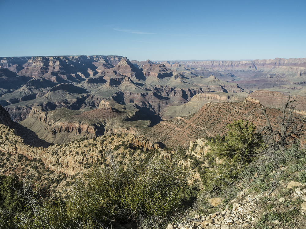
Mining relics, as well as tailings piles, dot Horseshoe Mesa.
To the Coconino Saddle
The trail begins on the north side of the looped parking area and wastes no time beginning its descent. Log stairs form switchbacks down the Kaibab Limestone cliff face, with uneven surfaces amplifying the feeling of exposure.
The trail levels out briefly as you cross a gully onto a west-facing slope. Contour around a promontory, turning your back to the thin ridgeline that extends from it. A brutal set of switchbacks ensues down sandstone slabs that make for rough walking.
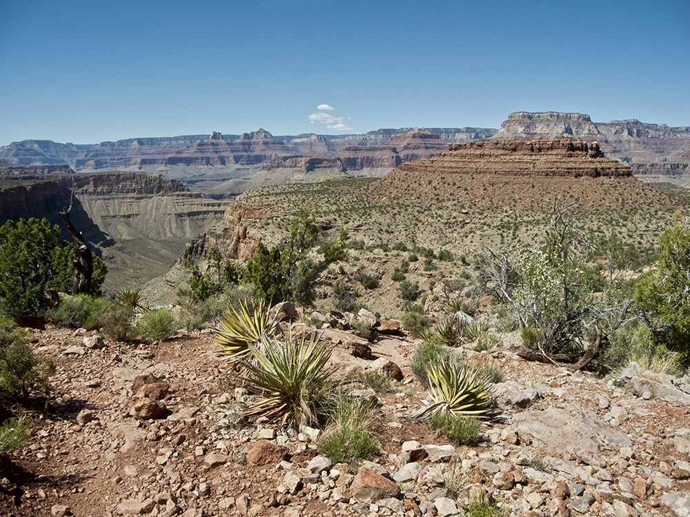
Around 1 mile, you reach Coconino Saddle (named for the contact zone between Coconino Sandstone and Hermit Shale), which offers exceptional views looking south into the upper valley of Hance Creek.
Horseshoe Mesa
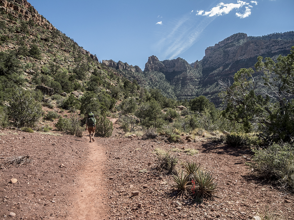
From here, traverse east across the head of the Cottonwood Creek drainage. The cobbled trail leads into tight switchbacks, descending through the Supai Formation and leveling into a gradual descent the rest of the way to Horseshoe Mesa. Cottonwood Creek deepens to your left as you head north; a few piñon and juniper trees offer modest shade.
Rocky sections interrupt the otherwise packed-dirt trail. You arrive at a trail junction at the bend of Horseshoe Mesa around 2.5 miles, from which you can embark on extended trips along several inner canyon trails. Campsites and toilet facilities are available to the north. This day hike continues east to Page Spring, but a couple longer options are generally summarized below:
- Continue past Page Spring down the Hance Trail to Hance Rapid at the Colorado River; or
- Descend the west fork of Horseshoe Mesa to hook up with the Tonto Trail and head west towards the South Kaibab Trail
Redwall descent to Page Spring
At the trail junction, turn right (east) towards Page Spring. The turquoise-colored rocks scattered along the trail are copper ore.
After climbing to the top of a small hill, bend around to the south and begin a steep descent of the Redwall Limestone. You cross a rock slide around 2.9 miles along a particularly treacherous part of the trail.
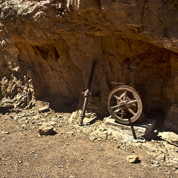
Soon after, you reach the Last Chance Mine. This mine was one of the few in the Grand Canyon that was actually profitable, with copper production estimated to have been around $75,000. Now listed on the National Register of Historic Places, this mine offers a snapshot of Southwest mining history. Metal bars prohibit entry into the shaft, but you’ll see several pieces of equipment nearby dating to the mine’s active years in the early 20th century.
Past this, the trail continues along an exposed slope. After more switchbacks, you reach the turnoff to Page Spring near 3.1 miles. Turn right at the sign and rusty wheelbarrow, following the trail across a drainage to hanging gardens and dripping springs at the base of the cliffs. This is the only reliable water source between the rim and Hance Creek; it and all other water should be treated.
Return the way you came, remembering that the steep descent you just finished turns into an even steeper ascent all the way to the canyon’s rim.
Directions to the Grandview Trail parking area
The trail starts at Grandview Point, one of the scenic overlooks along Desert View Drive (Hwy 64) on the park’s South Rim. You can access it from either entrance station. From Grand Canyon Village, drive about 12 miles east on Hwy 64, or from the junction of Hwy 89 and 64 at Cameron, Arizona, drive west on Hwy 64 for 44 miles. Turn north at the signed road for Grandview Point, and drive a short distance to the parking area.