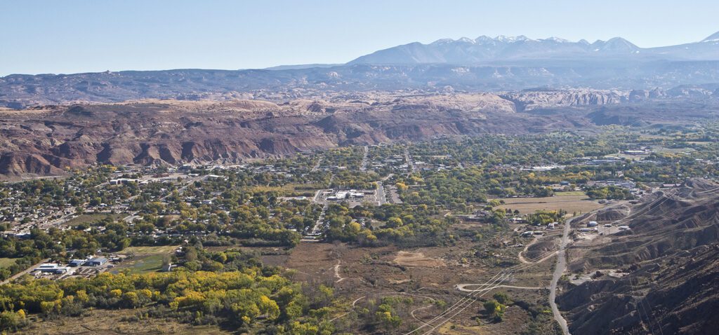
Views from the Portal Overlook Trail outside of Moab, Utah stretch as far as Arches National Park on a clear day
Climb up a sloping ledge of sandstone on the west side of the Colorado River to an overlook with sweeping views of the Moab area.
Note: This trail is hot during the middle of the day but in the shade in the afternoon, when the views are highlighted by the afternoon/evening sun.
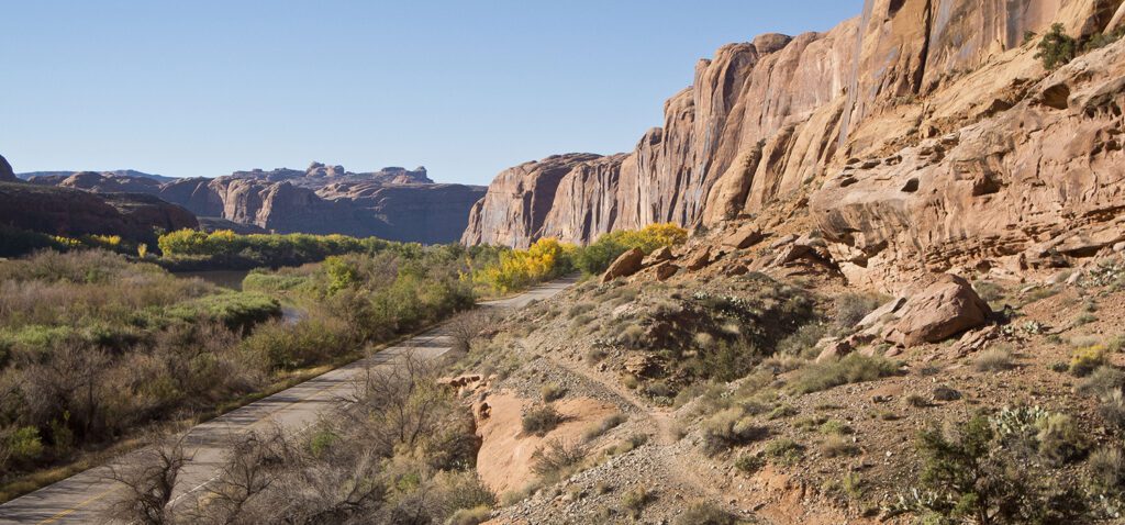
For the first few hundred feet, the trail parallels the highway, going through a dense stand of trees growing at the base of the cliff. But it soon climbs out of the streamside vegetation onto a dry sandy bench covered with saltbush and cacti. Note the cobbles deposited here by the Colorado River in the recent past.
In about a half mile, you reach a trail register. Then the trail begins to climb in earnest. It’s possible to save some distance on this hike by parking along the road upstream of the trailhead and accessing the trail at this point.
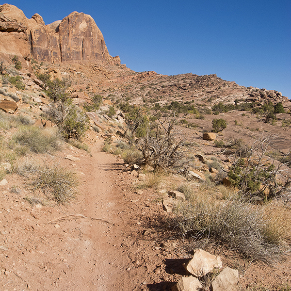
The trail leaves behind the recently deposited terrace of sand, gravel, and cobbles and begins to aggressively climb up a sloping ramp of Kayenta Sandstone.
Notice the dramatic difference between the Kayenta you are walking on, which was deposited by rivers and streams, and the upper cliffs of Navajo Sandstone, which were windblown sand dunes in the Jurassic Period (150–200 million years ago). After working your way up the broken ledges and scattered rock debris, you will get your first view into the Moab Valley at about 1.1 miles.
Panoramic views
The Portal Overlook is on a large slab of sandstone perched on top of a sheer cliff. Be careful, there are no safety fences!
Looking north, you can see the rock formations (and one of the Windows) in Arches National Park, as well as the Colorado River entering the Moab Valley. On the left side of the river, you can see the Atlas uranium mill tailings pile that polluted the river for decades, but that is now being moved to a more geologically stable area near the Book Cliffs.
After drinking in the panoramic views of Moab Valley and the distant La Sal Mountains, return the way you came, unless you wish to continue hiking to Poison Spider Mesa, about a mile farther.
Directions to the trailhead
From downtown Moab, drive about 4 miles north on US 191 to the junction with UT 279. Turn left and drive about 4 miles to the JayCee Park Recreation Site on the right side of the road. The trailhead is on the right side of the parking lot as you enter. Camping, pit toilets, and garbage collection are available.