Hike the Spencer Trail while you’re visiting Lees Ferry
The Spencer Trail climbs up the Echo Cliffs to a broad, open bench with stunning views.
The trail leaves from the gravel parking lot a few hundred feet past the launching ramps where you may see groups rigging rafts for river trips through the Grand Canyon. Remember to display your pass on your dashboard so you do not get ticketed by the park service.
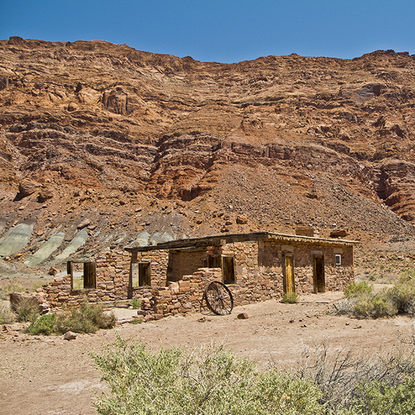
At the edge of the parking lot you will see a sign that says “Lee’s Ferry Historic District, River Trail, and Spencer Trail.” Go past the sign, continue beyond the two small rock buildings on your left, and cross a wooden bridge.
Veer left when you reach a couple modern stone buildings, and you will soon reach an old rusty boiler that was part of Charles Spencer’s failed attempt to recover finely powdered gold from the nearby Chinle clay deposits. A few hundred feet farther brings you to the junction of the Spencer Trail and River Trail; turn left.
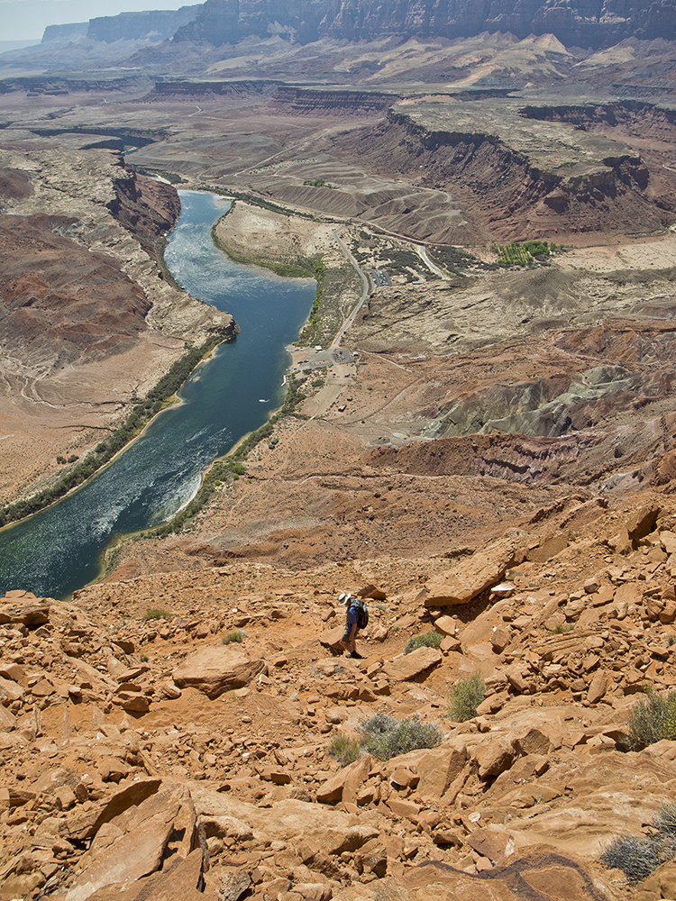
Climbing up, up, and up
The trail aggressively climbs up a debris slope below the cliffs that tower above. In about a hundred yards, you reach a set of sandstone slab steps. Soon after you’ll reach the first of numerous switchbacks.
As you climb, the upper part of the Paria Canyon comes into view. The Paria River is now one of the most important sources of sand for creating critically important beaches along the river in the Grand Canyon because Lake Powell captures all the sediment that washes down from the uplands of the Colorado River Basin. You can also see Lonely Dell, the area where John D. Lee and his family lived, along with many subsequent Mormon families that operated the ferry over the years.
After three or four switchbacks, the trail reaches the bottom edge of the cliff for the first time, but it soon is back on the rugged and rocky debris slope. After the sixth switchback, the trail works its way along a small ledge above the first fractured cliff face.
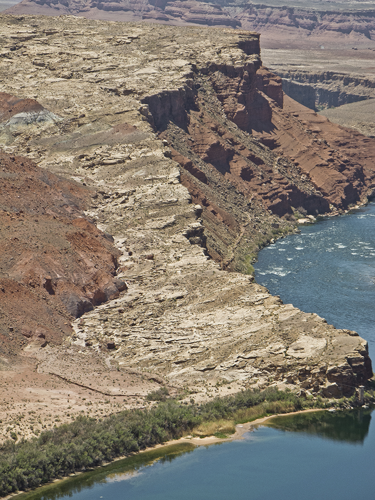
While you are taking a moment to catch your breath, look down at the ledge of white sandstone across the river from the launching ramp. Known as “Lee’s Backbone,” this sharply sloped slickrock was the location of the wagon road as it approached from the south. It is still faintly visible if you look closely. It was appallingly rough and was considered one of the worst stretches along what became known as the Honeymoon Trail, so named because Mormon pioneers traveled it to have their marriages sealed at the temple in St. George, Utah.
Around the turn of the century, a new road called “The Dugway” was constructed along the steep slope of broken red rock to the right of Lee’s Backbone. The Dugway was used until a few months before the completion of Navajo Bridge in 1926.
Are we there yet?
On a long traverse away from the river, up the Paria Canyon, the trail levels off a bit, which provides a welcome respite from the steep climb. At one point, it actually loses some elevation, which is hard to accept knowing that there is still a lot of elevation to overcome before reaching the top.
As you labor your way up this rugged, steep trail, keep in mind that, in 1776, the Dominguez/Escalante expedition climbed this same ridge a mile or so farther up the Paria River. It is difficult to imagine how difficult it must have been to get a large group of men, their horses, and their supplies up this steep, sandy, treacherous slope almost 300 years ago.
For those with excellent route finding skills, it is possible to hike along the ridge top to Dominguez Pass and return to the Paria Canyon floor by the route those early explorers used.
At one point the trail crosses a very steep debris slope where it becomes quite narrow, about 18 inches wide. This is an area to use extra caution because the trail is littered with loose rocks.
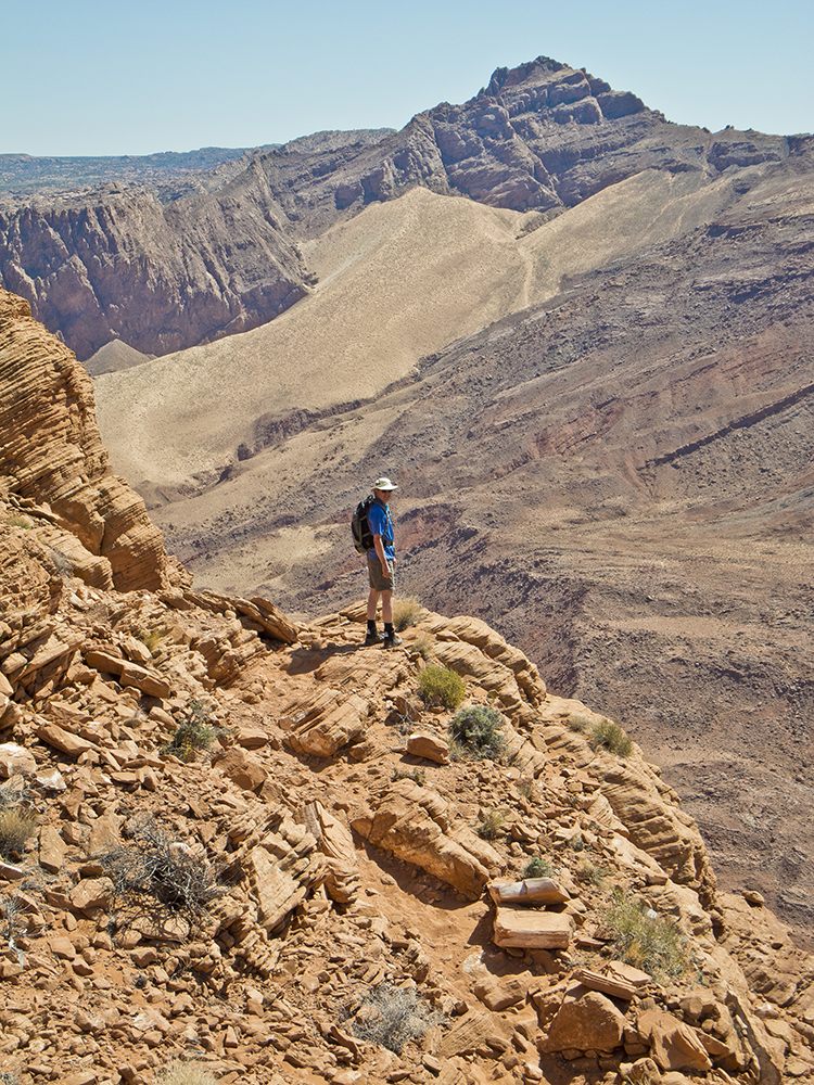
Soon after the narrow section, the trail climbs a series of short switchbacks and rock ledges as it works its way up to a small outcropping. From here, the trail again climbs aggressively up through some very rugged and broken terrain until it finally reaches a long traverse along a relatively level ledge that is about 50 feet wide. At the end of the long ledge, the trail goes through a final set of switchbacks to reach the top.
Views at last
Views to the east include the Kaiparowits Plateau, the long flat landform to the north, Navajo Mountain, and the Navajo Generating Station, which supplies power for running the massive pumps to get water from the Colorado River to Phoenix and Tucson.
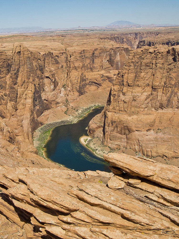
Views to the west include Marble Canyon, cut by the Colorado River, the Kaibab Plateau in far distance, and the Vermilion Cliffs, which define the southern edge of the Paria Plateau. If you walk down the slope towards the east you can peer into the only remaining section of Glen Canyon, which was drowned by Lake Powell in the early 1960s.
When you are done exploring the area and absorbing the views, return down the way you came.
Directions to the Spencer Trail
Drive about 6 miles from the junction of the Lee’s Ferry road and Highway 89A to the gravel parking lot at the end of the road just beyond the boat launching ramp. The junction of 89A and Lee’s Ferry Road is near the western end of the Navajo Bridge, which crosses the Colorado River about 125 miles north of Flagstaff, AZ.