Wander through forests on the north rim of the Grand Canyon on the Uncle Jim Trail
Note: The Dragon Bravo wildfire burned across the North Rim in July 2025. Check the Grand Canyon National Park website for closures and updates
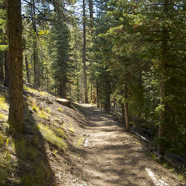
The Uncle Jim Trail takes you through ponderosa pine, Douglas fir, and the occasional stand of aspen.
The Uncle Jim trail starts next to a corral for the mules that also use this trail; for the first mile, it shares the path with the Ken Patrick Trail. From the trailhead, you climb a gentle grade and are treated to occasional views into Roaring Springs Canyon and the North Kaibab Trail far below. The trail soon curves left, and the views are left behind.
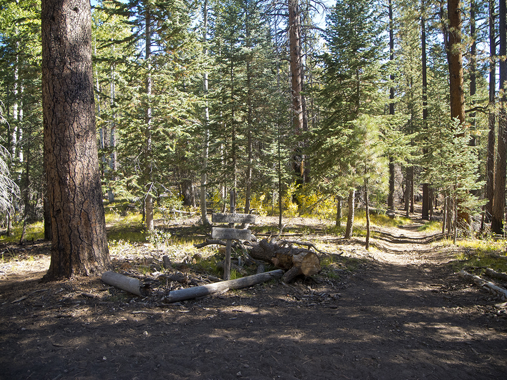
The trail climbs out of a valley, and at 0.9 mile, you reach a junction clearly defined with logs and a sign indicating that the Uncle Jim Trail goes right (the Ken Patrick trail goes straight). After the junction, the trail drops into another small drainage, hooks to the right, climbs a short hill, and arrives at another junction at 1.2 miles. This is the beginning and end of the loop.
Loop around Uncle Jim Point
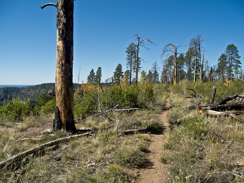
The trail ahead takes you to the rim of Bright Angel Canyon and follows it to Uncle Jim Point. A significant part of it travels through a burned area and places where many trees have died. The trail to the right goes directly to Uncle Jim Point, through a much healthier forest with minimal fire impacts.
Turning right, you go through a forest of Douglas fir, Engelmann spruce, ponderosa pine, and occasional groups of aspen. Within a couple hundred feet of Uncle Jim Point, the trail goes through a recent burn where New Mexican locust now abounds. You soon reach a metal hitching post for the mules; continue past it to Uncle Jim Point a couple hundred feet farther.
“Uncle” Jim was a game warden named James T. Owens, hired in 1906 after President Theodore Roosevelt established the Grand Canyon Game Preserve. During that era, wildlife managers believed that predators were “bad” and needed to be removed to benefit “good” game species.
Even President Roosevelt, a strong conservationist, hunted mountain lions and described one chased into a tree on the North Rim as “the destroyer of deer, the lord of the stealthy murder facing his doom with a heart both craven and cruel.”
Uncle Jim killed many mountain lions in an effort to benefit the Kaibab deer population, an effort that exceeded everybody’s wildest dreams as the deer herd exploded and destroyed much of the vegetation on the Kaibab Plateau. It is estimated that the deer population grew to 100,000 before it crashed. These events led wildlife managers to understand the importance of predators in managing prey species.
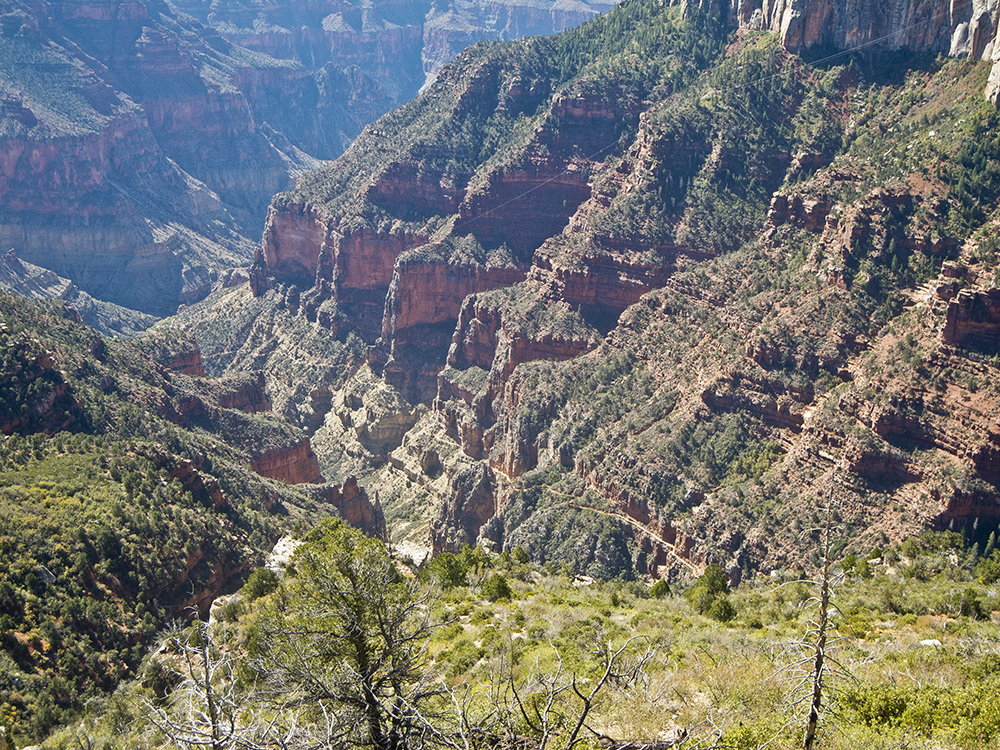
Views from Uncle Jim Point include Bright Angel and Roaring Springs canyons; the North Kaibab trail; Bright Angel Point; Deva, Zoroaster, and Brahma temples; the South Rim; Bill Williams Mountain near the town of Williams; and the San Francisco Peaks near Flagstaff.
The return hike
You can either return the way you came, or take the trail to the right to follow the rim of Bright Angel Canyon for another 0.8 mile. This section of the loop is 0.3 mile longer than directly returning to the junction, but you will get views into upper Bright Angel Canyon.
Once you have reached the junction that starts the loop, return the way you came.
Directions to the Uncle Jim Trail on the North Rim
The trailhead is located at the east end of the parking lot for the North Kaibab trail, 2 miles north of the Grand Canyon Lodge on Highway 67 (note that this highway is open into the North Rim only from mid May until the first snow).