This is a popup dialog that overlays the main content of the page. The popup includes a search form to help you find the information you are seeking. Pressing the close button or using the escape key will close the popup.
Resources
From maps and fact sheets to scientific data and issue briefs – the most vital information about the issues you care about, at your fingertips.
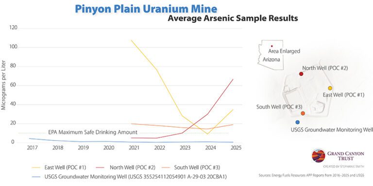
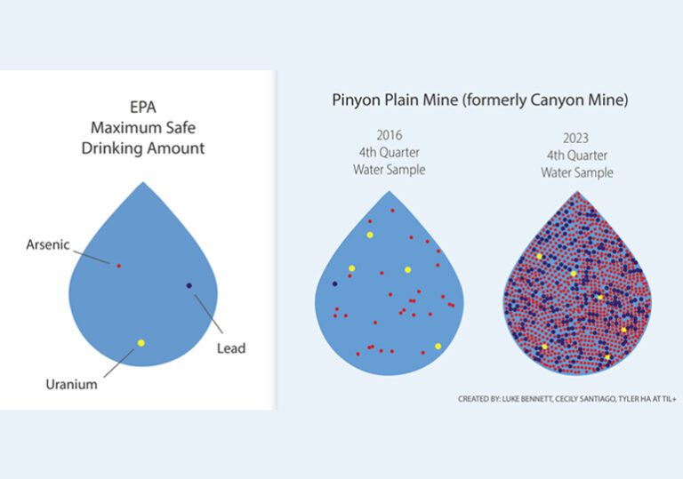
Rising arsenic levels in monitoring wells at Pinyon Plain uranium mine raise concerns about possible contamination of groundwater in the Grand Canyon region.
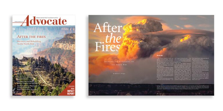
The spring 2026 edition of the Grand Canyon Trust’s Colorado Plateau Advocate magazine, with a feature on rebuilding after the Grand Canyon fires, plus the 2026 Impact Report.
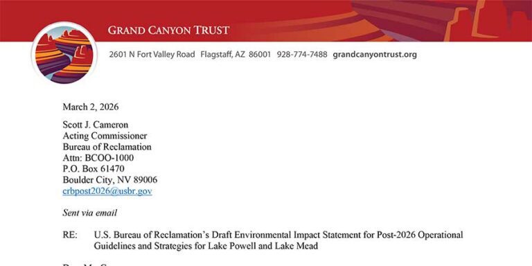
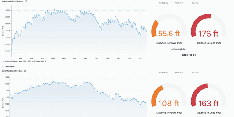
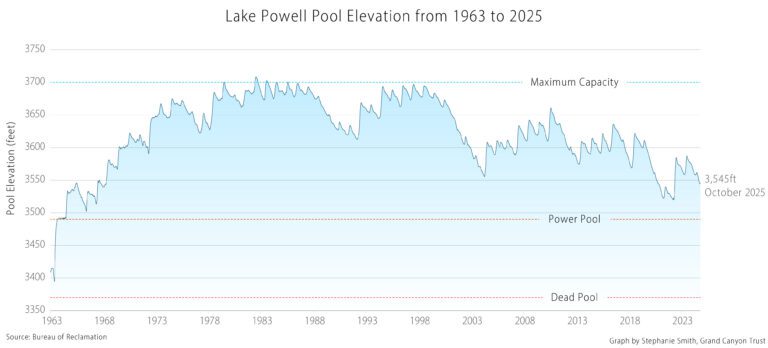
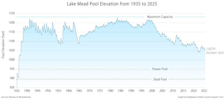
Read the Trust’s comments on the Bureau of Reclamation’s proposed guidelines and management strategies for the coordinated operations of Lake Powell and Lake Mead.
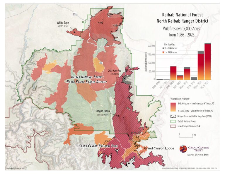
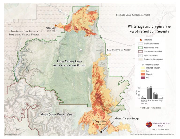
See a map of burn severity in the Dragon Bravo and White Sage fires, which burned more than 200,000 acres on the north rim of the Grand Canyon in 2025.
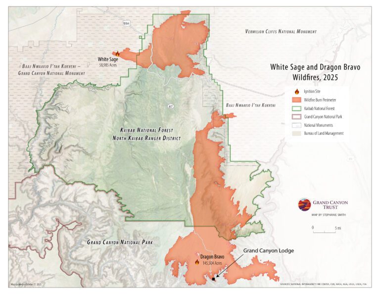
See a map of the areas the Dragon Bravo and White Sage fires burned on the north rim of the Grand Canyon in the summer of 2025, destroying the lodge and numerous other park buildings.
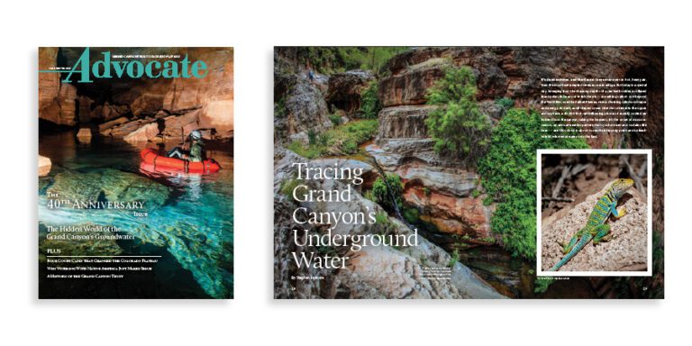
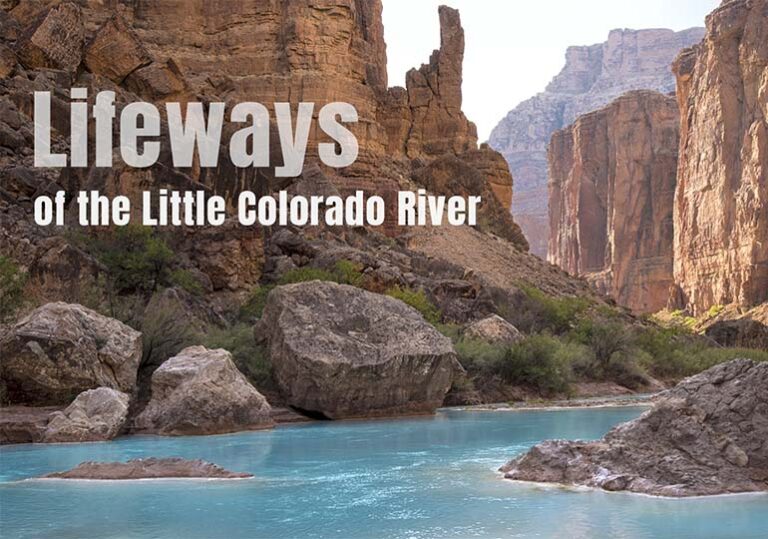
The fall 2025 edition of the Grand Canyon Trust’s Colorado Plateau Advocate magazine, including a deep dive into the Grand Canyon’s ancient groundwater.