2018 Backcountry Permits for Grand Canyon National Park Map

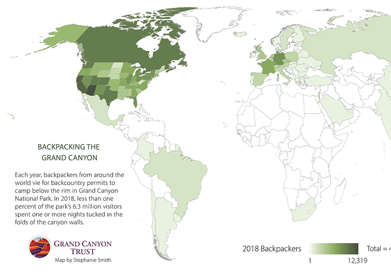
Grand Canyon National Park is the second most visited national park in the country, yet few spend a night below the rim. This much is clear: people come from all over the world to backpack in the Grand Canyon! Want a backpacking permit of your own? Find out how to get one ›
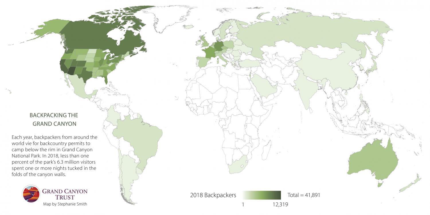
Map of backcountry permits from around the world for Grand Canyon National Park.

DATA SOURCE: GRAND CANYON NATIONAL PARK

Download a PDF of this map

Maps and graphs may be used for non-commercial purposes provided that they are not altered or edited and they are appropriately credited.

All map products should be credited to Stephanie Smith, Grand Canyon Trust, unless otherwise noted. A hyperlink to the Grand Canyon Trust website is appreciated.

For higher quality images or custom sizing please contact our communications director, Ashley Davidson, at adavidson@grandcanyontrust.org

Related Resources

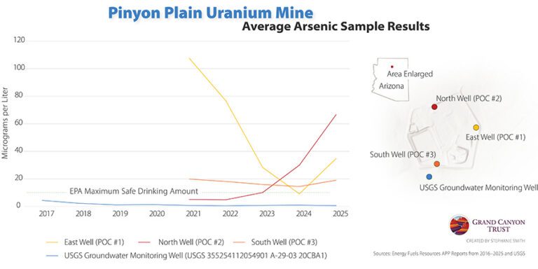
Line graph showing average arsenic levels (2017–2025) at Pinyon Plain Uranium Mine wells, with some readings exceeding EPA’s safe drinking water limit. Inset map marks well locations.
Rising arsenic levels in monitoring wells at Pinyon Plain uranium mine raise concerns about possible contamination of groundwater in the Grand Canyon region.
Magazine cover and feature spread titled "After the Fires," showing a forest landscape and a large cloud of smoke rising over a canyon at sunset.
The spring 2026 edition of the Grand Canyon Trust’s Colorado Plateau Advocate magazine, with a feature on rebuilding after the Grand Canyon fires, plus the 2026 Impact Report.