2025 Grand Canyon North Rim Fires Burn Severity Map

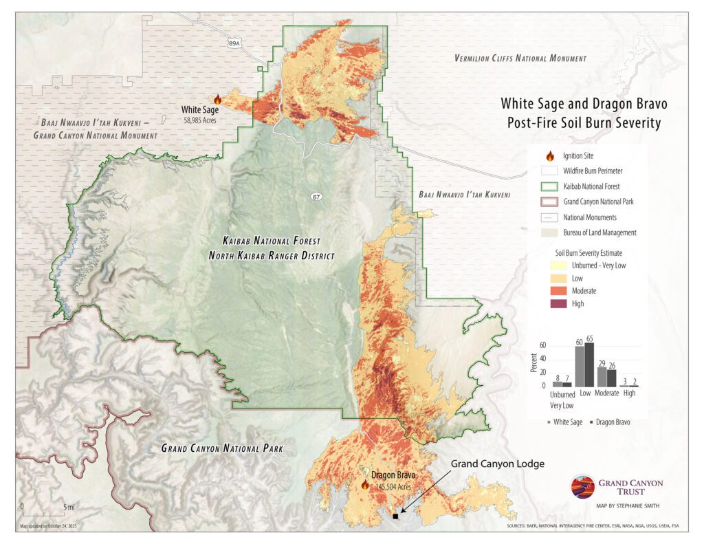
Map depicting burn severity on north rum of Grand Canyon for White Sage and Dragon Bravo areas, showing soil burn levels from unburned to high, with key landmarks and boundaries clearly labeled.

How severely was the soil burned in the Dragon Bravo Fire on the the north rim of the Grand Canyon?

As this map shows, according to data from interagency Burned Area Emergency Response (BAER) teams from the U.S. Department of the Interior and U.S. Forest Service, most (more than 70%) of the soil inside the perimeter of the Dragon Bravo Fire on the north rim of the Grand Canyon was burned at low or very low severity or was unburned.

According to 2025 data, 9,851 acres (7%) was unburned or burned at very low severity, 97,724 acres (65%) at low severity, 38,354 acres (26%) at moderate severity, and 3,470 acres (2%) at high intensity. The percentages were similar for the White Sage Fire to the north.
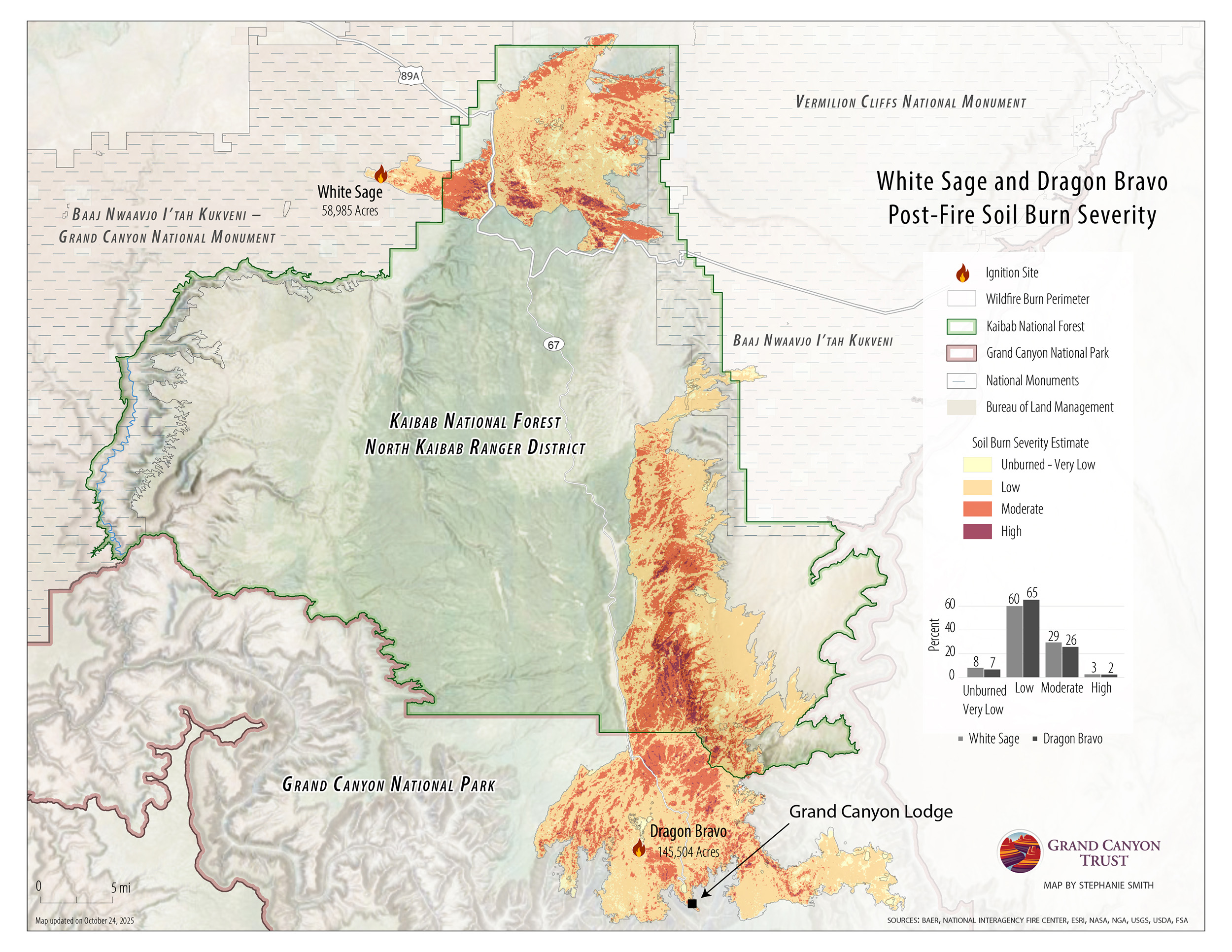
What does the map of soil burn severity for the Dragon Bravo and White Sage fires look like?

Map depicting burn severity on north rum of Grand Canyon for White Sage and Dragon Bravo areas, showing soil burn levels from unburned to high, with key landmarks and boundaries clearly labeled.
Download your free PDF of this map

Maps and graphs may be used for non-commercial purposes provided that they are not altered or edited and they are appropriately credited.

All map products should be credited to Stephanie Smith, Grand Canyon Trust, unless otherwise noted. A hyperlink to the Grand Canyon Trust website is appreciated.

For higher quality images or custom sizing please contact our communications director, Ashley Davidson, at adavidson@grandcanyontrust.org

Related Resources

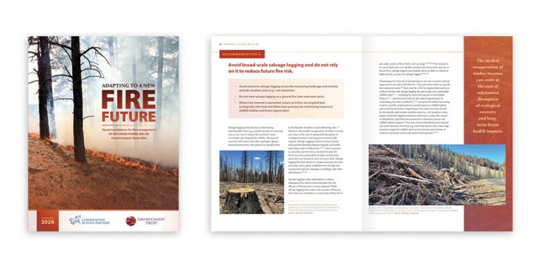
Report cover and inner pages featuring images of forest fire aftermath, burnt trees, and text discussing forest management and fire risk reduction.
This report outlines recommendations for fire management on the Kaibab Plateau and the Grand Canyon’s north rim.
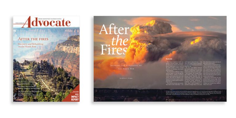
Magazine cover and feature spread titled "After the Fires," showing a forest landscape and a large cloud of smoke rising over a canyon at sunset.
The spring 2026 edition of the Grand Canyon Trust’s Colorado Plateau Advocate magazine, with a feature on rebuilding after the Grand Canyon fires, plus the 2026 Impact Report.