Bears Ears and White Mesa Mill Map

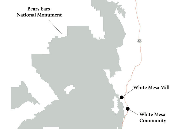
The White Mesa Mill, the U.S.’s last functioning uranium mill, is located a mile from Bears Ears National Monument and next to the Ute Mountain Ute community of White Mesa in southeastern Utah.

Locator map 

Bears Ears and White Mesa Mill mapDownload a PDF of this map ›

Simplified map

Bears Ears and White Mesa Mill map

Download a PDF of this map ›

Resource - map credit Stephanie Smith

Maps and graphs may be used for non-commercial purposes provided that they are not altered or edited and they are appropriately credited. All map products should be credited to Stephanie Smith, Grand Canyon Trust, unless otherwise noted. A hyperlink to the Grand Canyon Trust website is appreciated.

For higher quality images or custom sizing please contact our communications director, Ashley Davidson, at adavidson@grandcanyontrust.org.

Related Resources

A December 2024 poll of 500 voters across Utah by public opinion research firm New Bridge Strategy found strong public support for Bears Ears and Grand Staircase-Escalante national monuments, and for national monuments generally. In addition, nearly nine in 10 Utah voters say it is very important for tribes to have a strong role in […]

A bar graph showing in pink 75% of Utah voters support presidents' ability to protect public lands as national monuments, compared to 25% who oppose in gray bar, from the 2024 Utah National Monuments Poll
Utah voters strongly support national monuments and Bears Ears and Grand Staircase-Escalante in particular a December 2024 poll shows.