This is a popup dialog that overlays the main content of the page. The popup includes a search form to help you find the information you are seeking. Pressing the close button or using the escape key will close the popup.
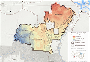
Resources › North Rim Ranches Projected Temperature Change
Maps and graphs may be used for non-commercial purposes provided that they are not altered or edited and they are appropriately credited.
All map products should be credited to Stephanie Smith, Grand Canyon Trust, unless otherwise noted. A hyperlink to the Grand Canyon Trust website is appreciated.
Read the Trust’s comments on the Bureau of Reclamation’s proposed guidelines and management strategies for the coordinated operations of Lake Powell and Lake Mead.
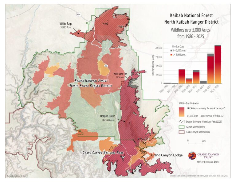
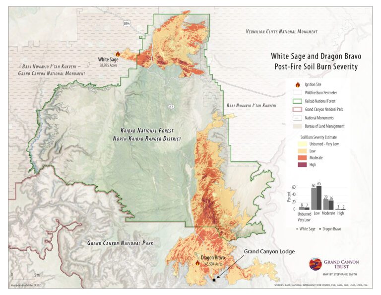
See a map of burn severity in the Dragon Bravo and White Sage fires, which burned more than 200,000 acres on the north rim of the Grand Canyon in 2025.