San Juan River Watershed Boundaries Map

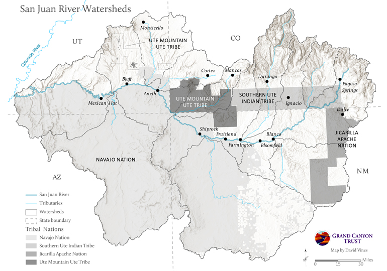
Waterways across the Four Corners region flow through the lands of the Ute Mountain Ute Tribe, Southern Ute Indian Tribe, Jicarilla Apache Nation, and Navajo Nation before pouring into the San Juan River.

Map of watersheds influencing the San Juan River

Download your copy

Maps and graphs may be used for non-commercial purposes provided that they are not altered or edited and they are appropriately credited.

This map product should be credited to David Vines, Grand Canyon Trust. A hyperlink to the Grand Canyon Trust website is appreciated.

For higher quality images or custom sizing please contact our communications director, Ashley Davidson, at adavidson@grandcanyontrust.org

Related Resources

Advocate Magazine cover with image of red packraft on clear blue water in a cave in the Grand Canyon
The fall 2025 edition of the Grand Canyon Trust’s Colorado Plateau Advocate magazine, including a deep dive into the Grand Canyon’s ancient groundwater.
Graphs display Lake Powell and Lake Mead Levels from 2000 to 2023, showing current elevations and distances to power and dead pool thresholds in feet.
How much water is in Lake Powell and Lake Mead? See a live feed of distance above power pool and dead pool at both reservoirs.