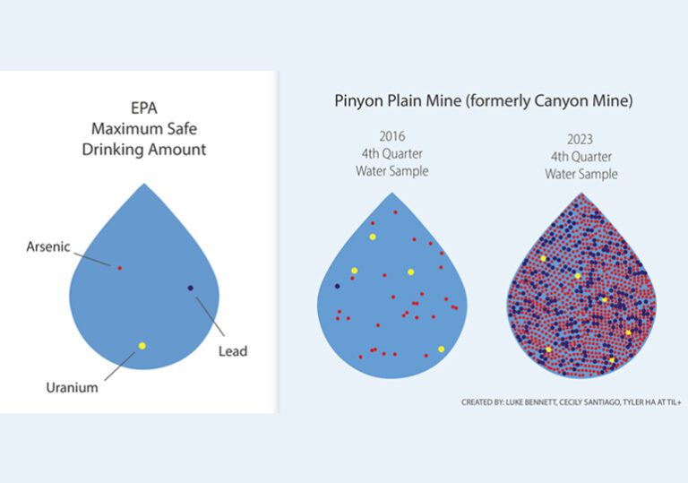
Why is there concern about arsenic levels in groundwater beneath Pinyon Plain uranium mine, formerly Canyon Mine, near the Grand Canyon?
Groundwater systems throughout the Grand Canyon region, with its geology of fractured rock, are complex; water can flow in many directions simultaneously and at speeds ranging from hours to millennia.
Because the hydrogeology beneath Pinyon Plain Mine is poorly understood, rising arsenic levels in monitoring wells at the mine raise concerns about possible contamination both of the Coconino Aquifer and of the deeper Redwall-Muav Aquifer, which feeds seeps and springs in the Grand Canyon.
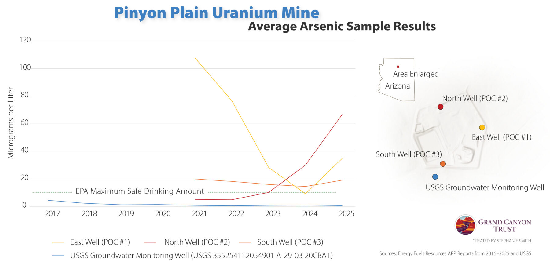
Why doesn’t the graph show the arsenic levels in the monitoring wells before 2021?
The monitoring wells weren’t drilled until 2021, nine years after mine development resumed (following roughly two decades of no development) and five years after the mine shaft started taking on millions of gallons of groundwater every year.
Maps and graphs may be used for non-commercial purposes provided that they are not altered or edited and they are appropriately credited.
All map products should be credited to Stephanie Smith, Grand Canyon Trust, unless otherwise noted. A hyperlink to the Grand Canyon Trust website is appreciated.
For higher quality images or custom sizing please contact our communications director, Ashley Davidson, at adavidson@grandcanyontrust.org