Bears Ears and Grand Staircase-Escalante National Monuments Modifications Map

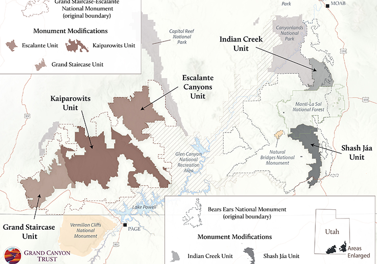
View the map of modifications made to Bears Ears and Grand Staircase-Escalante national monuments.

Modifications to Bears Ears and Grand Staircase-Escalante national monuments

Download your copy

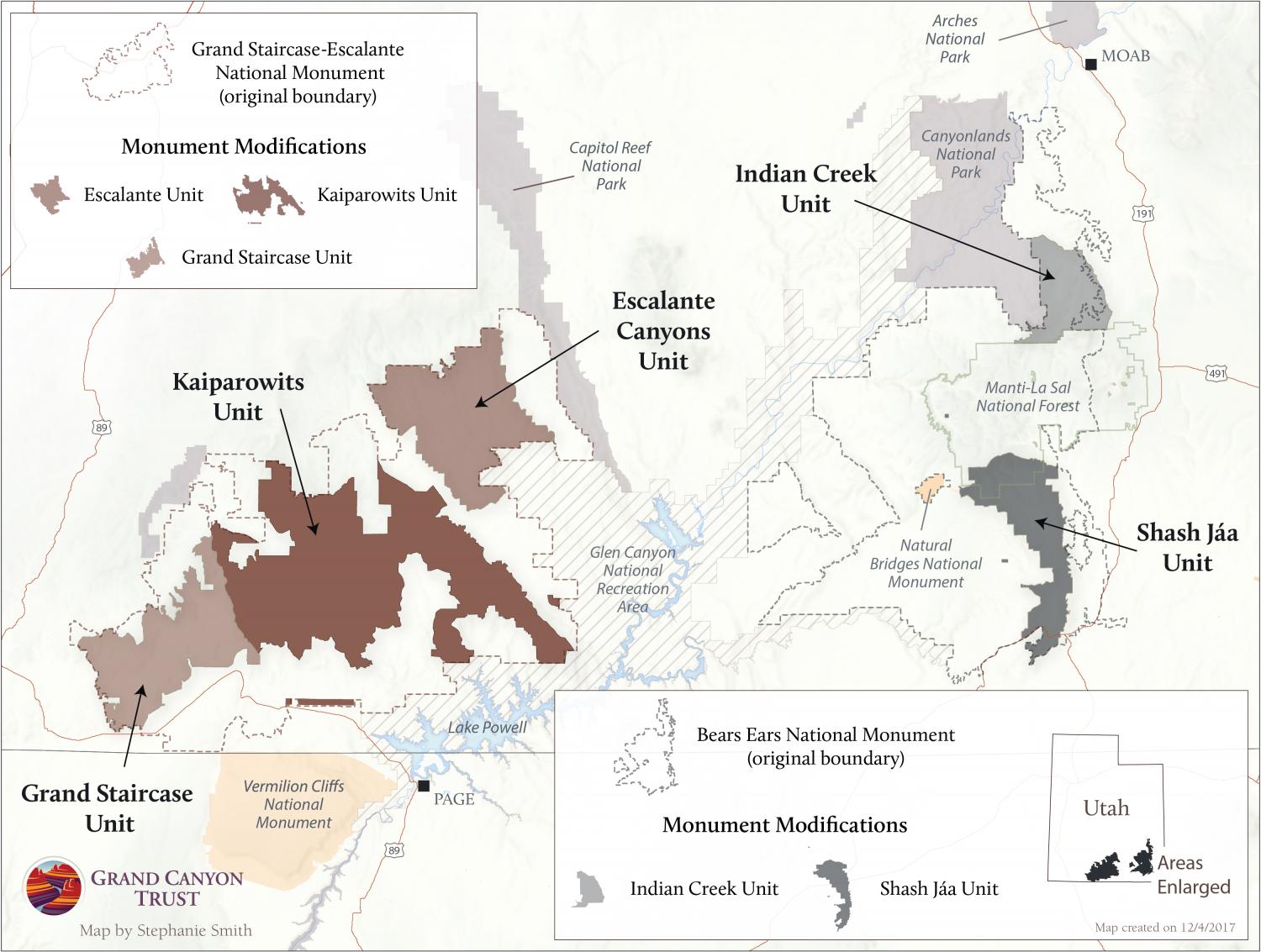
Get individual maps of changes to Bears Ears or Grand Staircase-Escalante National Monument.

Maps and graphs may be used for non-commercial purposes provided that they are not altered or edited and they are appropriately credited.

All map products should be credited to Stephanie Smith, Grand Canyon Trust, unless otherwise noted. A hyperlink to the Grand Canyon Trust website is appreciated.

For higher quality images or custom sizing please contact our communications director, Ashley Davidson, at adavidson@grandcanyontrust.org

Related Resources

Illustrated map of the Colorado Plateau showing major landmarks, animals, and vegetation across regions of Utah, Colorado, New Mexico, and Arizona.
The Grand Canyon Trust’s 2025 map of national monuments, national parks, landmarks, plants, and animals across the Colorado Plateau.