
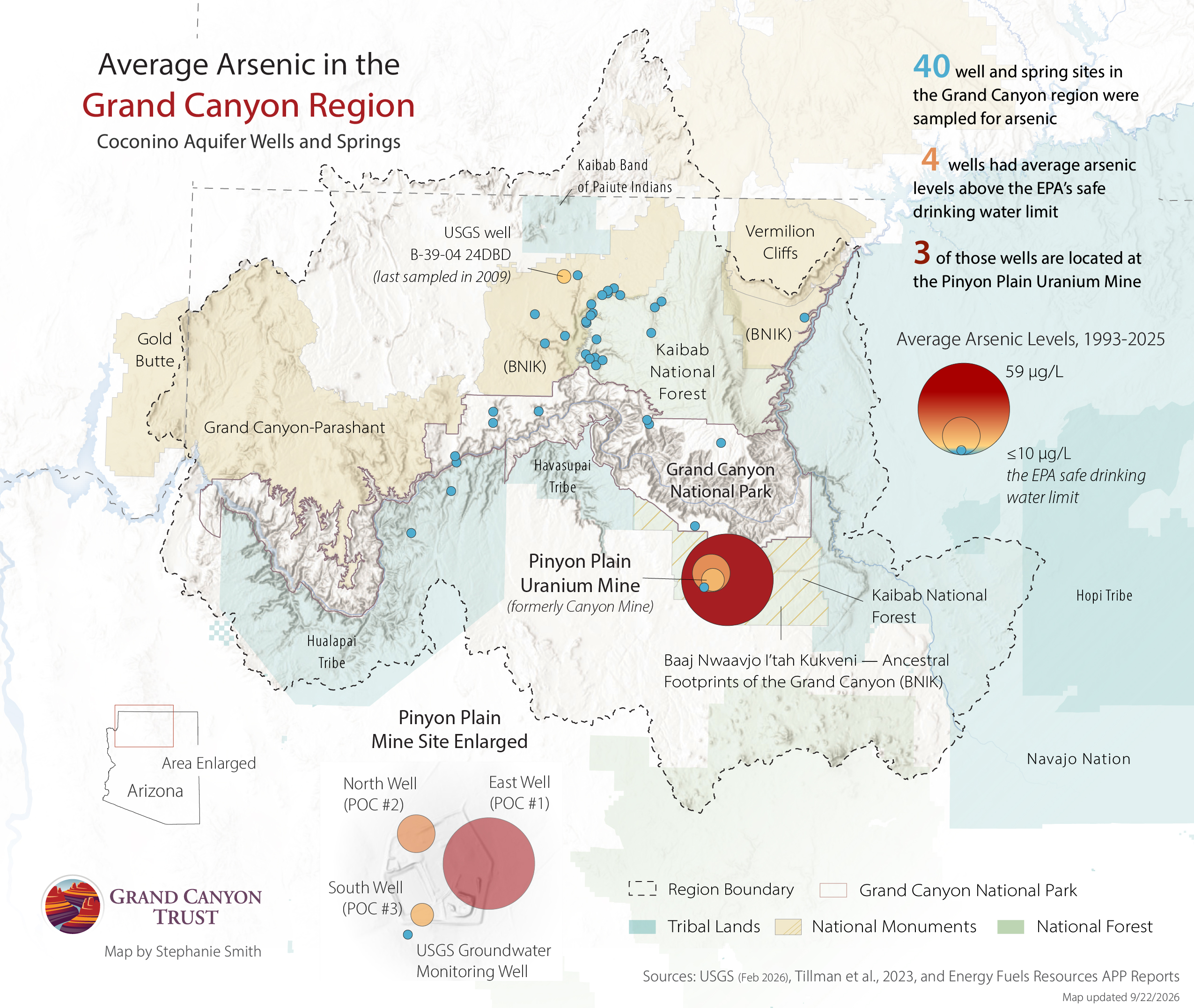
Data shows arsenic levels at Grand Canyon uranium mine are unusually high for the region
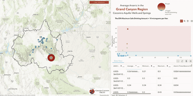
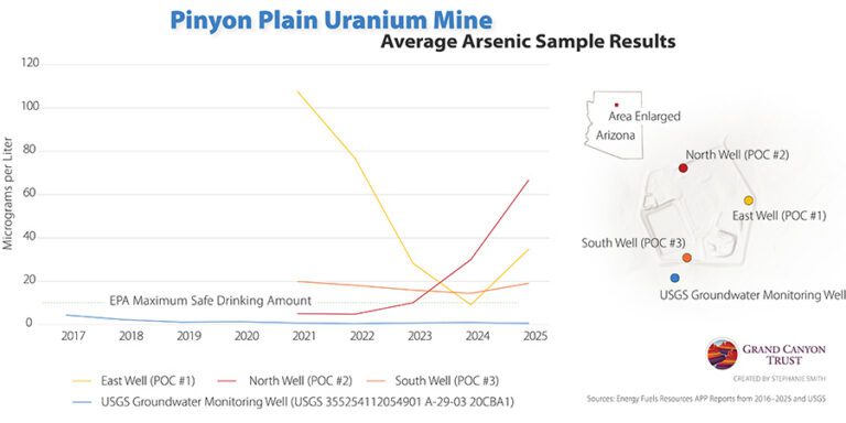
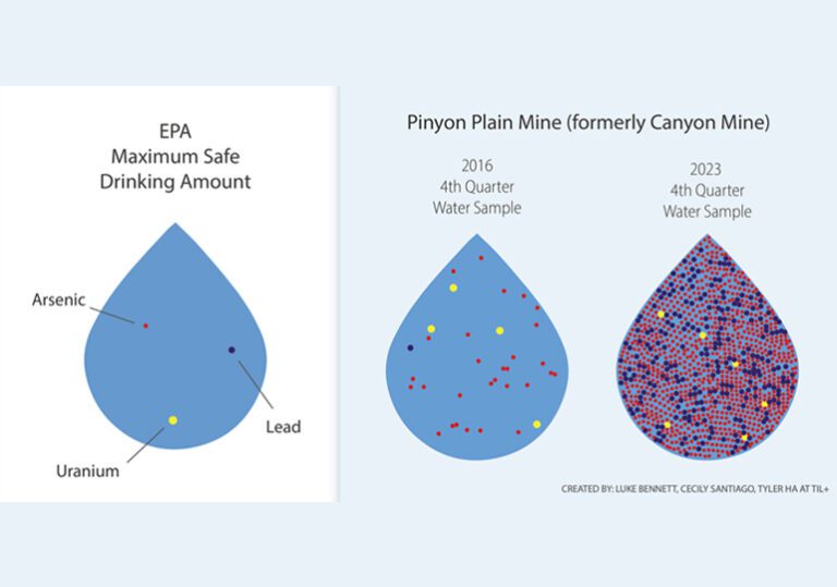
Between 1993 and 2025, 40 wells and spring sites in the Grand Canyon region were sampled for arsenic in the Coconino Aquifer. Four wells had average arsenic levels above the U.S. Environmental Protection Agency’s drinking water standard of 10 micrograms per liter. Three of those four wells are monitoring wells at Pinyon Plain Mine, where average arsenic levels are nearly twice the drinking water standard in the south well, nearly three times in the north well, and nearly six times in the east well. These elevated levels are unusually high and uncharacteristic of the Coconino Aquifer.
Maps and graphs may be used for non-commercial purposes provided that they are not altered or edited and they are appropriately credited.
All map products should be credited to Stephanie Smith, Grand Canyon Trust, unless otherwise noted. A hyperlink to the Grand Canyon Trust website is appreciated.
For higher quality images or custom sizing please contact our communications director, Ashley Davidson, at adavidson@grandcanyontrust.org