Angels Landing is one of the most hair-raising hikes in the national park system.
The hike to Angels Landing follows narrow ledges above sheer vertical cliffs that drop 1,400 feet to the canyon floor on both sides.
Lengths of chain bolted to the rock at particularly tricky spots provide hikers with secure handholds along the final half mile of the trail. For those who are uncomfortable with exposure, Scout Lookout is a fine destination.
A permit is required for hiking Angels Landing as of April 1, 2022. Apply for a permit before your trip via seasonal lottery system
Hike to Angels Landing
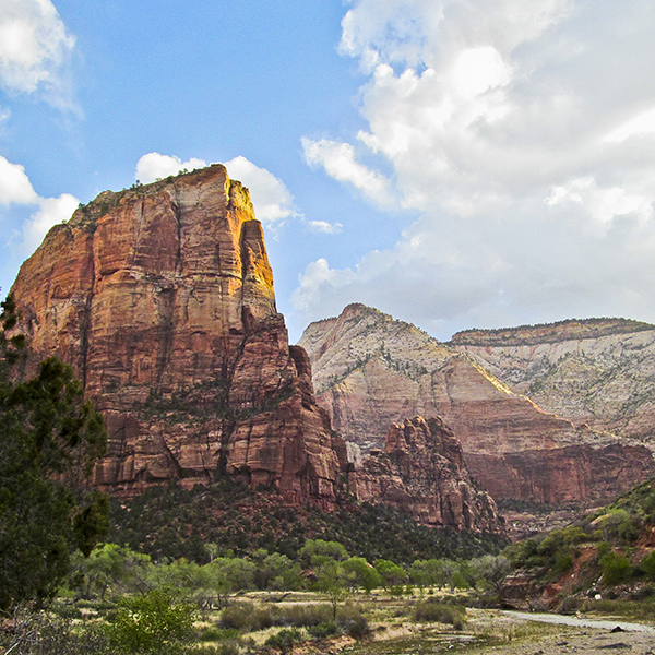
As you begin the walk along the trail, Angels Landing is the towering sandstone monolith directly in front of you. The white promontory with a small bump on top immediately to the right of Angels Landing is Observation Point. If you look farther right, you can see the Observation Point Trail switchbacking up the side of a white plateau capped with a low red mesa.
After a few hundred yards the trail leaves the river and climbs gently over the slopes above, heading towards the deep notch on the left side of Angels Landing. When the trail reaches the bottom of the west wall of Zion Canyon, it climbs aggressively up a few switchbacks before reaching a section carved into the cliff face. Immediately after crossing the cliff, the trail turns left into Refrigerator Canyon, leaving the sweeping views of Zion Canyon behind.
Switchback up Walter’s Wiggles
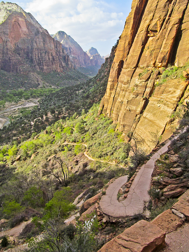
Refrigerator Canyon, named for the cool breeze that frequently blows through it, is a welcome relief in the summer. After about a third of a mile, the trail reaches the bottom of Walter’s Wiggles, an amazing series of 21 short, steep switchbacks constructed in 1925 when Walter Ruesch was the first custodian of what was then Zion National Monument. The “wiggles” were Ruesch’s idea and he was directly involved in their engineering and construction.
At the top of Walter’s Wiggles, Angels Landing and the ridge the trail ascends becomes visible. Soon you reach Scout Lookout, which provides sweeping views into Zion Canyon and is a great destination for anybody uncomfortable hiking narrow ledges and heights. Scout Lookout is also where the trail splits and pit toilets are located.
The left fork of the trail goes to the West Rim Trailhead (25.8 miles) near Lava Point in the north end of the park; the right fork goes to Angels Landing.
Leaving Scout Landing
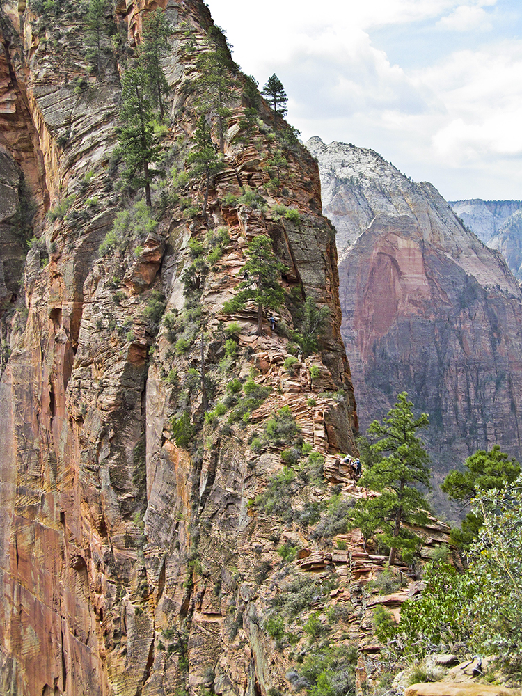
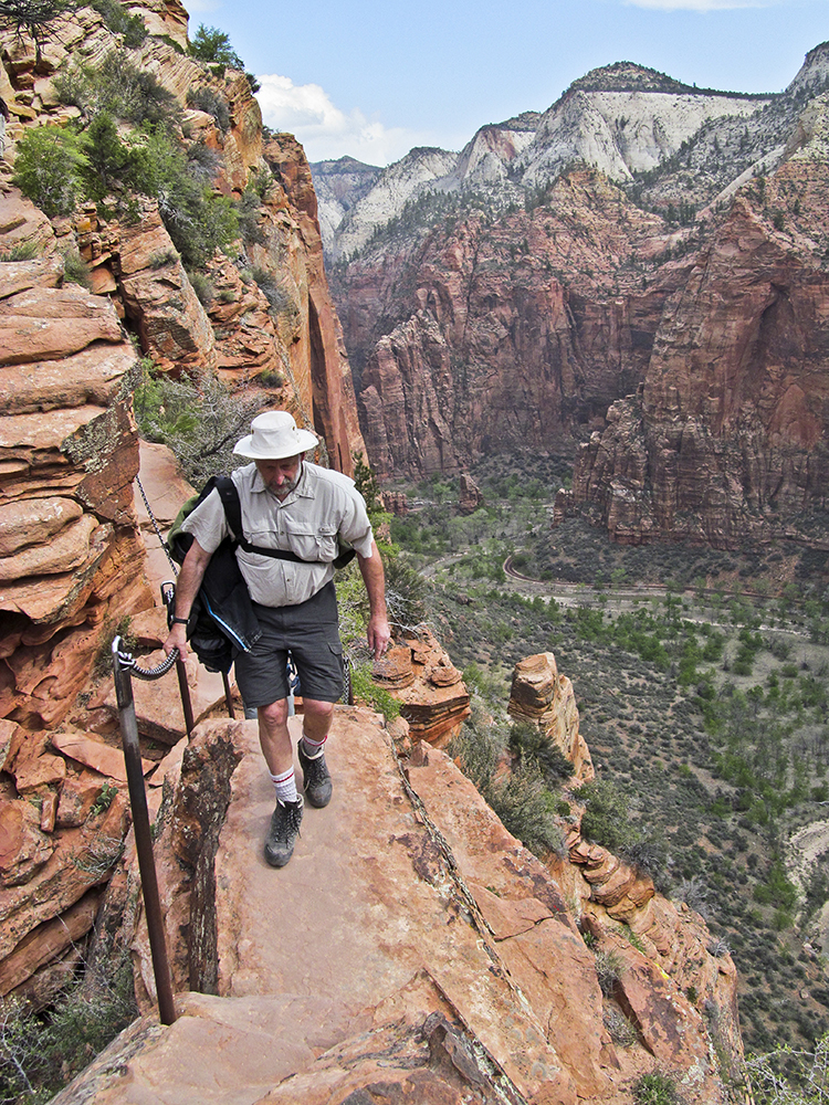
While Angels Landing is only a half mile from Scout Landing, it is the most precarious and exposed section of the trail. It is definitely not advised for anyone afraid of heights. Still, thousands of people hike it every year, and it can be a once-in-a-lifetime experience.
The time it takes to reach Angels Landing from Scout Landing can vary considerably depending on your physical condition and nimbleness, but planning two hours for the round trip is reasonable. You do not want to return in the dark. And you do not want to be out on the point in a thunderstorm or if it is lightning.
Follow the chains to Angels Landing
After crossing a flat saddle, the trail ascends the right side of a small sandstone outcrop. A couple of hundred feet later, the trail crosses to the left side of the saddle and follows a ledge with a chain along the top of a sheer cliff. The trail then reaches the low point on the saddle, where there are drop offs on both sides, one into Zion Canyon and the other into Refrigerator Canyon. There is a chain to navigate this particularly daunting spot.
The route to the top is a scramble up the ridge directly in front of you. The trail works its way along ledges, over humps, and up cracks to the top. There are chains to hold on to at the more exposed spots.
The top of Angels Landing is a narrow finger of broken sandstone slabs that slopes towards the south. After all the effort — both physical and psychological — this is a spot to spend some time drinking in one of the most sublime, remarkable landscapes in North America. Enjoy. You’ve earned it!
Directions
The trail begins at the Grotto shuttle stop and parking lot in Zion Canyon, about a mile upcanyon from Zion Lodge. To reach the trailhead from the shuttle stop, cross the highway and follow the paved path to the bridge across the Virgin River. Immediately after the bridge, the trail to Angels Landing and the West Rim turns right and follows the river. There is also a junction after the bridge with the Emerald Pools Trail, which climbs up a hill on the left. Some routes require backcountry permits. Find out more about the permit process