A long trudge grants access to a little-visited pocket of otherworldly rock formations called the Wahweap Hoodoos.
The trail to the Wahweap Hoodoos begins near the confluence of three creeks – Coyote Creek comes in from the left, Nipple Creek from the right, and Wahweap Creek is sandwiched in the middle.
From the 4WD parking area, follow the BLM trail sign north along a sandy path that drops you into Wahweap Creek (usually dry). From here, choose your own path as you make your way up the broad creek bed.
Hike to the Wahweap Hoodoos
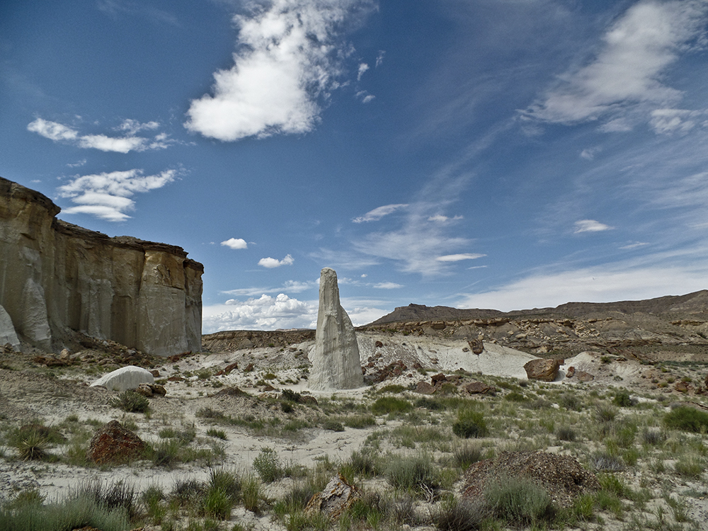
After you pass underneath a rickety fence suspended over the wash floor, navigation is easy. Near 2.3 miles, a drainage comes in from the left. Stay straight, continuing north up Wahweap Creek. Keep following the drainage north until you find the hoodoos, the first of which appear around 3 miles. The creek bottom, if wet, can be very slippery and difficult to hike. Avoid crossing the benches dotted with Russian thistle, sagebrush, and tamarisk – your unscratched legs will thank you!
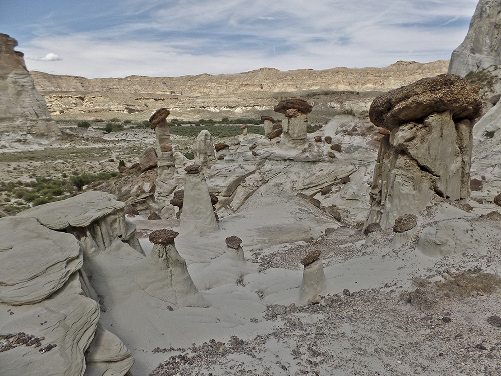
First group of hoodoos — along the stream
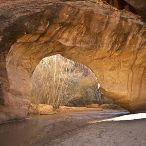
The stream channel hugs the left wall, and you spot the first hoodoos ahead on the west edge of the creek.
Here, white Entrada Sandstone forms ethereal chimney stacks. Time, weather, and wind have sculpted this highly erosive rock over millions of years. The brown mushroom caps, made of more resistant Dakota Sandstone, teeter on top and protect the Entrada Sandstone pinnacles beneath them. Please enjoy the view from a distance; stay on social trails, and don’t climb on the delicate structures.
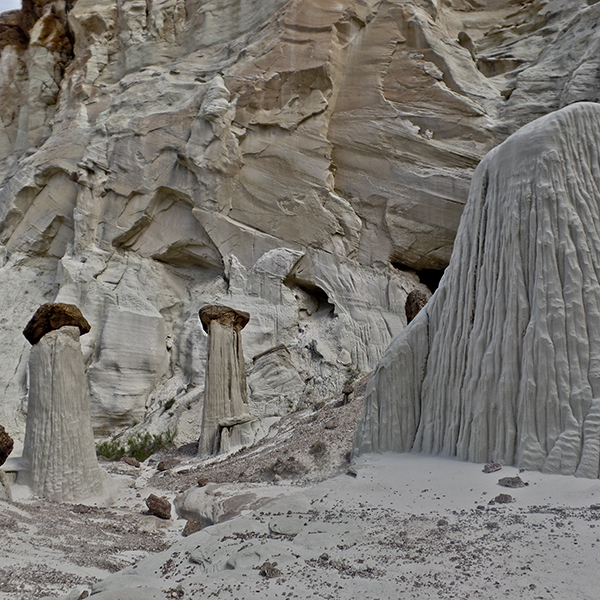
Second cove — hoodoo central
Near 4 miles, keep an eye out for a thick patch of tamarisk that juts up next to the hoodoos on the left wall. Contour along the base of the cliffs, squeezing between the sandstone wall and the overgrown tamarisk to reach a second outcropping of hoodoos. The cove opens into another unworldly scene of rock goblins, ghosts, and toadstools. Explore as you like, continuing upstream into the next alcove.
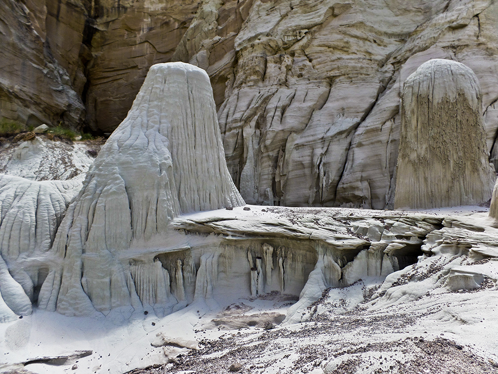
Third cove of hoodoos — Towers of Silence
The most photographed of the Wahweap hoodoos, Towers of Silence, appear in the third and final cove. Enjoy exploring the rarities, which stand like sentinels; when you’re ready to leave them behind, retrace your steps back to the trailhead along the stream bed.
Directions to the Wahweap Hoodoos trailhead
From the Glen Canyon Dam Bridge in Page, Arizona, drive north on Hwy 89 towards Kanab, Utah. At 16 miles, turn right onto Ethan Allen Road, which is directly across from the Big Water BLM Visitor Center. Stay on this road until you reach a T. Turn left onto the gravel road, pass a baseball field on your left, and continue past a fish hatchery. About 3 miles from the highway, continue north past a corral.
Shortly after, the road bends down and crosses Wahweap Creek. If driving a 2WD vehicle, park on the side of the road before the wash and start walking upstream. If you have a 4WD vehicle, you can cross the creek and drive three-quarters of a mile farther. Park in the designated area marked with a sign.