This classic Canyonlands hike crosses sandy benches, climbs slickrock domes, and crosses several canyons to arrive at the grassy expanse known as Chesler Park
Chesler Park is a fantastic loop hike in Canyonlands National Park.
Several trails start at the amphitheater parking lot, and the clutter of trail signs, arrows, and junctions you see at the Squaw Flat trailhead continues throughout the hike. Bring a map (available at the visitor center) and double check your route at junctions.
Across Big Spring Canyon
From the parking lot, pass through the split rail fence and cross an open grassland. Turn right toward Big Spring Canyon at the first junction, and continue hiking through soft sand along the base of a sandstone butte. The trail climbs up to a low ledge, traverses along the butte, and passes through a narrow crack.
As you drop off the ledge, you reach another junction. Continue southwest (left), ignoring a trail that leads to the western section of Needles Campground. At 0.75 mile, the trail crosses Big Spring Canyon. Pass backcountry campsite BS1, and follow signs toward Chesler Park.
After ascending the west canyon wall via a narrow drainage, the trail pinches off at a slickrock bench 200 feet above the canyon floor.
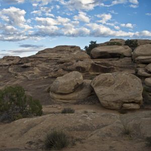
Rolling with the domes
Cairns mark the path southwest across undulating slickrock domes, with panoramic views stretching in every direction. The La Sal Mountains poke above Wingate Sandstone cliffs to the northeast, and you catch glimpses of the namesake Needles formations to the southwest.
For about a mile, the trail contours along the rust and beige colored sandstone. When you reach a slickrock bowl, climb up and over a ledgy pourover and continue toward the next drainage to the west. Switchbacks take you down to the floor of the drainage, where you walk past piñons, junipers, and sandstone outcrops.
Near 3.3 miles, you reach a junction with the Elephant Hill Trail. Continue west, following signs toward Chesler Park. The trail climbs up and soon squeezes through a crack. Enjoy brief shade from an overhung ledge, and descend into Elephant Canyon.
Elephant Canyon and beyond
When you get to the bottom of Elephant Canyon, bypass the trail to Druid Arch on your left and the campsite on your right. Walk directly across the sandy floor, following a small drainage out of the canyon. The steady incline continues for another half mile as you head southwest toward the Needles.
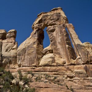
At 4.4 miles, turn left at the trail junction. Your steep climb ends at a saddle between two sandstone spires. Linger here and appreciate the fantastic views of Chesler Park to the southwest, where needles of pink sandstone surround the broad, grassy meadow.
A stroll through the park
You can loop around Chesler Park in either direction, but this description goes clockwise. After dipping down from the saddle, the trail splits. Keep left, following the arrows toward the Joint Trail.
Meander along the perimeter of Chesler Park for the next 1.5 miles. A trail to Druid Arch comes in from the left, but keep straight (south) at the junction. Several outcrops of Cedar Mesa Sandstone hide backcountry campsites. The trail swings north at around 6 miles, as you continue hugging the edge of the park.
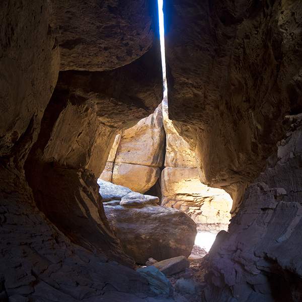
Squeeze through the Joint
You pass a 500-yard spur trail to a viewpoint on your left, and the Joint Trail continues straight ahead. Soon, the trail disappears in a “joint.” The spires and rock outcroppings that form the Needles arise from a crosshatched pattern of parallel cracks; the Joint Trail takes you through one of these narrow fissures.
Your shoulders just about span the gap – hikers with husky builds may need to turn sideways to squeeze through. Keep straight through the slot for a quarter mile, and if you choose to explore the network of slots, make sure you don’t get lost!
Scramble over a few boulder jams, turning right into an adjoining slot after passing through a hollowed out “subway” section. As you exit the narrows, the park opens up once again to low hills of grass, piñon pines, and juniper trees. The trail undulates past sandstone “mushrooms,” crosses a wash, and continues to a jeep parking area. Here, you find picnic tables and pit toilets.
Loop back via the jeep road and Connector Trail
Slog along the sandy jeep road, and stay right (north) when you reach a junction with Beef Basin Road. In a quarter mile, look for a cairn on the right that marks a footpath into the Needles. The trail starts to climb between two sandstone ridges. Hike north, following cairns to the junction with the Connector Trail where you turn right (east).
The trail alternates between sandy stretches and slickrock expanses. Follow the cairns up and down benches, around spires, and through mini slots. You eventually reach the flat grassland of Chesler Park around 9.25 miles. Continue another quarter mile to complete the loop. From here, turn north (left) and retrace the 4.5 miles of trail back to the amphitheater parking lot.
Directions to the trailhead
Take Highway 191 south out of Moab for about 40 miles, and turn west (right) onto UT 211. Drive another 34 miles to the Needles visitor center. From here, continue to the Squaw Flat Campground road. Turn left, staying left again at the next junction (the road to the right goes to the group campsites). Reach a parking lot near the campground amphitheater area on the left. Backcountry camping requires a permit. Find out how to navigate the permit system
General Location Needles District of Canyonlands National Park
Distance 14.1 miles (22.7 km)
Difficulty Strenuous
Highest/Lowest Elevation 5,650/5,100 ft (1,720/1,555 m)
Fees Park entrance fee required. Check the website below for current information.
Pets Leashed pets are allowed on front-country roads and campgrounds.
More Info NPS website


Adventure awaits
Sign up to get three hikes in your inbox every month for a year.

Special membership offer
Join the Grand Canyon Trust today to receive your adventure kit:
- $25 donation: a Grand Canyon map, The Advocate magazine subscription, bookmark, and sticker
- $75 donation: everything above plus four stunning note cards
- $100 donation: all the benefits of the $75 level, plus a Grand Canyon Trust hat
Related Hikes by Destination
Distance: 11 miles (17.7 km)
Difficulty: Strenuous
Type: Out and back
Distance: 24.2 miles
Difficulty: Moderate
Type: One way
Distance: 11 miles (17.7 km)
Difficulty: Strenuous
Type: Out and back
Distance: 2.5 miles (4 km)
Difficulty: Easy
Type: Loop hike