Hike along the outskirts of Flagstaff on the southeast section of the Flagstaff Loop Trail
The 44-mile Flagstaff Loop Trail links many established trails and roads. This section of the Loop Trail begins at the Campbell Mesa Trailhead on Walnut Canyon Road and ends at JW Powell Boulevard near Lake Mary Road.
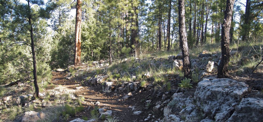
Starting at the Campbell Mesa Trailhead, go south across the road, and follow the trail through the scattered trees along the rim of the mesa. Soon, the trail emerges from the trees, follows a cleared powerline right-of-way, then crosses Walnut Canyon Road. It then goes along a very straight side road that follows the edge of a section of land owned by the state of Arizona. You pass some abandoned ranch buildings on the right at 1.1 miles, and the trail enters Forest Service lands at 1.4 miles.
Walnut Canyon
Most of this trail is within the 27,914-acre Walnut Canyon Study Area, which surrounds Walnut Canyon National Monument. Coconino National Forest, the National Park Service, Coconino County, and the City of Flagstaff are considering a variety of management options to help buffer the monument from development as Flagstaff continues to grow. The study area has been identified as an important wildlife corridor for numerous species.
For the next couple miles, the trail meanders along the south side of a shallow drainage. At 3.7 miles, the trail crosses a dirt road and goes past a trick tank, which is constructed of sheets of corrugated metal laid on the ground that funnel water into a small trough for wildlife.
At 4.5 miles, you come to another dirt road. Going left will take you to a trailhead near Elaine Lake in the Continental Lakeside Acres subdivision. Continue across the road where the trail switchbacks down a short, ledgy slope of Kaibab Limestone. The trail joins a dirt road and turns left. At 5.4 miles, a trail from Fisher Point comes in from the left; continue straight ahead.
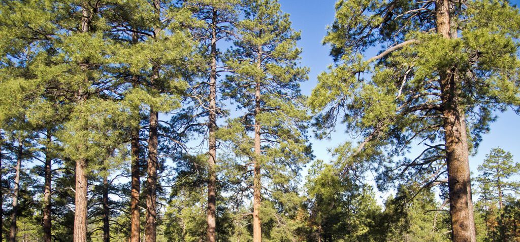
The trail follows a dirt road for 0.4 mile and then leaves the road by turning left. In a quarter mile you come to another dirt road. Cross it and go up the small hill past charred remains of some snags that recently burned. Note that there are several mature ponderosas with scorched bark, but the trees survived, a defining characteristic of the fire-adapted ponderosa pine. The trail swings through a couple of large switchbacks, crossing a ridge with good views and a nice picnic spot.
Skunk Canyon
The Loop Trail crosses the Arizona Trail 6.8 miles from the trailhead. It continues to wander along a ridge, and you reach the rim of Skunk Canyon at 8.1 miles, where the trail does a big loop as it drops into the canyon. When you reach the junction with the Skunk Canyon Trail, go right.
At 9.1 miles, the trail hooks to the right and leaves Skunk Canyon. There is a faint trail that goes left past a small white building in the valley bottom to a subdivision on Lake Mary Road. Stay to the right and follow the trail as it goes up a tributary valley. You get glimpses of the Lake Mary water treatment plant, built in 1941 to treat water from Lower and Upper Lake Mary.
You reach the YX Ranch Road at 10.3 miles, where you cross the road to continue on to JW Powell Boulevard. A hundred yards past the road, you see a small, yellow abandoned building with “plane” and “aircraft” spray painted on it. The building is used in first responder training exercises. The trail curves left at the building, and, in a few hundred yards, you arrive at JW Powell Boulevard.
Directions
Campbell Mesa Trailhead: From downtown Flagstaff, drive east 4.5 miles on East Route 66 (US Highway 89); turn right on Country Club, cross Interstate 40 and go 1.5 miles to Old Walnut Canyon Road; turn left and drive 1 mile to the Campbell Mesa Recreation Access sign on the left. Park at the gate (don’t block it) and walk up the road approximately 400 feet to the trailhead.
JW Powell Boulevard Trailhead: From downtown Flagstaff, drive 1.7 miles south on Milton Road to Forest Meadows (the last stoplight before Milton enters the freeway); turn right, go one block and turn left on Beulah Boulevard; go 0.7 mile and turn left on Lake Mary Road; drive 1.3 miles to the intersection with JW Powell Boulevard. Park along the dirt road that comes in from the right and walk up JW Powell Boulevard 100 yards to the trail.

General Location Flagstaff, Arizona
Distance 10.5 miles (17 km)
Difficulty Moderate
Trailhead Elevation 6,820 ft (2,080 m)
Highest/Lowest Elevation 7,050/6,780 ft (2,150/2,065 m)
Fees No fee
Pets Allowed on a leash
More Info Flagstaff Loop Trail Map
Adventure awaits
Sign up to get three hikes in your inbox every month for a year.

Special membership offer
Join the Grand Canyon Trust today to receive your adventure kit:
- $25 donation: a Grand Canyon map, The Advocate magazine subscription, bookmark, and sticker
- $75 donation: everything above plus four stunning note cards
- $100 donation: all the benefits of the $75 level, plus a Grand Canyon Trust hat
Related Hikes by Destination
Distance: 5.2 miles (8.4 km)
Difficulty: Strenuous
Type: Out and back
Sites: 15
Season: Open year-round
Reservations: Backcountry permit required
State: Arizona
Nearest Towns: Flagstaff, Williams, Tusayan, and Cameron, Arizona
Distance: Up to 13 miles
Difficulty: Easy
Type: Point-to-point
