An easy walk on the Flagstaff Loop Trail through the 2,251-acre Observatory Mesa Natural Area
The 44-mile Flagstaff Loop Trail encircles town and links many established trails. This section of the Loop Trail begins at the Flagstaff Urban Trail System (FUTS) Trailhead in the Railroad Springs Subdivision, follows Tunnel Spring and Observatory Mesa trails, drops off the mesa to join a FUTS trail that goes to the Schultz Pass Road, and ends at the Schultz Creek Trailhead.
The trail begins by passing between two houses and dropping into a small drainage with dense vegetation. The trail parallels the railroad tracks, the mainline of the Burlington Northern Railroad. It soon reaches an underpass, where you cross to the north side of the tracks. You follow the base of the mesa for a few hundred feet before reaching a steel gate marking the entrance to the Observatory Mesa Natural Area.
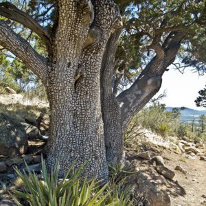
Observatory Mesa
From the gate, the trail follows an old road that steadily climbs the side of the mesa. One mile from the trailhead, you pass two water tanks on the right. The area you are passing through was originally owned by the state of Arizona, but in December 2013, the city of Flagstaff acquired it with funds from a voter-approved bond and an Arizona State Parks Growing Smarter grant. A total of 2,251 acres were purchased, ensuring that much of Observatory Mesa will always be available for wildlife and the enjoyment of residents and visitors.
Two miles from the trailhead, you reach Forest Road 515. Go through the gate, and continue to follow the wide graveled path, which is part of the Flagstaff Urban Trail System. You are now within a portion of 750 acres owned by the Lowell Observatory.
Look for a Flagstaff Loop Trail sign and single-track trail coming in from the left, about 0.2 mile past the gate; take this trail. In a hundred feet you leave the observatory property and re-enter the city’s natural area. The trail skirts a valley on your right and soon crosses a road. The trail continues across the mesa for the next mile until you reach a split-rail fence, where it hooks to the right, following the north side of a drainage. In a few hundred feet, the trail begins to descend the edge of the mesa by dropping down the drainage through groves of Gambel oak. The trail reaches Cobblestone Circle, a paved street in the Anasazi Ridge subdivision.
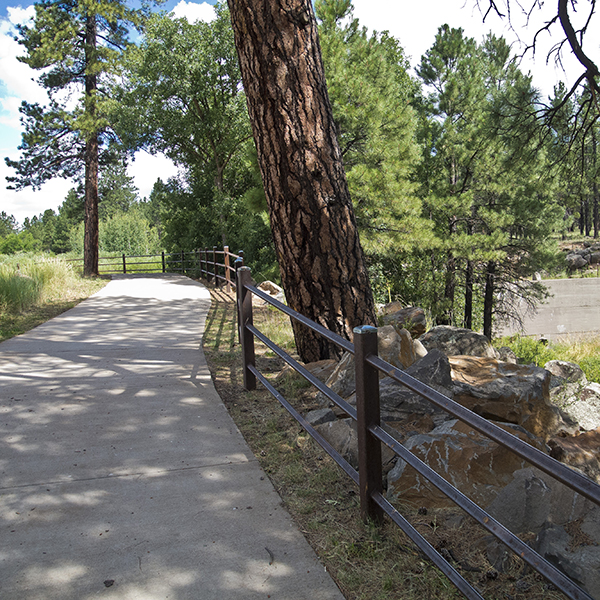
Along the gravel urban trail
Cross the street, and continue straight ahead along the steel fence until you reach the Flagstaff Urban Trail, which is a wide graveled path. Turn left and stay on the trail as it heads northwest, crossing two streets (watch for vehicles), paralleling the Rio de Flag, and passing by several houses. Soon after you reach a section of paved concrete trail, you see a dam and small pond on the right. The dam was built in the 1950s by C. C. Cheshire, who ran livestock in the area now occupied by the Cheshire subdivision. Continue along the trail to the intersection of U.S. 180 and Schultz Pass Road. Cross Highway 180 and follow Schultz Pass Road for 0.3 mile, where you go left at the intersection with the Elden Lookout Road. Where the pavement ends, go right down the hill to the Schultz Creek Trailhead and parking lot.
Directions
Railroad Springs Trailhead: From downtown Flagstaff drive 0.6 mile south on Milton Road to West Route 66; turn right and drive 1.4 miles to Railroad Springs Boulevard; turn right and go 0.4 mile to a T intersection with Adirondack Street, where the trail enters the forest on the north side of the street.
Schultz Creek Trailhead: Drive north on US Highway 180 for 3 miles to the intersection with the Schultz Pass Road; turn right and go 0.3 mile to a junction with the Elden Lookout Road. Go left and continue for a few hundred yards to a gate and the end of the pavement. Turn right on a dirt road that goes down a hill to the parking lot for the Schultz Creek and Rocky Ridge trailheads.
General Location Flagstaff, Arizona
Distance 5.8 miles (9.3 km)
Difficulty Moderate
Highest/Lowest Elevation 7,410/6,840 ft (2,260/2,085 m)
Fees No fee – Check the website below for current information.
Pets Allowed on a leash
More Info Flagstaff Loop Trail Map
Adventure awaits
Sign up to get three hikes in your inbox every month for a year.

Special membership offer
Join the Grand Canyon Trust today to receive your adventure kit:
- $25 donation: a Grand Canyon map, The Advocate magazine subscription, bookmark, and sticker
- $75 donation: everything above plus four stunning note cards
- $100 donation: all the benefits of the $75 level, plus a Grand Canyon Trust hat
Related Hikes by Destination
Distance: 5.2 miles (8.4 km)
Difficulty: Strenuous
Type: Out and back
Sites: 15
Season: Open year-round
Reservations: Backcountry permit required

State: Arizona
Nearest Towns: Flagstaff, Williams, Tusayan, and Cameron, Arizona

Distance: Up to 13 miles
Difficulty: Easy
Type: Point-to-point