Hike the Humphrey’s Peak Trail to reach the highest point in Arizona
The Humphrey’s Peak Trail climbs to 12,633 feet. On a clear day, you can see the Grand Canyon from the top.
Note: Before hiking, be sure to check the weather forecast. For most people this is a summer hike, and summer monsoons bring intense thunderstorms and lightning to the mountain. It’s best to start early in the morning and keep a close watch for cloud buildup, especially once on the exposed summit.
Through the aspens in the Kachina Peaks Wilderness Area
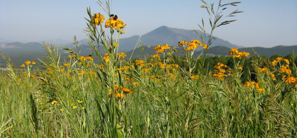
After leaving the trailhead, you pass under a ski chairlift and through a grassy meadow with seasonal wildflowers and mountain views. Kendrick and Sitgreaves mountains rise to the west and Agassiz Peak is above you to the east. Agassiz may look like the highest point, but in fact it stands next in stature to Humphrey’s Peak.
After crossing the meadow, the trail enters a thick canopy that obscures the view of the surrounding mountains. At the trail register, veer left to continue climbing the mountain; turning right will take you to the Arizona Snowbowl ski lodge.
From here, the trail switchbacks up the side of the mountain. As you climb higher, the deep forest opens around 3.5 miles and bristlecone pines begin to replace the aspens, fir and spruce trees you’ve seen throughout the hike.
Above treeline
Another quarter mile brings you to treeline, where you need to stay on the trail. Though the slopes appear relatively barren above this point, the plant life of this rare tundra environment is extremely fragile. The San Francisco Peaks groundsel, a threatened species, grows only in the alpine environment of the San Francisco Peaks. Leaving the trail could lead not only to trampling this beautiful low-lying flower, but also to a $500 fine.
By this point, the thin air and steep slopes make for a difficult push to the top of the saddle between Agassiz and Humphrey’s peaks. Sharp switchbacks and big rock steps add to the challenge of reaching the saddle, which is at 11,800 feet.
Saddle to summit: atop Humphrey’s Peak
While you catch your breath at the saddle, look east to enjoy views into the Inner Basin. Humphrey’s, Agassiz, Fremont, Doyle, and Aubineau peaks encircle this U-shaped depression. It is a caldera left from past volcanic activity. Geologists estimate that San Francisco Mountain, a stratovolcano, once reached nearly 16,000 feet in elevation. In the eruption hundreds of thousands of years ago, the east flank of the Peaks collapsed to form the Inner Basin. That event, along with later erosion, has whittled the summit down to a mere 12,633 feet.
The Inner Basin has provided some of Flagstaff’s water since 1884. A pipeline brings water down from springs and wells, producing up to two million gallons a day during the peak season.
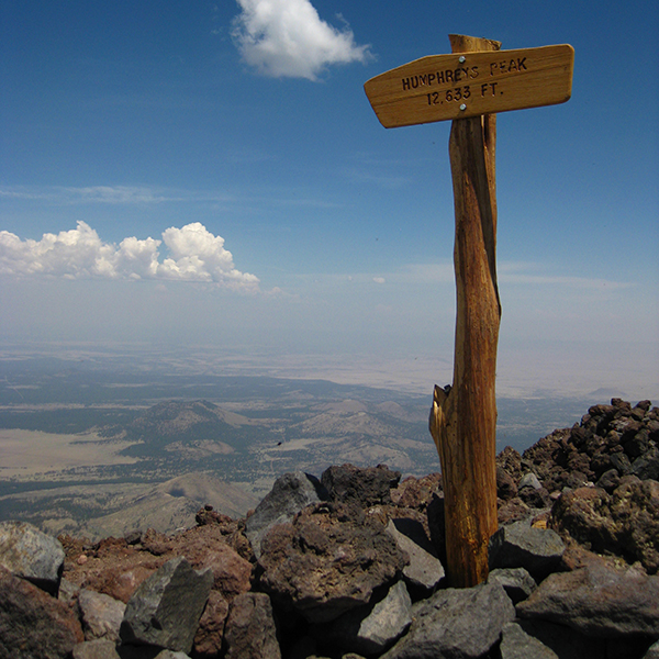
From the saddle, Humphrey’s Trail turns north (left) and continues up to the summit, while the Weatherford Trail veers right towards Agassiz, Doyle Saddle, and Lockett Meadow. Immediately after leaving the saddle, you weave your way through a section of large boulders, requiring modest scrambling. The trail is fairly obvious, but wooden stakes periodically mark the trail. Continue climbing along the west side of the ridge past several false peaks. One final, rough, and exposed mile leads to the summit, where a wooden sign marks your well-earned accomplishment—you’ve climbed to the highest peak in the state!
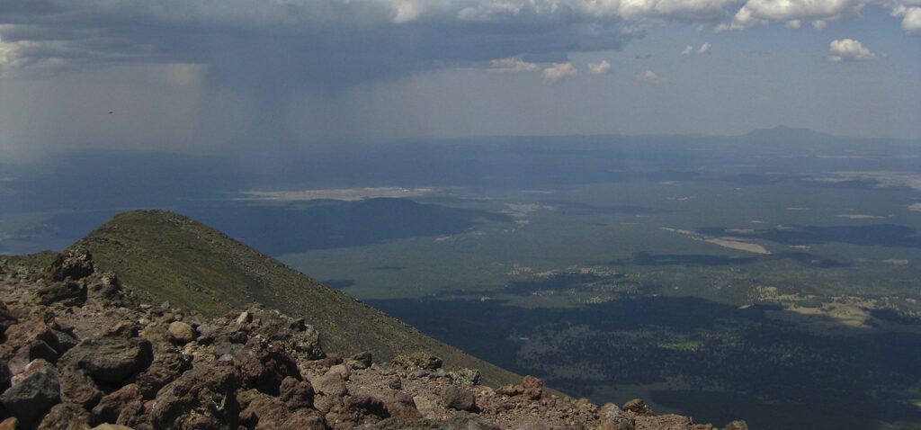
Panoramic views of northern Arizona stretch below you. On a clear day, you can see the Grand Canyon to the north, the Mogollon Rim to the south, and all the mountains and canyons in between. The San Francisco Peaks are sacred to at least 13 Native American tribes, so respect the mountain during your visit.
As you descend, the steep slopes require carefully choosing where you step. Loose rocks can easily slip beneath your feet, so take your time on the way down. Humphrey’s Peak is a popular destination, which means you’ll likely share the trail with other hikers. Yield to those climbing up the mountain.
Directions to the trailhead
From downtown Flagstaff, drive north on Hwy 180 for about 7.5 miles and turn right onto Snowbowl Road. Follow the winding road for the next 5 miles. Drive through the Snowbowl “welcome” gate and turn left into the large gravel parking lot. The trailhead is at the far end of the parking lot where you will see a trailhead sign at the top of a few steps.