Hike the Jasper Forest Trail through a dense collection of petrified logs and scattered flakes of colorful petrified wood
The hike to Jasper Forest is not a trail, rather a park service route.
Only visitors who are comfortable hiking off trail with only vague indications of where to go should do this hike. While the route follows an old abandoned road built in the 1930s, it has mostly disappeared, except for an occasional clump of asphalt and some small sandstone abutments for culverts that were removed long ago. This hike can become quite difficult if the ground is wet because bentonite clay quickly becomes a gooey slick mess that gloms onto boots.
Hike details
The Jasper Forest hike is 2.5 miles round trip. It begins in Petrified Forest National Park at the Jasper Forest overlook, where an indistinct path drops into a small drainage near the spot where the road widens into the parking lot. Continue another few hundred yards down the drainage until you are close to the highway. Look left for the heavily eroded roadbed that drops off the rim. A couple of hundred yards below the rim, the road wraps gently to the right past a bluff with many rounded boulders. The “road” then crosses a dry creek bed, bears right up the drainage, and then bears left around a small bluff. From here the road is a tiny bit more apparent as it winds along the base of the bluff.
Enjoy the views
The area below the bluff is dense with richly colored petrified logs, and chips of petrified wood pave the ground in some spots. Keep your eyes open for the occasional log sitting on a pedestal of soil. The logs protect the soil directly under them from eroding, while the neighboring unprotected soil is washed away, creating the pedestal. Please remember that taking any of the vibrantly colored stone chips is not only illegal within the park, it also robs the people who come after you of enjoying what you are experiencing.
After 200 hundred yards or so, the route bends to the right and goes around a point of the rim. After rounding the point, the route crosses a shallow valley and broad creek bed on its way to a basin tucked into the rim with a small Chinle hill in the middle of it. The famous formation known as Eagle Nest Rock sat on top of the hill, but it collapsed during a heavy rain in 1941. The roadbed circles the hill and this is the end of the hike. Return the way you came.
Directions to the trailhead
Drive north from the Rainbow Forest Museum about 7.5 miles and turn left at the Jasper Forest overlook. Drive south from the park headquarters near I-40 for roughly 18 miles and turn right at the Jasper Forest overlook. The trailhead is not marked. Park in the overlook parking lot and walk to the spot where the incoming road widens into the parking lot and look for a faint path going down a small drainage. See trail description for more information.
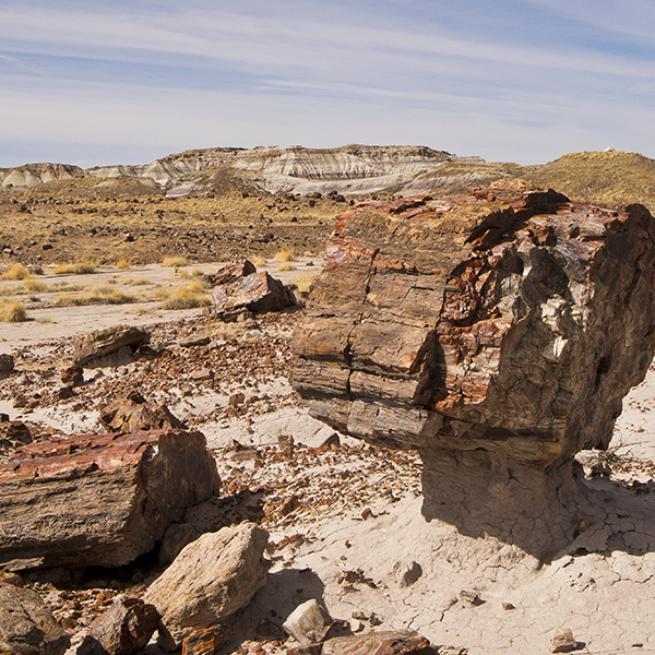
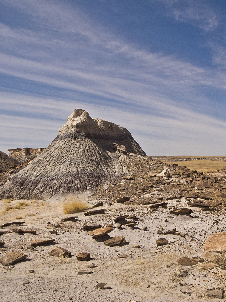
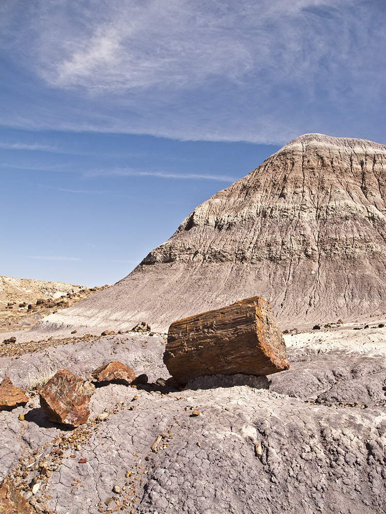
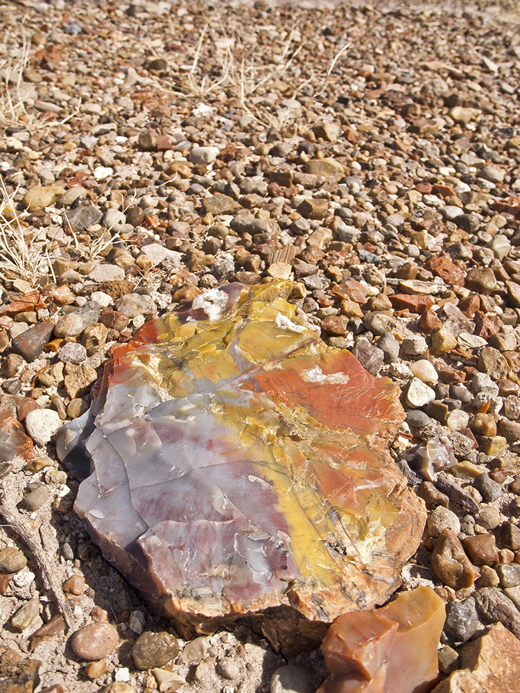
General Location Petrified Forest National Park
Distance 2.5 miles (4 km)
Difficulty Moderate
Trailhead Elevation 5,550 ft (1,692 m)
Highest/Lowest Elevation 5,550/5,450 ft (1,692/1,661 m)
Fees Park entrance fee required. Check the website below for current information.
Pets Allowed, check for restrictions
More Info NPS website
Adventure awaits
Sign up to get three hikes in your inbox every month for a year.
Special membership offer
Join the Grand Canyon Trust today to receive your adventure kit:
- $25 donation: a Grand Canyon map, The Advocate magazine subscription, bookmark, and sticker
- $75 donation: everything above plus four stunning note cards
- $100 donation: all the benefits of the $75 level, plus a Grand Canyon Trust hat
Related Hikes by Destination
Distance: 5.2 miles (8.4 km)
Difficulty: Strenuous
Type: Out and back
Sites: 15
Season: Open year-round
Reservations: Backcountry permit required
State: Arizona
Nearest Towns: Flagstaff, Williams, Tusayan, and Cameron, Arizona
Distance: Up to 13 miles
Difficulty: Easy
Type: Point-to-point