Hike the Petroglyph Point Trail in Mesa Verde National Park to see rock writings from the Southwest’s earliest residents
This loop hike in Mesa Verde National Park follows the bottom of a cliff to a petroglyph panel.
Note: There is an informative trail guide available at the registration box for this trail that makes this hike much more interesting.
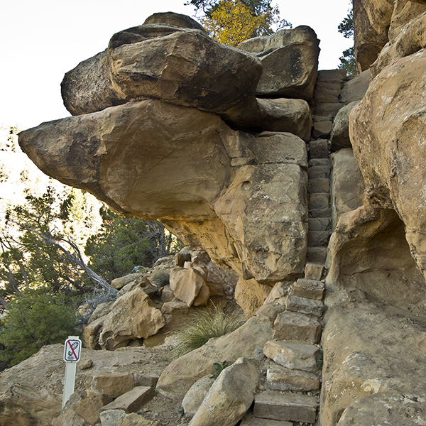
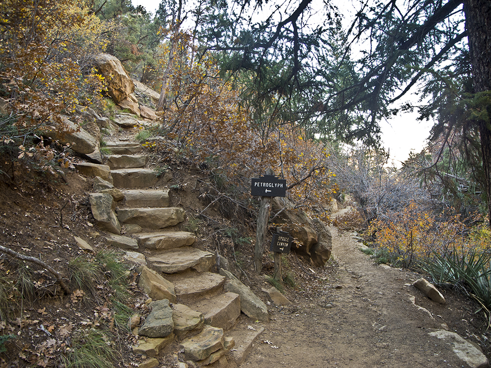
After leaving the Spruce Tree House Trail, you quickly reach a junction for the Petroglyph Point and Spruce Canyon Trails where you go left up several stone steps. The Spruce Canyon Trail continues downcanyon along the bottom of a cliff until you reach a narrow crack. You ascend it and then immediately descend a short stairway of rock blocks jammed into another crack.
The trail enters an alcove that provides relief from heat on warm summer days. The dense vegetation includes Oregon grape (also known as creeping holly grape), used by the Navajo to make a medicine for rheumatism, and chokecherry, which produces a red berry that is used to make jam and syrup. Gambel oak and Douglas fir are also abundant along this trail.
The trail continues to wind along the bottom of the cliff, which is Cliff House Sandstone, the upper layer of the Mesa Verde Group. The sand that was cemented together to make this sandstone was deposited when this area was the shoreline of an ancient sea that advanced and retreated many times, creating sandbars and beaches.
Cultural history on the trail
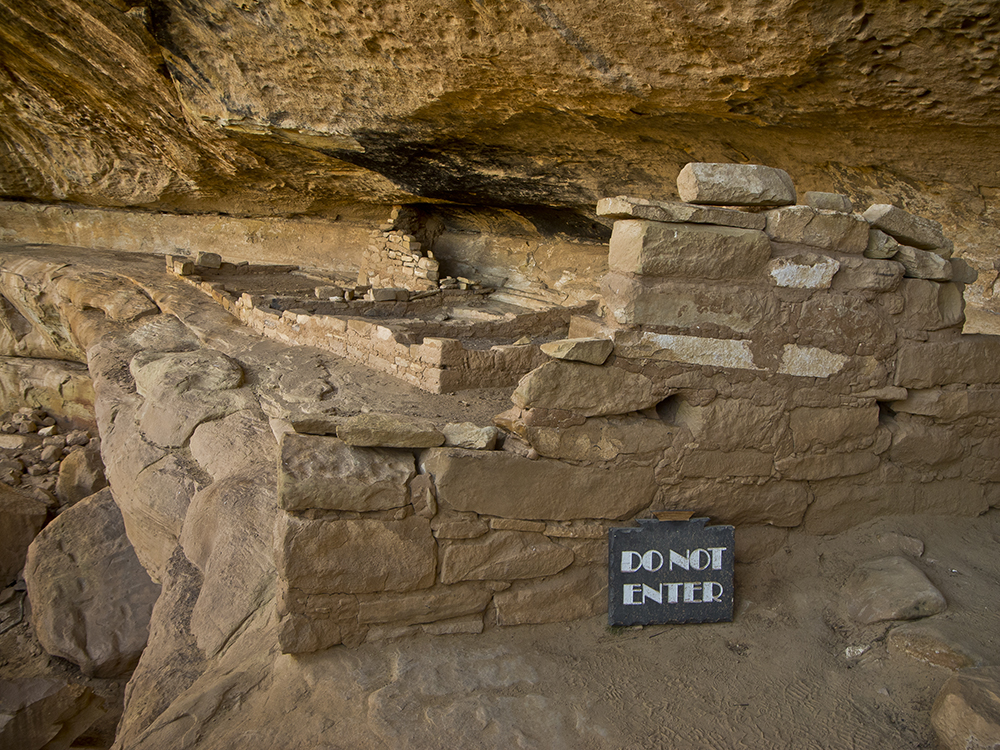
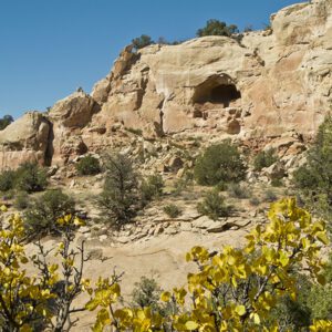
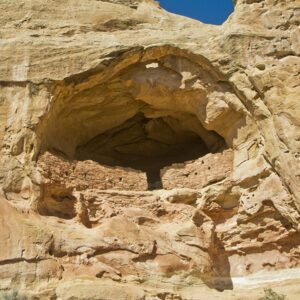
After a couple of switchbacks, you reach another alcove with a few low walls that are the remains of a small cliff dwelling. Please respect the “Do Not Enter” sign. Just beyond the site, you will see a rock with smooth depressions created when early residents repeatedly sharpened their stone axes.
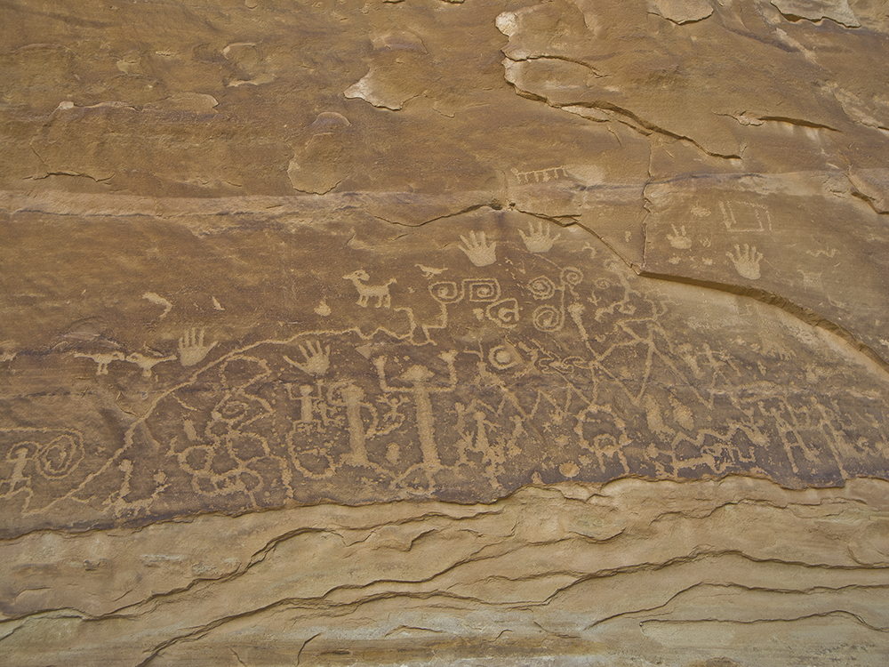
Continuing along the bottom of the cliff, you reach the petroglyph panel at about 1.2 miles. While it is one of the largest panels in the park, it is modest compared to many other panels found on the Colorado Plateau. The figures were pecked into the rock, most likely by a person holding a sharp rock and striking it with a hammer stone. This spot was named “Pictograph Point” long ago, but that is incorrect. Pictographs are figures painted on rock, while petroglyphs are pecked into the rock, as these are.
Hike back along the rim
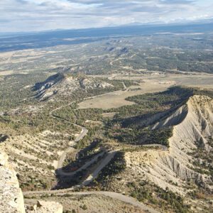
Immediately after the panel, the trail climbs abruptly out of the canyon and heads back along the rim. Following the rim, you pass through a “pygmy forest” of low-growing piñons and Utah junipers, one of the most widespread and important plant communities on the Colorado Plateau. Among other things, piñons provide pine nuts, an oily, high-protein, staple food for people and animals. The wood is used in construction, the pitchy gum was used to repair cracked pots and waterproof baskets, and the needles are chewed to help combat venereal disease. Utah junipers are easy to identify by their shaggy bark, which was used in roof construction and to provide insulation in sandals. The largest Utah juniper in Colorado, measuring 52 inches in diameter, was found on Mesa Verde. Another one was 1,300 years old.
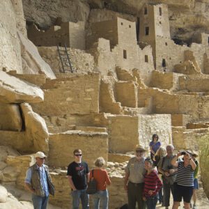
The trail continues to follow the rim, and soon you are walking just above the alcove that holds Spruce Tree House; the Chapin Mesa museum and other park buildings are visible across the canyon. The trail crosses the canyon above a pouroff and returns to your starting point.
Directions to the trailhead
Drive to the Chapin Mesa Museum and visitor area, walk down the paved trail to Spruce Tree House a few hundred feet, then branch off on the trail to the right that goes to Petroglyph Point and Spruce Canyon.