The Slickrock Trail is a nice walk over rolling sandstone hills to panoramic views of southern Utah
The Slickrock Trail is a popular trail in Canyonlands National Park (not to be confused with the Slickrock BIKE trail outside of Moab).
The trail starts directly behind the “Slickrock Foot Trail” sign. Walk past a self-pay kiosk (with trail brochures for 50 cents), and climb up a sandy slope to the top of a sweeping slickrock expanse. From here on, the trail is marked with cairns.
The road remains in sight for a short distance, but you soon turn northeast climbing up and over sandstone hills. You reach Viewpoint 1 off to your right around 0.3 mile, where you can see the La Sal Mountains and cliffs that form Island in the Sky to the north.
Continue north on the main trail, passing junipers, blackbrush, and Mormon tea shrubs. When you reach the loop junction at 0.5 mile, turn right to follow the trail in a counter-clockwise direction.
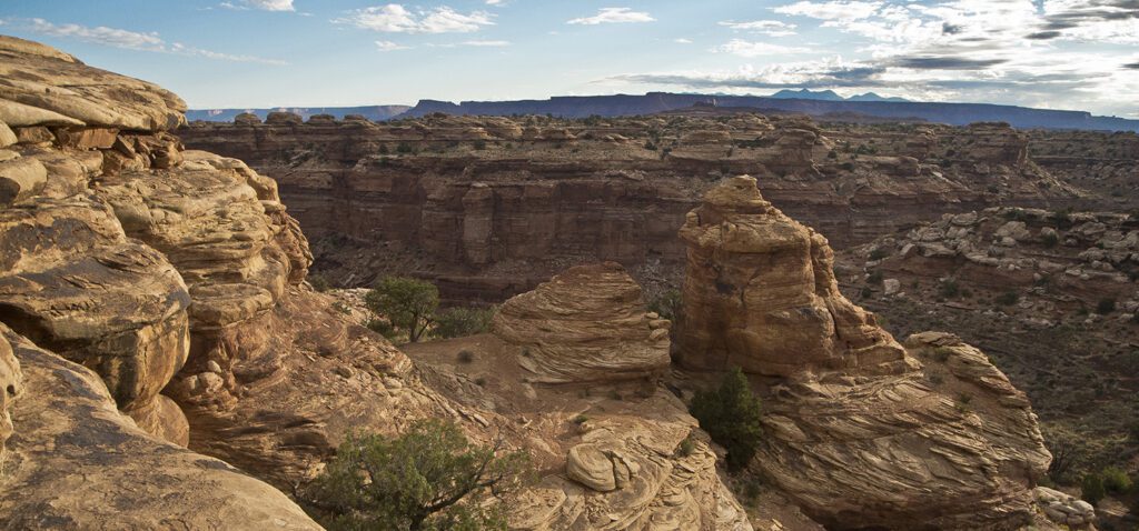
Little Spring Canyon
The trail follows Little Spring Canyon off to your right, and you soon arrive at Viewpoint 2. A sandstone terrace forms a pouroff, and the trail contours along the lip of it to a thin sliver of rock. From the unfenced overlook, views into Little Spring Canyon are partially blocked by interesting swirls of sandstone. Viewpoint 3, which is just a little farther up the main trail, offers unobstructed views of Little Spring Canyon.
You turn west on the main trail, walking past pot holes and depressions in the slickrock. Viewpoint 4 is off to your right, and the short spur trail takes you to an overlook of Big Spring Canyon. Junction Butte is prominent to the north.
Return to the main trail and begin your hike back to the trailhead. As you turn south, a spiny profile of the Canyonlands Needles dominates the horizon. The park road comes into sight as you near the loop junction. Turn right, following the section of trail you already walked back to your vehicle.
Directions to the trailhead
Take Hwy 191 about 40 miles south of Moab, Utah. At the junction of Hwy 191 and UT 211, turn right (west) on UT 211 for 34.5 miles. Pass the Needles District visitor center on your right, and continue down the park road. Just before it dead ends, look for a sign marked “Slickrock Foot Trail” on the right. Park on the right side of the road. Backcountry camping requires a permit. Find out how to navigate the permit system