Sunset Crater Volcano National Monument highlights northern Arizona’s volcanic (and explosive) past, speckled with cinder cones and long-hardened lava flows
People often get Sunset Crater confused with nearby Meteor Crater, the latter of which is, indeed, an impact scar from a meteor hurdling in from outer space. But Sunset Crater is not a depression in the ground; rather it’s a cinder cone with a “crater,” or depression at its top.
The iron-rich cinders capping Sunset Crater glow shades of red and inspire the namesake for the monument. About a mile in diameter at its base, 1,000-foot high Sunset Crater smoothly tapers to the rim surrounding a hidden 300-foot-deep crater at the top of the cone. While you can’t hike to the top, several short trails offer stellar views of Sunset Crater.
Visiting the monument
Sunset Crater Volcano National Monument is a small park, and a convenient detour, on your way to or from Grand Canyon National Park. Stretch your legs on the several short trails (each a mile or shorter) and explore this arid volcanic field. The Sunset Crater-Wupatki Loop Road jogs off Hwy 89, loops past Sunset Crater and Wupatki national monuments, and reconnects with Hwy 89 about 18 miles north of the original junction.
Getting there: From the train station in Flagstaff, AZ, take Rte 66 east through town until it becomes US 89. Continue north for a total of 12 miles, looking for signs pointing east towards Sunset Crater. Turn right on Sunset Crater–Wupatki Loop Road (FR 545), and continue for about 2 miles until you reach the visitor center.
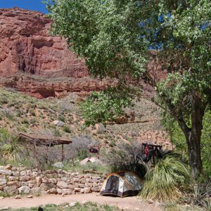
Nearby campground: Bonito Campground
So when did Sunset Crater blow?
Geologists have been engaged in a long debate about the timing of Sunset Crater’s eruption. Latest research indicates it erupted between A.D. 1040 and 1100, lasting no longer than 50 years, maybe only a few months. The first eruption blew a blanket of cinders around the crater, forming the initial structure of the cone. Intermittent volcanic activity continued. The cinder fall eventually covered hundreds of square miles, and molten lava oozed from the bottom of the crater forming the Kana’a and Bonito lava flows. Today, Sunset Crater lies dormant, allowing visitors to view this geologic curiosity. But people can no longer hike to the top; the park service ended that practice in the 1970s due to serious erosion on the crater.
The San Francisco Volcanic Field
While the highlight of the monument is Sunset Crater, the boundaries encompass over 3,000 acres of the much larger San Francisco Volcanic Field. More than 600 volcanoes pepper the landscape around the San Francisco Peaks, the biggest volcano in the area and the southern backdrop to the monument. To some people, the volcanic field resembles a moonscape—so much so that NASA and the US Geological Survey used the craters and cinder cones southwest of the monument to train astronauts for the Apollo 11 moon landing.
Calling the volcano home
Both before and after the volcanic activity, the Sinagua people lived in the area surrounding Sunset Crater. Sinagua means “without water,” the label archaeologists used to describe this culture and their arid land. Still, Sinagua farmers did grow corn, beans, and squash in the grassy parks in the area. In the 1930s, archaeologists uncovered pithouses beneath layers of ash, indicating people were living here when Sunset Crater erupted. The lack of furnishings in their dwellings suggests they had warning of the impending eruption and safely fled the area.
After the volcanic activity settled down, the Sinagua returned. While the volcano initially destroyed all plant and wildlife in a wide circumference, some archaeologists speculate that ash deposits created prosperous farming conditions. Others suggest it was a period of good moisture following the eruption that encouraged agriculture. Or maybe a combination of reasons. In any case, the population in the region boomed, leading to the construction of some large pueblos, especially those in nearby Wupatki National Monument. Eventually, these northern Sinagua left, heading south to the Verde Valley and east to the Hopi Mesas.