Colorado River Maximum Flows Graph

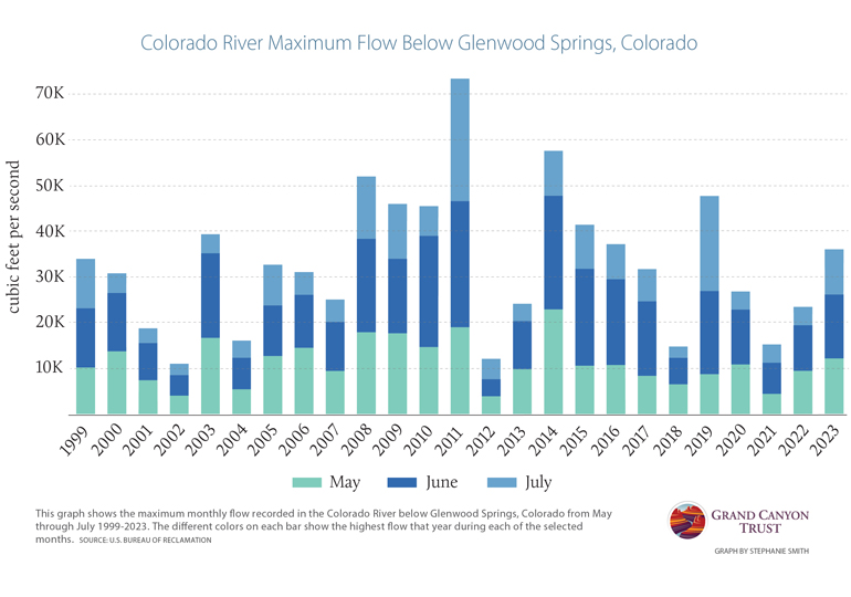
High Colorado River flows are, in part, the result of heavy snowfall that blanket the mountains throughout the Colorado River Basin. This graph shows the maximum flow recorded in the Colorado River below Glenwood Springs, Colorado, during the months of May, June, and July from 1999-2023.

View Colorado River flows over time

Download the PDF

Maps and graphs may be used for non-commercial purposes provided that they are not altered or edited and they are appropriately credited.

All map products should be credited to Stephanie Smith, Grand Canyon Trust, unless otherwise noted. A hyperlink to the Grand Canyon Trust website is appreciated.

For higher quality images or custom sizing please contact our communications director, Ashley Davidson, at adavidson@grandcanyontrust.org

Related Resources

A December 2024 poll of 500 Arizona voters by public opinion research firm GQR found strong public support for Baaj Nwaavjo I’tah Kukveni – Ancestral Footprints of the Grand Canyon National Monument.
Watch, listen, and learn from Native people who have called the Grand Canyon home since time immemorial.