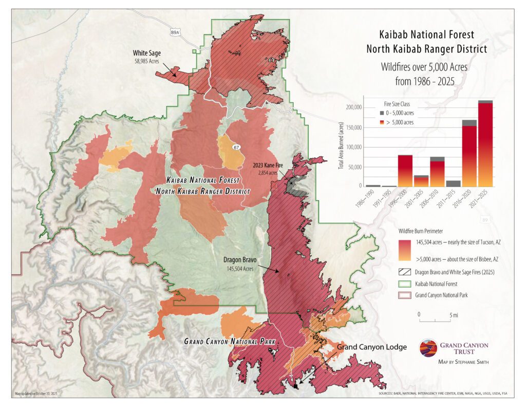
Where have wildfires burned on the north rim of Grand Canyon National Park?
Fire is part of the landscape on the north rim of the Grand Canyon. This map shows where wildfires over 5,000 acres have burned on the north rim between 1986 and 2025.
 Download your free PDF of this map
Sources: Data for the wildfire perimeters in this map was sourced from the National Interagency Fire Center’s Open Data Site.