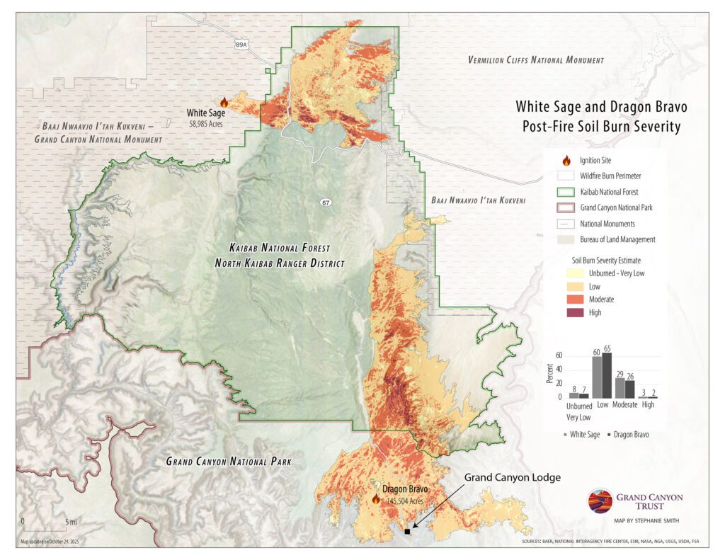
How severely was the soil burned in the Dragon Bravo Fire on the the north rim of the Grand Canyon?
As this map shows, according to data from interagency Burned Area Emergency Response (BAER) teams from the U.S. Department of the Interior and U.S. Forest Service, most (more than 70%) of the soil inside the perimeter of the Dragon Bravo Fire on the north rim of the Grand Canyon was burned at low or very low severity or was unburned.
According to 2025 data, 9,851 acres (7%) was unburned or burned at very low severity, 97,724 acres (65%) at low severity, 38,354 acres (26%) at moderate severity, and 3,470 acres (2%) at high intensity. The percentages were similar for the White Sage Fire to the north.