Map of the Month: meet the nerd behind the Trust maps for an insider glimpse into the world of cartography in this monthly blog series.
 by Stephanie Smith, GIS Director

“Your line has a wobble.”
The critique glared at me as I read through what seemed like millions of red pen strokes blanketing the first map production I was proud to call my own.
Throughout my life as a cartographer, these five words will forever follow me, not because the wobble caused a lower grade, but because it taught me to eliminate distractions for readers by paying attention to the smallest details.
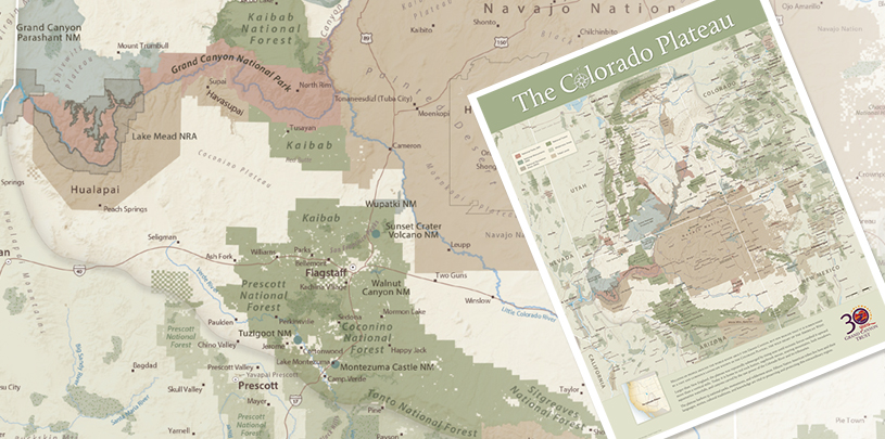
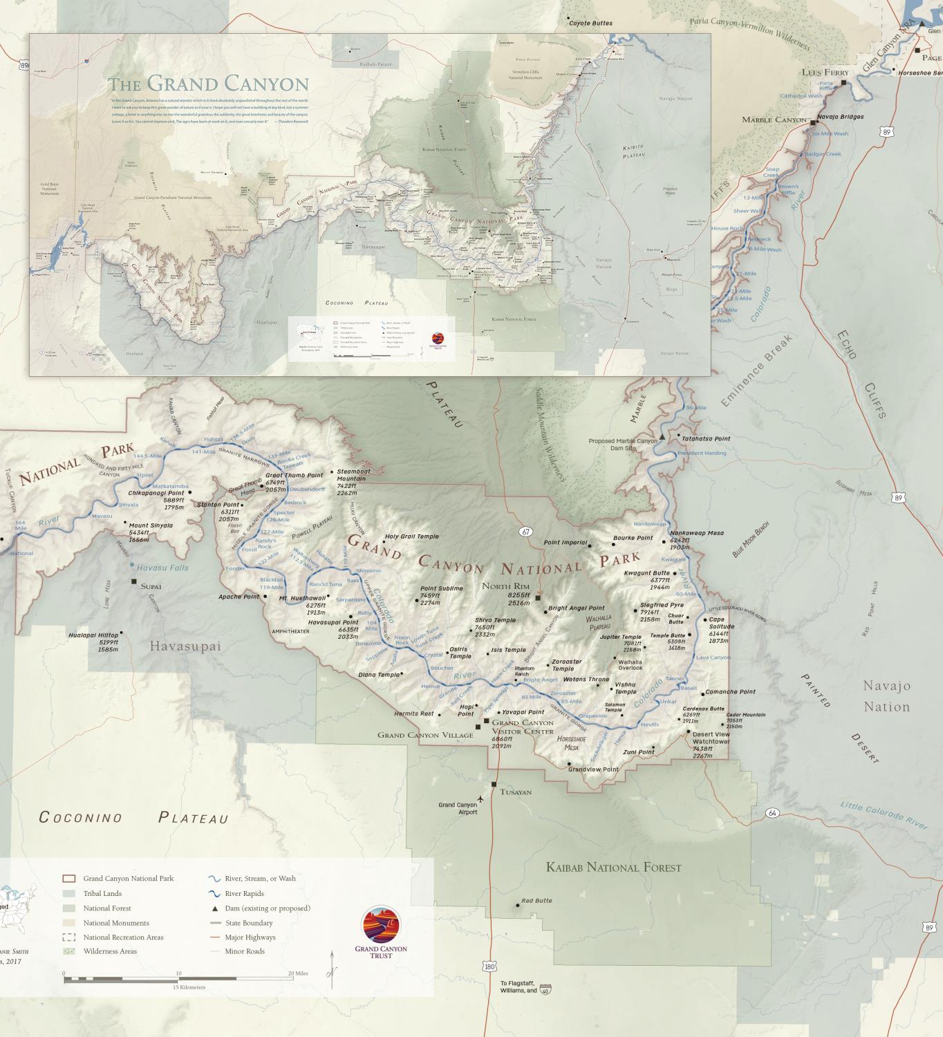
As the GIS (Geographic Information Systems) Director for the Trust, I design maps to help tell the story of our work. Creating the 30th Anniversary Map of the Colorado Plateau brought back all the anxiety and questions I first asked as I learned the elements of cartographic design in college: Did I choose the most accurate data? Is there a silly misspelling hiding in the sea of place names? What if the text covers another symbol? Would different colors make the readers’ map exploration more enjoyable? Is that shadow too dark; is it too light? What if I missed a wobble?
While “wobble” is not a technical term, by any stretch of the imagination, it is the perfect word to describe what most would never notice – a line that is not as smooth as it could be, likely unnoticeable to all but a few but very clear when zoomed in to 300 percent.
I’m sure the anniversary map still has some wobbles, but with a landscape as curvy and rugged as the Colorado Plateau, a little wobble seems fitting. I hope you explore it enough to find all the wobbles I missed!
How do I get a copy?
The 30th Anniversary map is no longer avaliable, however by becoming a member of the Grand Canyon Trust today and you will receive a small folded version of our new limited edition Grand Canyon National Park map. With a donation of $500 or more, you can receive the original 36×18 inch version, rolled and ready to frame, as our way of saying thank you for helping us protect this incredible place!
