Hike the Confluence Trail in Canyonlands National Park to see where the Green and Colorado rivers meet
Before you hike the Confluence Trail, here’s a fun fact about the Colorado River.
Above the confluence, the rivers were originally known as the Green and the Grand (think Grand Mesa and Grand Junction), with the Colorado River beginning below the confluence.
However, the Grand River’s name was changed to the Colorado River in 1921 at the request of Colorado Representative Edward Taylor, over the objections of the states of Wyoming and Utah, and the U.S. Geological Survey.
Hike the Confluence Trail
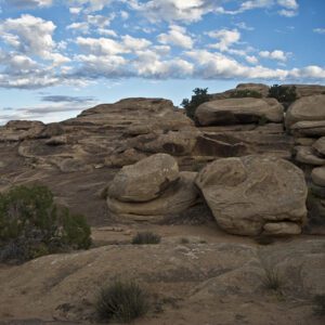
From the trailhead sign, the trail drops down a series of sandstone ledges to the bottom of Big Spring Canyon. There it goes left to cross the creek bed and then climbs up a short tributary on the far side of the canyon. Near the top of the tributary, you reach a ledge where you’ll see a “keyhole” between two sandstone knobs — photo opp! From here, the trail goes left and you reach a ladder that the park service has provided to help you get up the final ledge. A short climb takes you to a saddle with a balanced mushroom rock on the right. Look back and see your parked car, as well as views of the Abajo Mountains to the southeast.
Elephant Canyon
The trail levels out and wanders across a wide sandy basin. When you cross a broad, shallow canyon, you’ve reached the lower end of Elephant Canyon.
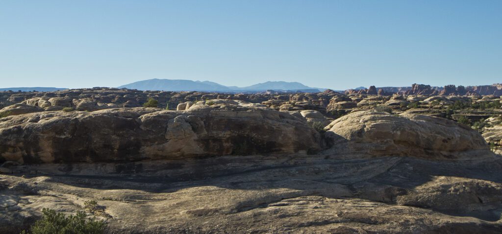
Proceed up a series of sandstone ledges. At the top, the trail hooks right along a slickrock ledge with sweeping views. Walk toward a prominent red butte, and drop into a sandy basin. You’ll cross more slickrock humps and hollows as you head toward a four-wheel-drive road.
Grabens
Next, the trail drops into Cyclone Canyon. Cyclone Canyon is an example of a graben, which is piece of the earth’s crust that has shifted down. Cracks appear as the rocks slide, ultimately widening and creating the series of canyons, or grabens, that parallel the Colorado River. As you continue, you reach a sign in the middle of Cyclone Canyon where the trail goes right along a road. The trail continues left along this road up a shallow drainage bordered by slickrock until it reaches a side canyon where it veers sharply left, going to a backcountry campground.
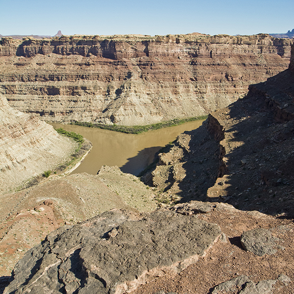
Continue past the picnic table and the sign that marks one-half mile to the Confluence Overlook. After you leave the campground, you climb up a steep hill and go through a saddle where the far walls of the Colorado River gorge become visible. The trail descends slickrock ledges and follows a low ridge to a pile of rocks perched on the edge of the thousand-foot-deep canyon.
From this vantage, enjoy the staggering views, savor the silence, and if you’re lucky, wave to river runners below who frequently float the Green and the Colorado to this point. They usually stop at the confluence because the wild water of Cataract Canyon begins immediately below it. Return the way you came.
Directions to the Confluence Trail in Canyonlands National Park
Take Highway 191 south out of Moab, at about 40 miles turn west (right) onto UT 211, go another 34 miles to the Canyonlands visitor center. Stay on the main road until it ends at about 6.5 miles. The trailhead is behind the large red and white signs at the end of the road. Backcountry camping requires a permit. Find out how to navigate the permit system ›