Don’t skip the Hidden Canyon Trail in Zion
Hike up the east wall of Zion Canyon to a deep, hidden, hanging canyon.
Note: This trail begins at the Weeping Rock shuttle stop, which is where the hike to Hidden Canyon and Observation Point also begins.
From the parking lot, cross the bridge over the creek flowing from Weeping Rock to a junction and sign with information about the trails that can be accessed here. The trail to Weeping Rock alcove goes left, but continue straight for Hidden Canyon.
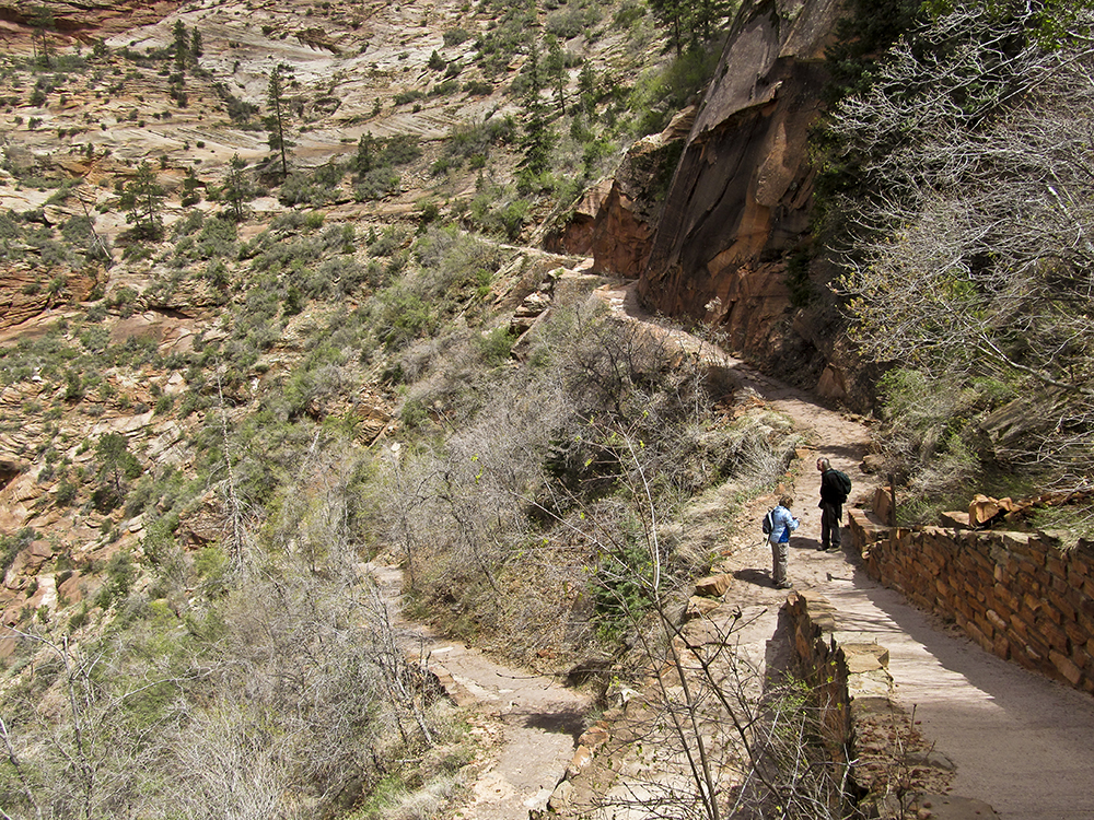
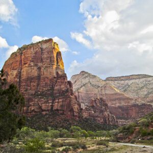
The trail wastes no time beginning to climb, swinging to the left and charging straight uphill. The trail soon reaches the first of numerous switchbacks that ascend the curving wall of the large amphitheater above Weeping Rock alcove. The towering sandstone monolith on the other side of the Virgin River is Angel’s Landing.
Hidden Canyon Trail
After about 0.7 mile, you reach the junction for the trail to Hidden Canyon, where you go to the right up some short steep switchbacks. In the summer, this section of the trail is relatively cool, being on the north side of a ridge.
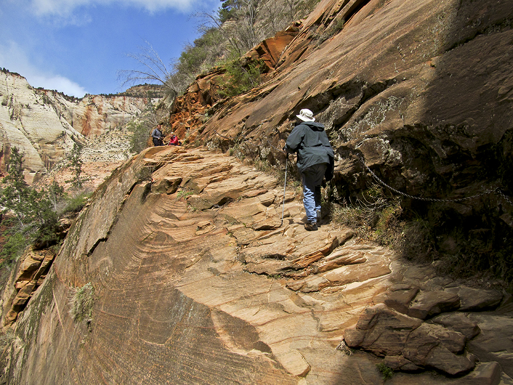
At the top of the switchbacks, the trail reaches a small saddle and turns right into a short steep drainage. It levels off for a short distance and then goes along a section carved out of solid rock. A chain fastened to the cliff acts as a handrail. If you look across the drainage you can see the trail hacked out of the cliff on the other side. After crossing the streambed, you climb a long stairway built of sandstone slabs. At the top you hook right and begin walking along the section carved into the cliff face.
Into Hidden Canyon
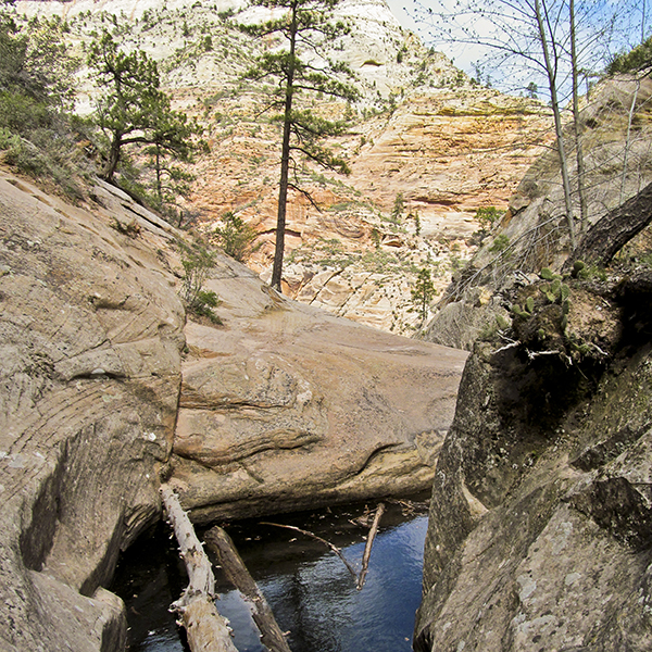
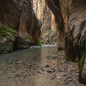
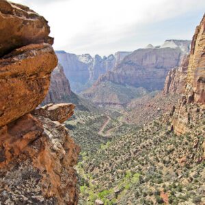
The trail, which is narrow and has another chain handrail in some spots, wraps around the nose of the cliff and you get great views of the main canyon and the valley floor far below. There is a deep plunge pool at the mouth of Hidden Canyon, which you go around using steps carved into the sandstone surrounding the pool. After you negotiate the steps, you reach a large slab of smooth rock that is a lovely spot to sit and take a breather.
A sign above the pool identifies the end of the maintained trail. Continuing up the canyon will require some scrambling. And indeed, you soon have to climb over a small boulder jam. However, the trail then drops into the streambed, which is smooth and sandy. There are a few more piles of boulders you must scramble over, but they are not much of a challenge.
The walls of the canyon are crossbedded Navajo Sandstone, and moss and ferns flourish along the cracks created by the crossbedding.
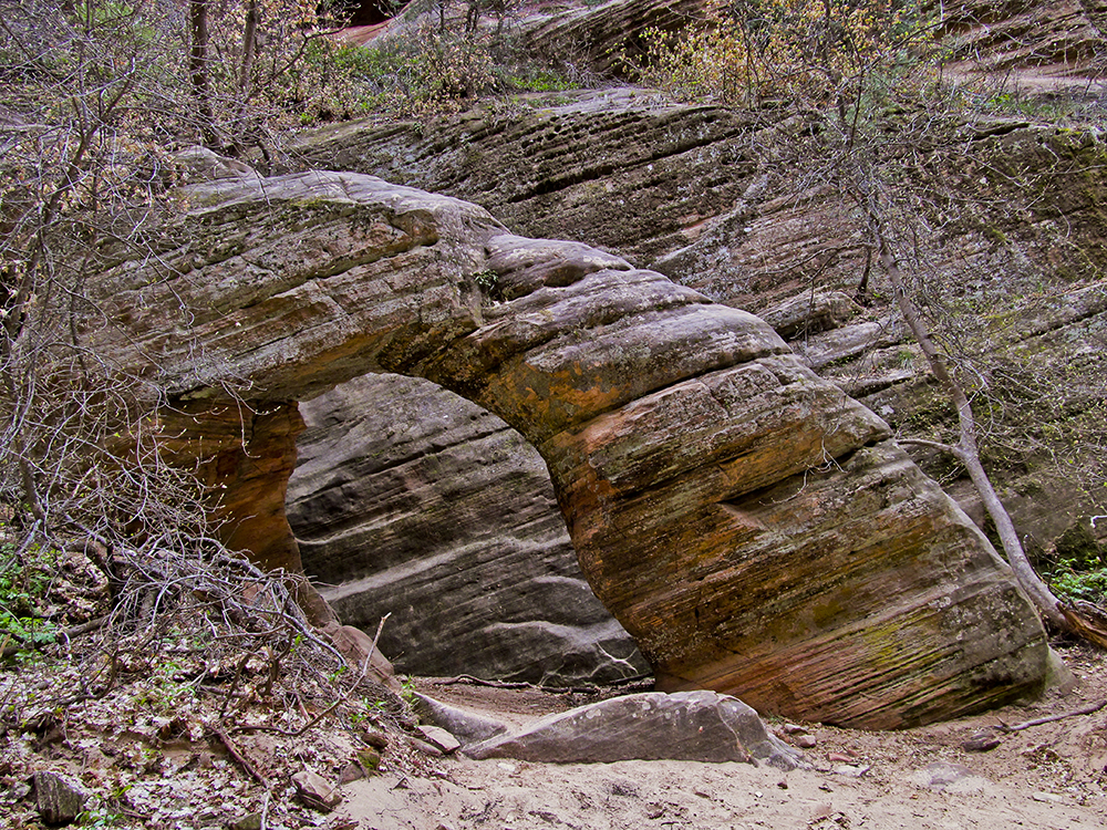
About 0.25 mile from the canyon mouth, you reach a small arch on the floor of the canyon. Unlike many of its larger brethren scattered across the Colorado Plateau, this little guy is delightfully human-sized. This is the turnaround point, so slowly work your way back to the mouth of the canyon, savoring the green vegetation and hanging gardens created by this shady oasis.
Directions to the Weeping Rock Trailhead
Take the shuttle bus from the park visitor center to Weeping Rock Trailhead; or when allowed during the off-season, drive approximately 6.8 miles up Zion Canyon to the trailhead. Find out if you need a backcountry permit, and if you do, how to get it.