A short but steep hike to a magnificent cliff dwelling called Moon House in Bears Ears National Monument
Moon House, a multi-room cliff dwelling named for its celestial pictograph, is an exceptional archaeological site in McCloyd Canyon on Cedar Mesa, Utah.
The Bureau of Land Management requires a day use permit to visit Moon House and limits access to 20 people per day. Remember, it is illegal to remove any artifacts or damage sites in any way. Fines or jail time can result for those who break the law. Leave all artifacts where you find them, don’t lean on walls or enter interior rooms, avoid touching rock art, and don’t add modern graffiti.
Hike to Moon House
From the BLM kiosk at the trailhead, hike north along the dirt road for 1.25 miles. The Abajo Mountains poke above the rolling hills of sagebrush and piñon and juniper trees, and cryptobiotic soil covers the sandy benches on both sides of the road. You cross a wash around 1 mile, and the road ends at a sandstone patio. Foot trails seem to leave from every side of the parking area, but look for two No Motor Vehicle posts separated by a line of rocks on the north side of the 4WD parking area. The wide bedrock trail continues north from here and is marked with large cairns.
Descend into McCloyd Canyon
The trail starts an immediate descent towards McCloyd Canyon that steepens when you reach the rim. Follow the cairns down a precipitous, rocky route, curve around to the right side of a slickrock amphitheater, and slide down the lip of an overhung ledge. A pile of rocks below aids your descent.
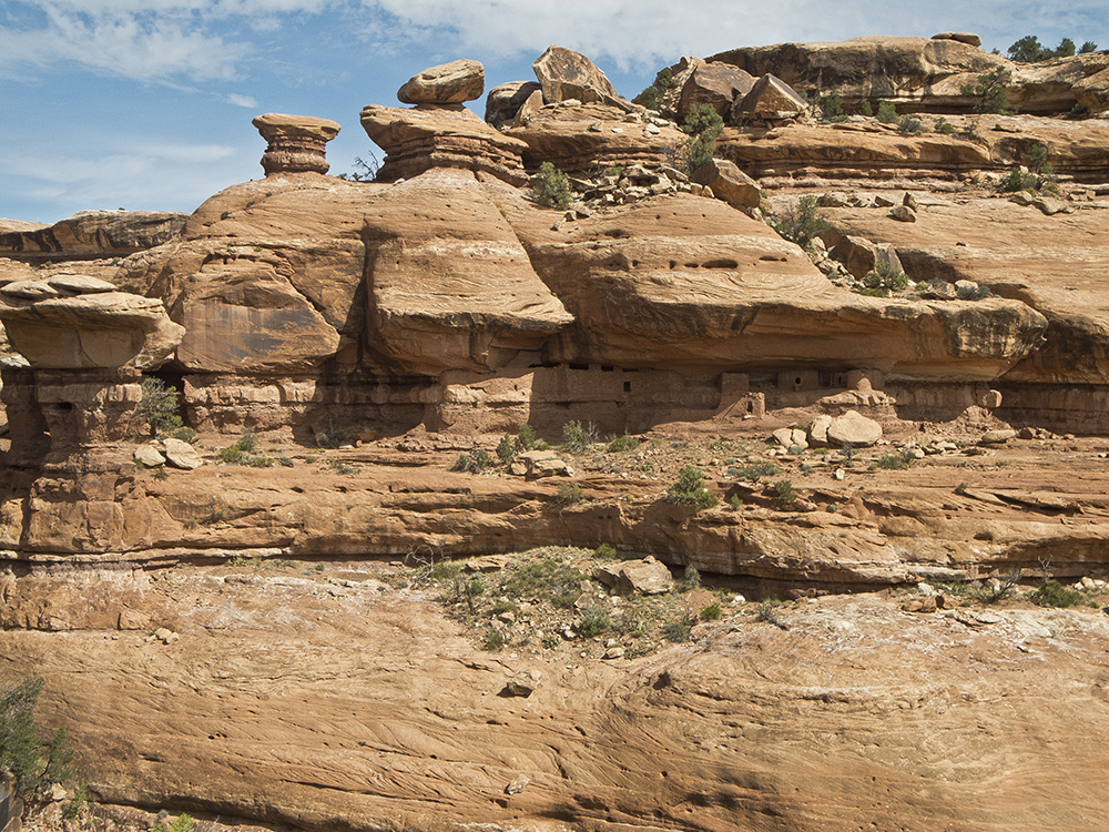
The trail swings back to the left, making a large switchback across the amphitheater. A little ways down the trail, you can see Moon House hidden on a ledge on the opposite canyon wall.
Directly across from the site, the trail drops down to the bottom of the canyon. After a few broad switchbacks, the trail descends a steep scree slope and spits you onto the canyon floor at 1.6 miles.
Climbing up to Moon House
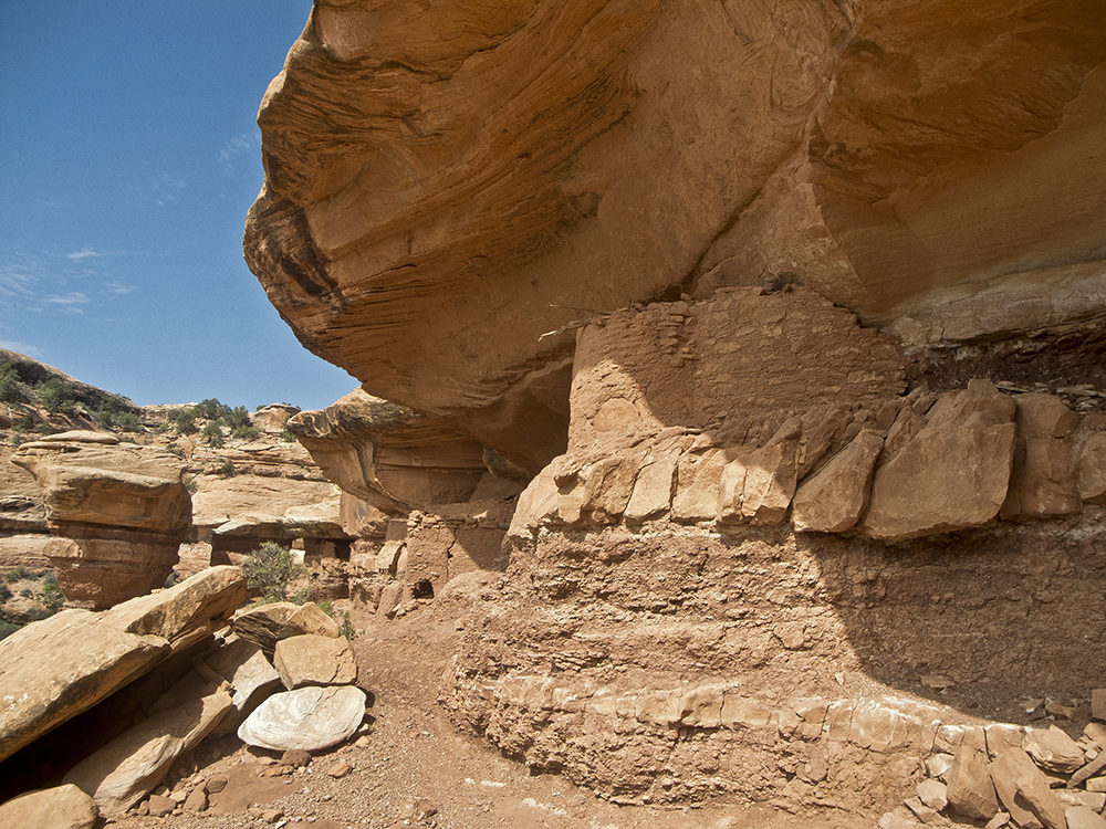
Turn right, crossing to the other side and proceeding downcanyon a short distance along the slickrock floor. Stay left of a pouroff, and you soon reach a route that ascends the left canyon wall. Climb to the next tier of slickrock, where several cairns lead you higher. The final push involves climbing up a crack to the base of an overhung ledge around 1.7 miles. From here, you can access Moon House.
Visit Moon House with respect
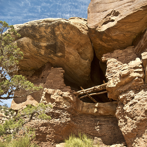
Look for an ammo can, whose contents include cultural interpretation and visitation information for the site. Archaeologists estimate that migrating Puebloan people built the dwellings around A.D. 1264.
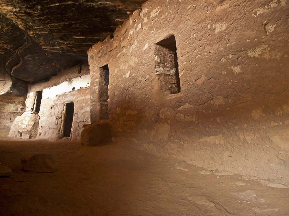
You may enter the main portion through the small doorway in the long rock wall; just be careful not to pull yourself in using the sides or top of the entryway. A hidden hallway and string of rooms stretch behind the fortified wall. Since you can’t enter the rooms, bring a flashlight or headlamp to see inside. Corncobs lie on the floors of the rooms, and pictographs decorate the outside and inside.
The room that gave Moon House its name is the one with a painted white band around it, with pictographs of half moon and full moon figures on opposite walls. Like the other rooms, don’t enter it. You can clearly see the pictograph by shining light into the room. The BLM put sterile sand on the floor to absorb moisture from people’s breath that can break down the ancient pigment on the walls.
With thousands of people visiting this fragile place, please follow all guidelines to help preserve the site. Return the way you came.
Directions to the Moon House trailhead
From the junction of UT 95 and UT 261, drive south on UT 261 for about 4 miles. Stop at the Kane Gulch Ranger Station on the left side of the road to pick up your required hiking permit (March 1 – June 15 and Sept 1 – Oct 31). For other dates, see the BLM’s permit information ›
Continue heading south on UT 261 for another 6 miles until you reach Snow Flat Road. Turn left, pass a BLM map, and veer left at a small sign marked “Trail.” This road can become impassable when wet, so check the weather before beginning your trip.
In about 3.5 miles, the dirt road deteriorates. Even with high clearance vehicles, some road construction may be necessary to help ease you down bedrock drops. The road improves again, and around 8 miles you reach the trailhead marked by a kiosk. You can park in the dirt lot on the right side of the road.