Climate Vulnerability for North Rim Ranches

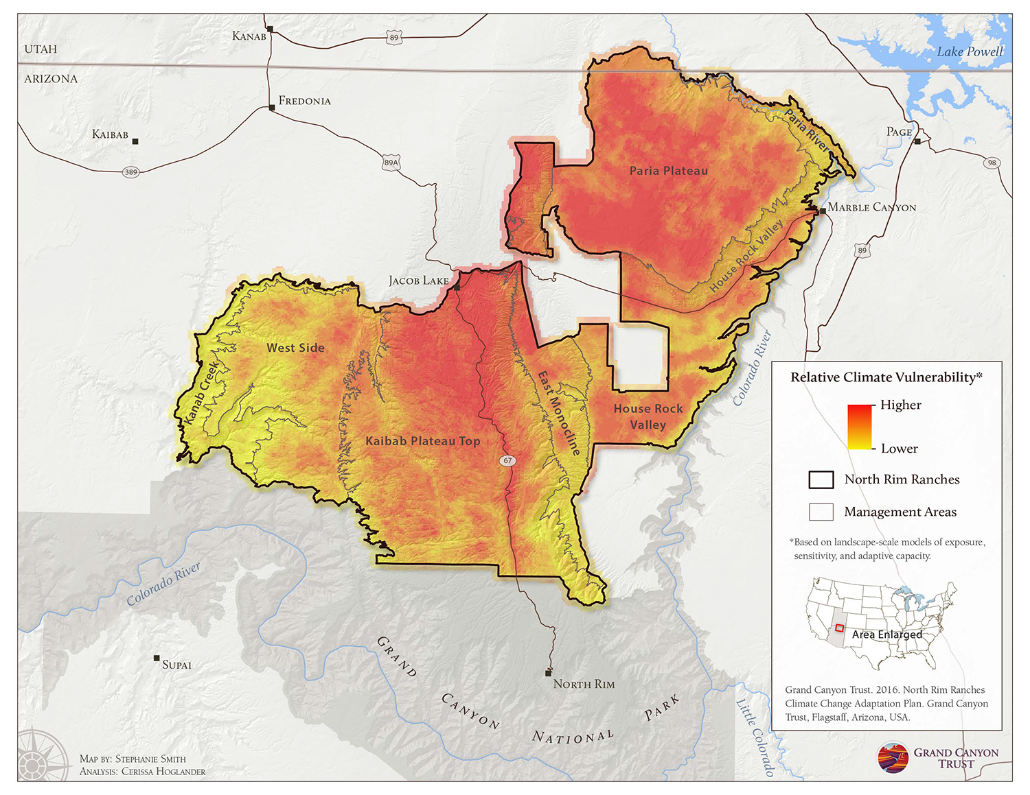
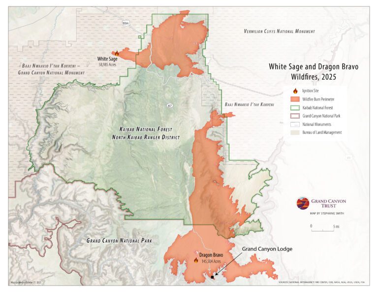
This map shows relative climate vulnerability on the North Rim Ranches.

North Rim Ranches climate vulnerability

Download the map ›

Resource - map credit Stephanie Smith

Maps and graphs may be used for non-commercial purposes provided that they are not altered or edited and they are appropriately credited. All map products should be credited to Stephanie Smith, Grand Canyon Trust, unless otherwise noted. A hyperlink to the Grand Canyon Trust website is appreciated.

For higher quality images or custom sizing please contact our communications director, Ashley Davidson, at adavidson@grandcanyontrust.org.

Related Resources

Map showing the North Rim Lands of the Grand Canyon in Arizona, highlighting national parks, forest service areas, tribal lands, monuments, and Bureau of Land Management.
Map of the Grand Canyon Trust’s North Rim Ranches located on the North Rim of the Grand Canyon.

The rules for managing the Colorado River expire at the end of 2026. There isn’t enough water in the Colorado River to go around. New rules are desperately needed to sustain the river for people and the environment. Learn about current water use in the Colorado River Basin › Download the two-page PDF ›

Below Glen Canyon Dam, nonnative fish like smallmouth bass are threatening imperiled humpback chub in the Grand Canyon. Get the facts ›   Download the PDF ›