Grand Staircase-Escalante National Monument Grazing Buyout Status Map, 2020

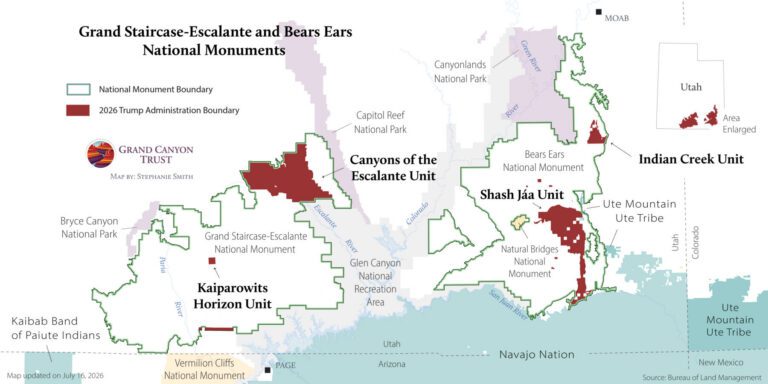
Below is a map of lands along the Escalante River corridor in Grand Staircase-Escalante National Monument included in the 1999 Grand Canyon Trust buyout, updated to indicate status as laid out in the 2020 Grand Staircase-Escalante National Monument monument management plan.

Map of grazing status changes in Grand Staircase-Escalante National Monument in 2020.

Download your copy

Maps and graphs may be used for non-commercial purposes provided that they are not altered or edited and they are appropriately credited.

All map products should be credited to Stephanie Smith, Grand Canyon Trust, unless otherwise noted. A hyperlink to the Grand Canyon Trust website is appreciated.

For higher quality images or custom sizing please contact our communications director, Ashley Davidson, at adavidson@grandcanyontrust.org

Related Resources

Illustrated map of the Colorado Plateau showing major landmarks, animals, and vegetation across regions of Utah, Colorado, New Mexico, and Arizona.
The Grand Canyon Trust’s 2025 map of national monuments, national parks, landmarks, plants, and animals across the Colorado Plateau.