This is a popup dialog that overlays the main content of the page. The popup includes a search form to help you find the information you are seeking. Pressing the close button or using the escape key will close the popup.
Resources › Maps of 2026 Cuts to Bears Ears and Grand Staircase-Escalante National Monuments
Maps of 2026 Cuts to Bears Ears and Grand Staircase-Escalante National Monuments
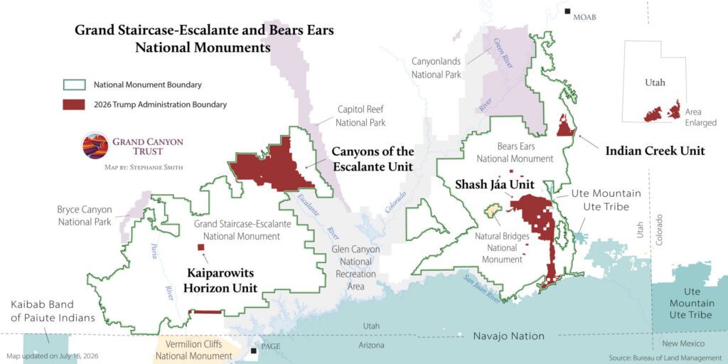
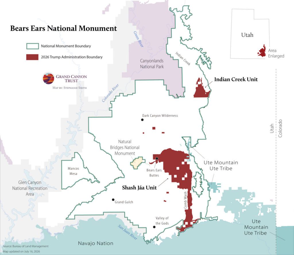
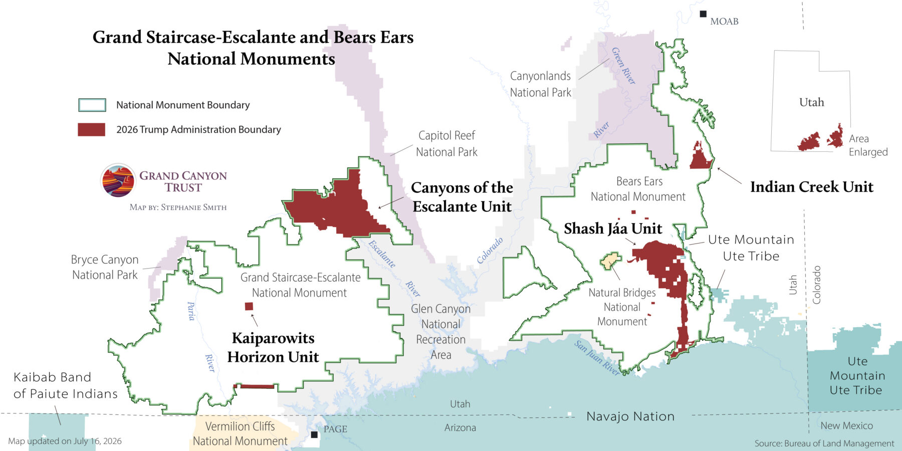
See maps showing the 2026 reductions to Bears Ears and Grand Staircase-Escalante national monuments.
On July 13, 2026, President Trump issued proclamations reducing Bears Ears and Grand Staircase-Escalante national monuments for a second time.
These maps show which lands were removed from monument protections and how the new boundaries compare with the original designations.
The 2026 proclamations remove nearly 3 million acres from Bears Ears and Grand Staircase-Escalante national monuments, reducing each monument by roughly 90%. These unlawful, unpopular actions are being challenged in court. Compare the current boundaries with previous boundaries and download high-resolution maps.
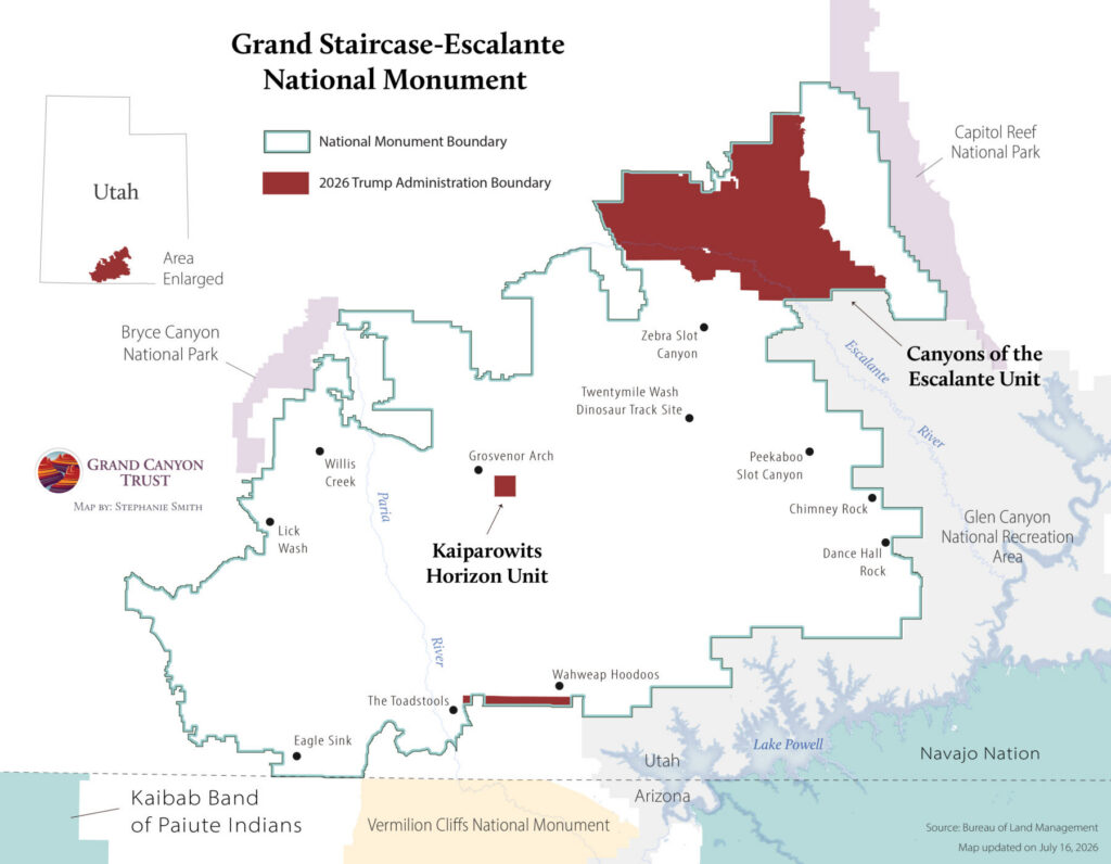
This map shows the lands removed from Grand Staircase-Escalante National Monument under the 2026 proclamation, reducing the monument by approximately 90%.
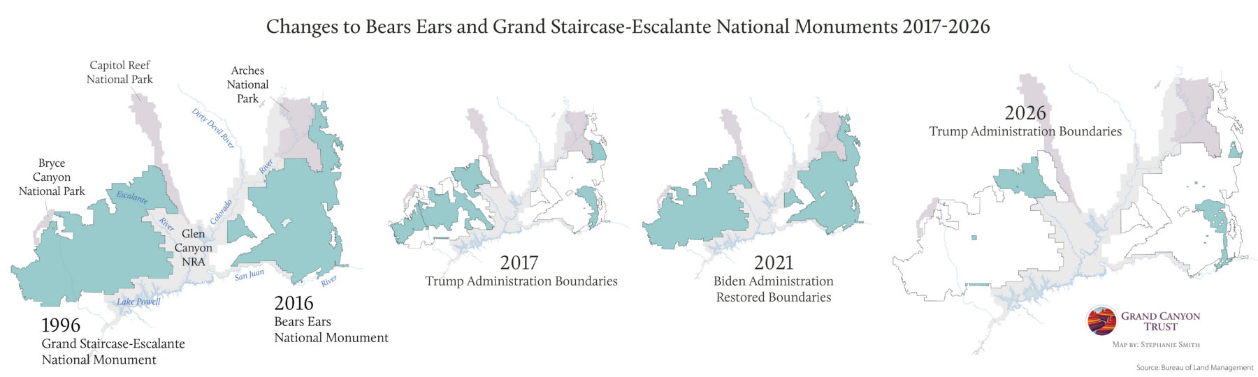
Timeline of Bears Ears and Grand Staircase-Escalante national monuments (1996-2026)
The 2026 proclamations reduce both monuments even more than the 2017 proclamations, which sought to shrink Bears Ears by 85% and Grand Staircase-Escalante by nearly half. This timeline compares monument boundaries from 1996 through 2026, showing how protections have been dramatically reduced under the Trump administration.
Maps and graphs may be used for non-commercial purposes provided that they are not altered or edited and they are appropriately credited.
All map products should be credited to Stephanie Smith, Grand Canyon Trust, unless otherwise noted. A hyperlink to the Grand Canyon Trust website is appreciated.
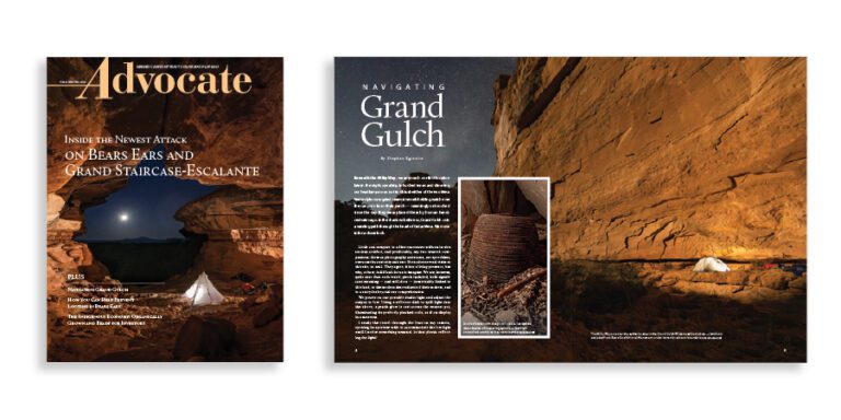
The fall 2026 edition of the Grand Canyon Trust’s Colorado Plateau Advocate magazine, with a feature on the cuts to Bears Ears and Grand Staircase-Escalante national monuments.