A colorful landscape of cliffs, canyons, and plateaus, Grand Staircase-Escalante National Monument offers rugged escape and promises true adventure
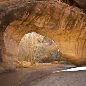
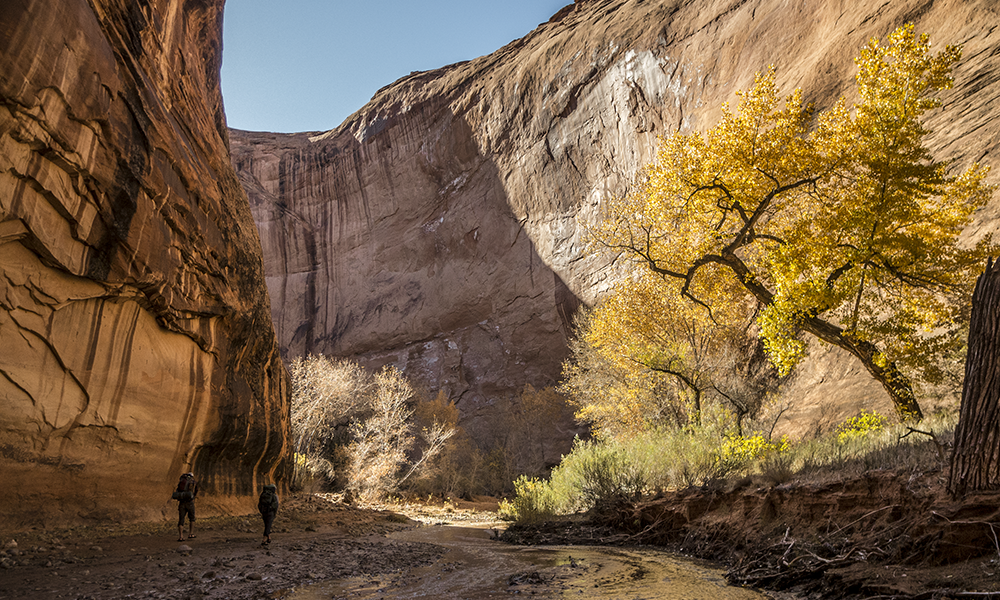
Grand Staircase-Escalante National Monument contains some of the country’s most remote and rugged lands, whose beauty comes from geologic artistry. Over many millions of years, rock layers built up—limestones, on top of sandstones, on top of shales—only to be eroded by the forces of water, wind, and time. The sculpted landscape you see today is a showcase of sinuous canyons, striking cliffs, and broad vistas.
Three adjoining units make up this massive monument from west to east: the Grand Staircase, the Kaiparowits Plateau, and the Canyons of the Escalante. Roads are few, but adventure is limitless.
Visiting the monument
Grand Staircase-Escalante National Monument is exceptional in both size and terrain. At 1.9 million acres, it’s the largest national monument in the contiguous United States and the first to be managed by the Bureau of Land Management. Since Scenic Byway 12 cuts through the heart of the monument, many tourists pass through on their way to/from nearby Bryce Canyon, Capitol Reef, and Zion national parks. The scenery from the car is amazing, but the backcountry in Grand Staircase is unsurpassed. If venturing into the more remote parts of the monument, be prepared for big, open country.
Accomodations
Hotels, motels, RV campgrounds, and state park campgrounds fill quickly during peak tourism season (spring and fall). The monument offers dispersed camping, but the BLM asks you to camp in already disturbed areas. You can find good campsites along many of the dirt roads (Hole-in-the-Rock Road, Burr Trail Road, Cottonwood Canyon Road). Free permits for dispersed camping can be obtained at the visitor centers or trailheads.
Gateway towns include: Page and Fredonia (Arizona); and Big Water, Kanab, Mt. Carmel, Orderville, Glendale, Alton, Hatch, Panguitch, Bryce Canyon City, Henrieville, Cannonville, Tropic, Escalante, and Boulder (Utah).
Visitor centers: Cannonville Visitor Center | Escalante Interagency Visitor Center | Kanab Visitor Center | Big Water Visitor Center | Paria Contact Station | Anasazi State Park Museum
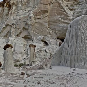
Trails: Boulder Mail Trail | Upper Calf Creek Falls | Lower Calf Creek Falls | Golden Cathedral Trail | Peekaboo, Spooky & Brimestone Canyons | Coyote Gulch via Crack-in-the-Wall | Willow & Fortymile Gulch Loop | Cottonwood Narrows Trail | Hackberry Canyon & Yellow Rock | The Toadstools | Wahweap Hoodoos
Services and Gasoline
Don’t expect to find a Walmart, Target, or even a true supermarket in or near Grand Staircase-Escalante National Monument. The monument itself has no services, save for the visitor centers, but the small gateway communities usually have gas stations, convenience stores, and/or small markets. Keep an eye on your supplies and fuel up when you have the chance. If you plan to explore the monument’s backcountry roads, bring a good map of the area or pick one up at a visitor center. Cell phone service is spotty within the monument; carry extra gas, water, food, and a spare tire.
Backcountry Roads
Dirt roads access most of the trailheads in the monument, and their conditions vary. Some are graded, others washboarded. But all are prone to frequent flash floods that can make them impassable to even 4WD vehicles. Call or visit the Escalante Interagency Visitor Center for the latest road reports before you leave; plan accordingly.
2WD vehicles: Good on Hwy 12 (paved), Burr Trail Road (paved) and possibly the upper stretches of Hole-in-the-Rock Road (call ahead for recent conditions).
High clearance: Needed for most of the dirt roads in the monument.
4WD vehicles: Necessary for travel on the Kaiparowits Plateau, Cottonwood Canyon road and Hole-in-the-Rock Road after recent floods, and most spurs off of the main dirt roads.