by Stephanie Smith, GIS Director
The “Grand Canyon Escalade” seems like the bad proposal that will never go away. Since first word of the Phoenix developers’ plans to build a mega resort and tramway fluttered about in 2009, the developers have found financial backers and are currently lobbying the Navajo Nation to approve the deal.
If approved, the development would cover 420 acres of land and bring up to 10,000 people a day to the confluence of the Colorado and Little Colorado rivers—an ugly proposal indeed.
What would Escalade look like?
I have reviewed the proposal many times. Yet I never really grasped the magnitude of the proposed structures until I mapped them for myself.
Using GIS (Geographic Information Systems) software and 3-D imaging, I took the developers’ map and located the exact position of each of their proposed developments to recreate the boundaries. In the GIS world, we call this georeferencing and digitizing. The result was the following map:
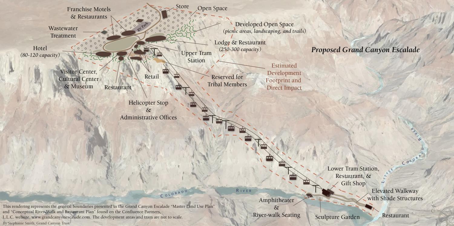
For those of us who may never take a private flight over the area, or stand on the beach where the two rivers meet, it can be hard to envision such a massive development. This map highlights not only the gigantic gondola (not to scale), but an elevated walkway along the river, a restaurant, gift shop, amphitheater, and sculpture garden below the rim, and a slew of structures on the rim itself.
Sacred Spaces
Let’s not forget that the entire confluence area—rim to river—is sacred to tribes and is a significant place in ceremonies, both historically and today. The developers stress that they have reserved a spot where tribes can continue their practices in private with no public access.
But if you look closely, you will see the paltry patch on the rim that has been marked “reserved for tribal members.” With all the other surrounding attractions—a continually passing tram, restaurants, gardens, helicopter pad, and lodges—how private do you think it could realistically be?