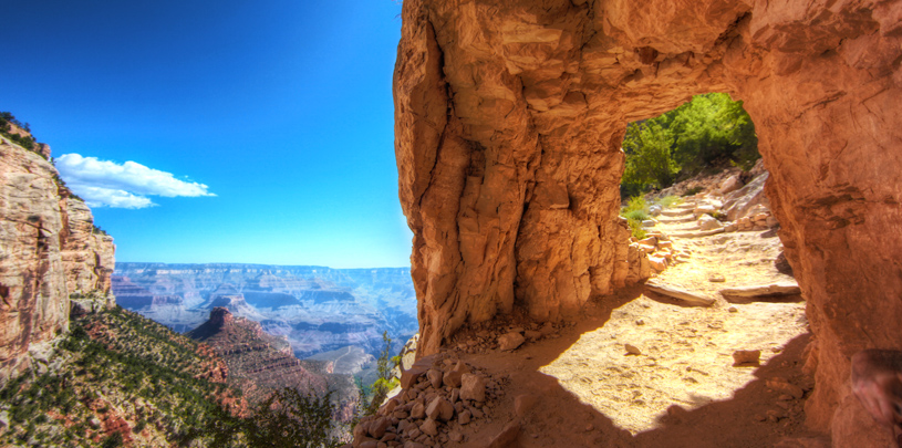
Most trails in the Grand Canyon are rim-to-river routes, plummeting a vertical mile into the depths of geologic time. But the Tonto Trail is one of the few that traverses the canyon lengthwise, snaking in and out of drainages for 95 miles on a mostly level bench called the Tonto Platform. This 13-mile section of the Tonto Trail is bookended by Bright Angel Trail to the east and Hermit Trail to the west, and is a recommended backpack trip. Read more about necessary permits for backpacking trips ›
Leaving Havasupai Gardens
Descend the Bright Angel Trail from the South Rim to Havasupai Gardens (formerly called Indian Garden). Near the hitching posts, follow the signs toward Tonto West and Plateau Point. The trail crosses Garden Creek, swings over to the west canyon wall, and contours along the shale slopes for three-quarters of a mile. At the Y junction, veer left onto Tonto West; right takes you to Plateau Point.
Horn Creek
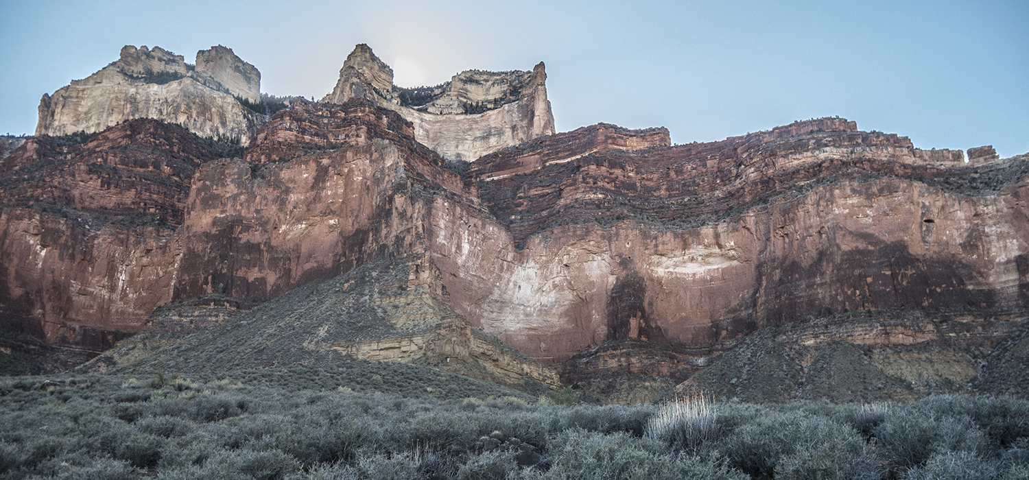
The trail continues west, making a broad arc around the base of a butte called The Battleship. A gradual descent drops into the Horn Creek drainage around 2.5 miles. While you might see a trickle of water in the east arm of the creek, the park service warns, “There is water in the bed of Horn Creek about half the time, but unfortunately it is radioactive so don’t drink it unless death by thirst is the only other option.”
Though not visible from the trail, remnants of an old uranium mine litter the head of the Horn Creek drainage on the South Rim. The Orphan Mine, originally patented for its copper ore in the early 1900s, became a productive uranium mine during the Cold War. When the park service acquired the abandoned site in 1987, they also inherited the land’s toxic legacy. In 13 years of mining uranium on the South Rim, the Orphan Mine allowed dissolved uranium to leach down Horn Creek, contamination that continues to this day, thus the need for warning sign.
Salt Creek
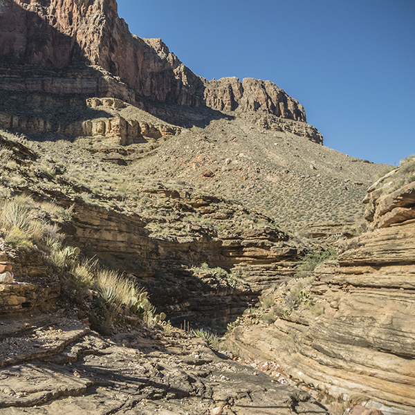
After crossing the boulder-choked west arm of Horn Creek, the trail starts to bend around Dana Butte. Here, the Tonto Trail’s flat reputation falters briefly, as two small ridges force you to climb up several hundred feet. But from the north side of Dana Butte, the trail resumes a fairly level character, and you continue wandering west along the blackbrush-studded bench.
You can catch a few glimpses of the Colorado River before the trail hooks back into the Salt Creek drainage and descends through the ledgy Tapeats Sandstone. Around 7.3 miles, you drop to the gravel creekbed. Walk a short ways upstream, looking for a cairn marking the route up the opposite wall. Continue past signs for the Salt Creek campsites and composting toilet, and make your way back up to the Tonto Platform.
Monument Creek
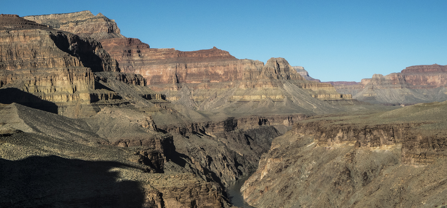
Proceeding west from Salt Creek to Monument Creek, the trail winds in and out of small gullies and drainages. Pass Cedar Spring (unreliable) and continue for a few miles before reaching a steep descent into Monument Creek. The trail switchbacks down the Tapeats ledges, cutting all the way into the Grand Canyon’s basement rock — the ancient Vishnu Schist. When you reach the east arm of the creek, look for cairns marking the route across it. Campsites, tucked between bushes and trees, line the creek, and reliable water is a short walk downstream.
[Note: you can follow Monument Creek all the way downstream to its confluence with the Colorado River at Granite Rapids.]
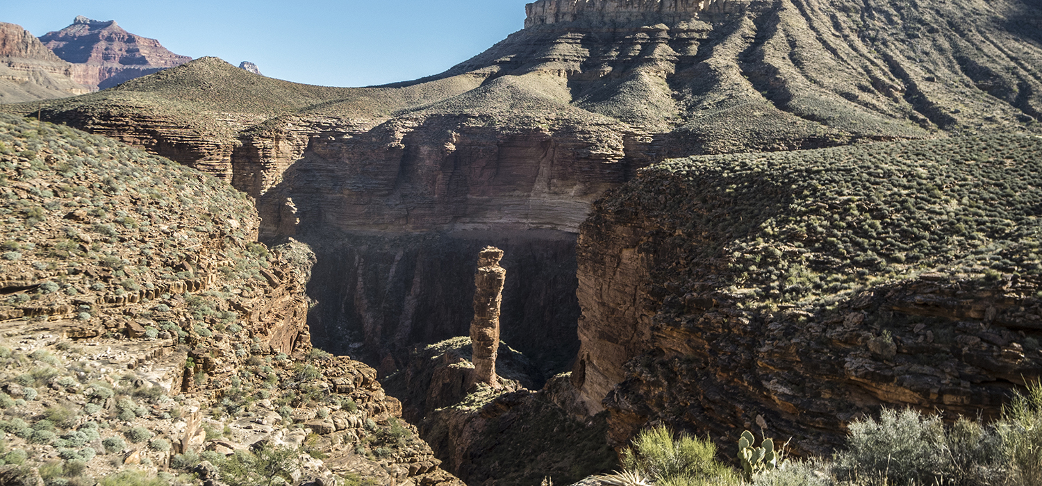
As you make your way over to the west arm of Monument Creek, you pass the namesake “monument” — a cylindrical pillar of sandstone. Follow cairns up the dry streambed, keeping a close eye out for the exit route up the east canyon wall. From here, the trail gradually climbs back up to the Tonto Platform, topping out at a small saddle north of Cope Butte. In three-quarters of a mile, you intersect with the Hermit Trail.
[Note: If you’re camping at Hermit Creek, continue down the Hermit Trail for one mile. See the full Hermit Trail description for details.]
Since the Tonto Trail starts 3,000 feet below the rim, driving to the start of the trail is not an option. You must get there by foot. See the Bright Angel and Hermit trail descriptions for access information to this section of the Tonto Trail.
Get monthly hikes in your inbox for a year.
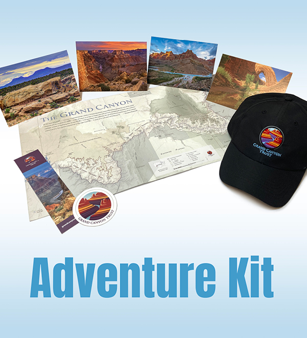
Join the Grand Canyon Trust today to receive your adventure kit:
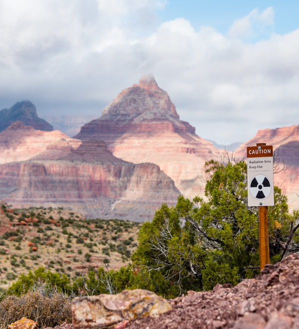
Water is life in the Grand Canyon, but uranium mines located on public land mere miles from the North and South Rims threaten to contaminate the Grand Canyon's waters. The Park Service warns hikers not to drink out of several creeks along the Tonto Trail because of contamination from a uranium mine that closed in 1969.

The future of the Grand Canyon is in your hands. Will you donate today to help protect it forever?

Find out about opportunities to speak up for the Grand Canyon when it needs you most.
Even a short journey of a few hundred steps offers a deeper perspective on the Grand Canyon.
Read More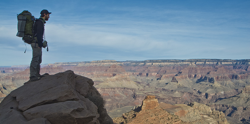
Wondering how to get a permit to hike and camp in Grand Canyon National Park? Let's break it down.
Read More
Forget long lines and congested trails! An off-season hiking trip to one of the Southwest’s national parks offers the same spectacular scenery without the crowds. Pack your snow shoes, crampons, or...
Read More